In the overnight hours, Danielle rapidly intensified from 95kts/965mb to 115kts/946mb in just six hours. The intensity as of 15Z today is still 115kts and 946mb. This makes Danielle the first major (CAT3+) hurricane of the season. The satellite presentation is very impressive now... it is symmetric, with a clear eye and vigorous eyewall. Although this dramatic intensification wasn't forecast, the track has continued to 'behave'... recurvature is still expected to occur by 62W, keeping the worst of the effects east of Bermuda, though the island could still experience tropical storm conditions. Danielle is currently about 480 miles SE of Bermuda and tracking NW at 10kts.
Earl hasn't changed much in the last 24 hours... the intensity has held steady and the track forecast hasn't changed. It is currently a 40kt TS located about 1300 miles E of the Leeward Islands. The intensity forecast hasn't changed much either... it's still expected to enter a much more favorable environment in a few days and become the next hurricane, and perhaps major hurricane by the time it's north of Puerto Rico.
And, the easterly wave that was southeast of the Cape Verde islands yesterday has continued to get better organized and is now due south of those islands. Over the next several days, it is forecast to head WNW and develop quickly into a tropical storm, hurricane, and perhaps major hurricane. The next name on the list is Fiona. This time of year, having this burst of activity is quite normal.
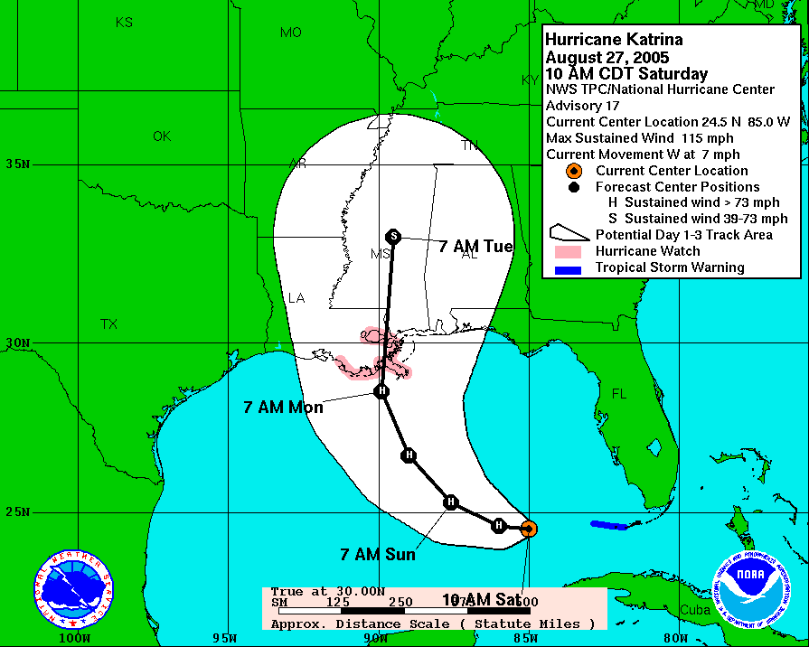
Five years ago today, the first Hurricane Watch was issued for the LA coast in advance of Katrina's landfall. Coincident with that Watch being issued, a mandatory evacuation was ordered for the City of New Orleans, knowing that it's a very vulnerable area to storm surge (on the coast and below sea level).
http://www.nhc.noaa.gov/archive/2005/graphics/AT12/17.AL1205W.GIF
On the 28th, the storm reached Category 5 intensity and the following accurate forecast discussion came out of the New Orleans National Weather Service office:
http://en.wikipedia.org/wiki/National_Weather_Service_bulletin_for_New_Orleans_region#Bulletin_text
On the morning of the 29th, it made landfall as a Category 3 storm on the LA/MS border.
http://einstein.atmos.colostate.edu/~mcnoldy/tropics/katrina05/Katrina_29Aug05.gif
Please visit my tropical Atlantic headquarters.
No comments:
Post a Comment