20 June 2013

Barry making landfall, and past Barrys

Shortly after an Air Force reconaissance aircraft began its probing of TD2 yesterday, it found winds to support upgrading it to a tropical storm (35kt+ winds at the surface are required), and it became the second named storm of the season: Barry.

As I mentioned on Monday, Barry is one of the original names introduced to the lists back in 1983.  The modern system of naming storms (alternating male-female) began in 1979, and there are six annual lists of names that are re-used.  So, this is Barry's sixth reincarnation!  Incidentally, the only "B" storm to get retired since 1979 is Bob in 1991... it was replaced with Bill, which will be used for the fourth time in 2015.
The tracks of Barry, all six times.  Only in its first use in 1983 did it briefly reach minimal hurricane intensity... all others topped out as tropical storms.
Today, as of 8am EDT, Barry is making landfall on the Mexican coast just north of Veracruz as a 40kt tropical storm. While heavy rains are the primary concern, tropical storm force winds extend about 80 miles from the center (mostly to the north and east).

Enhanced infrared satellite image of Tropical Storm Barry near landfall (image from 8:15am EDT).
Past track (black line), current extent of tropical storm force winds (orange shading), and tropical storm warnings (blue coastline).
Unfortunately, the radar that is close to the landfall location is still down for maintenance, so we only have satellite data and surface observations to capture the structure and motion of the storm as it makes landfall.  However, if you're desperate for radar data, there are some distant outer rainbands within range of the the Brownsville TX radar as of this update.

Now that it is mostly over land, it will quickly weaken and dissipate, though heavy rain and the resulting mudslides and flooding will remain a concern for the next couple of days in central Mexico.


19 June 2013

TD2 organizing quickly... Barry before landfall?

Tropical Depression 2 emerged back over water just before 11pm EDT on Tuesday, and is now comfortably over the Bay of Campeche.  As of 8am EDT, it's still a tropical depression with 30kt winds, and centered about 130 miles east of Veracruz, Mexico.  However, given its satellite appearance and other satellite measurements, it stands a very good chance of being upgraded to Tropical Storm Barry soon, well before it makes its second and final landfall near Veracruz tomorrow afternoon (local).


The water temperature is amply warm at 29C, but it's in an environment with about 15kts of vertical shear... not hostile, but not friendly either.  Since coming back over the water though, the deep convection associated with it has really increased in coverage and intensity.  The vertical shear is also expected to decrease notably over the next day.

A reconaissance aircraft is scheduled to begin probing the storm by 2pm EDT.  The long radar loop from Sabancuy, Mexico is still available, and unfortunately, the next radar site of interest in Alvarado is down for maintenance as of this update.

As mentioned before, landfall is expected on Thursday afternoon (local time) near the city of Veracruz, and a tropical storm warning is in effect for much of the central and southern portions of the state of Veracruz.


Climatologically, the second named storm forms on August 1, so if this is upgraded to Barry today, we'd be about six weeks ahead of par.  Also, if this scenario seems like something you've seen before, you'd be right.  Other storms to follow similar tracks with similar intensities include Arlene 2011, Alex 2010, Marco 2008, Gert 2005, etc.

Previous storms with tracks and intensities comparable to TD2.


18 June 2013

Heavy rain biggest concern from Tropical Depression 2

Tropical Depression 2 made landfall on southern Belize at 5pm EDT yesterday, as expected.  Now, as it weakens over land, its forward motion has slowed to 8mph and it is dumping heavy rain over the mountainous terrain in Guatemala, Belize, and southern Mexico. 


The decreased forward speed means it will spend more time over land than originally forecast.  Whatever remains of it could reach the Bay of Campeche by Wednesday evening (local), but will it have enough organization to re-intensify?  The official forecast from NHC as of 5am EDT today does include minimal strengthening, but still not enough to become a tropical storm... and that comes with the uncertainty disclaimer that it may never re-emerge over water.


Rainfall totals in Belize, Honduras, and southern Mexico already exceed 5" at some locations, and while 3-5" is expected over the general area, some locations could end up with up to 10".  I have a new radar loop from Sabancuy, Mexico available today... it will accumulate new frames every 15 minutes, so check back later too!


17 June 2013

Tropical Depression 2 heading for Yucatan peninsula

UPDATE: At 11am EDT, this disturbance was upgraded to Tropical Depression 2, with 30kt winds and a 1008mb central pressure.

A slow-moving easterly wave that has been trackable for about five days is now arriving at the Yucatan peninsula, with a 1008mb surface low centered on the northern Honduras coast and about 80 miles east of the Belize coast.  It is quite unusual to have any noteworthy easterly wave activity so early in the season, and this is the second wave this month.  An aircraft recon mission that was planned for the area later this afternoon to get a better assessment of the intensity has been canceled due to proximity to land... will have to wait for its re-emergence into the Bay of Campeche for next flight.

Early morning visible satellite image of the disturbance.  The past track of the center is shown by the black line, the current location is the red L, and the potential future track is in bright green.
I have a long radar loop available from Belize that will aid in identifying and tracking a surface low -- new frames will be appended to it, so check back throughout the day.

This disturbance has been very slow to develop... one reason is its proximity to land (it tracked over northern South America for the last few days), and another is its low latitude (doesn't get much of a rotational boost from the Coriolis effect).  Now, it will be trekking over land again, but could emerge into the Bay of Campeche tomorrow and stand a chance of further development.  If it ends up tracking over Mexico, then it is finished.

The majority of models keep it right along the extreme southern Bay of Campeche, again too close to land to strengthen much, but still capable of producing a lot of rain.  The forecast motion is WNW-NW, which would bring the center into the Tampico, Mexico area on Thursday.  There are currently no watches or warnings associated with this disturbance, but as always, you can find the latest watches and warnings on the NHC website.

If this disturbance should reach tropical storm intensity, the next name on the list is Barry.  A trivia nugget: Barry is one of the original names introduced to the lists back in 1983.  The only "B" storm to get retired since the modern era of naming began in 1979 is Bob in 1991.


07 June 2013

Andrea's landfall and forecast

Andrea made landfall on Thursday at 5:40pm EDT near Cedar Key, FL as a tropical storm with 55kt (65mph) sustained winds.

Radar and satellite view of Tropical Storm Andrea as it was making landfall in northern Florida (2140 UTC).  Potent rainbands extended through southern Florida and even into Cuba and as far north as North Carolina.
There was some minor storm surge flooding along the western Florida peninsula -- from the Fort Meyers area up to around Cedar Key -- but generally in the 2-4' range, as predicted.  Heavy rain fell across the Florida peninsula and up into Georgia and South Carolina, and approximately 15 tornadoes have been reported in association with Andrea so far.

Observed rainfall and reported tornadoes (inset) during the Wednesday-Thursday period.
On the topic of tornadoes, I thought I'd also share with you a nice article by Doug Main at LiveScience.com... we chatted on the phone for a while on Thursday, and he conducted a very thorough interview on the topic of tornadoes in hurricanes.  You can find the article here: 
How Tropical Storm Andrea Is Spinning Up Tornadoes

Today, Andrea is racing up the east coast and will bring with it heavy rain, the threat of tornadoes (particularly from North Carolina up to the Delmarva peninsula), and some moderate winds.  The strongest winds (30-40mph) will be in eastern SC and NC, then much weaker further up the coast.  Rainfall totals of 2-4" should be common from coastal Virginia to Massachusetts and extending inland a couple hundred miles... local totals could certainly be higher.  Today's storm surge concern areas are the Delaware Bay, Lower Bay, Long Island Sound, and the entire southern coast of MA.  Check the NWS website for specific forecasts and warnings for your area.

As of 8am EDT today, Andrea is a tropical storm with 45mph sustained winds and centered near Charleston, SC.  It is zipping quickly to the northeast at almost 30mph.  All of the rain associated with the storm is to the north of the center.  Check out my extended radar loops of the storm too... I added one that covers the northeast US today!

Radar (colors), satellite (grays), and track (green symbols with gray dotted line) for Andrea as of 8am EDT today.  Note the huge cloud field to the north of the current center (the TS marker).
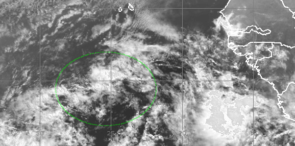
One week ago, I first introduced the easterly wave that exited Africa (which, by the way, is quite unusual for early June)... well, it is still out there at around 50W, gradually making the trek westward, but has been embedded in a hostile environment and has not been able to develop much.  It continues to struggle, but is still trackable.  I will keep an eye on it of course, but just wanted to mention it again for continuity.  It is of no concern in the foreseeable future.


06 June 2013

Andrea forms, strengthens, and targets Florida and East Coast

Today's update on Tropical Storm Andrea and the disturbance in the central Atlantic can be found on Washington Post's Capital Weather Gang blog:


05 June 2013

Interest in the Gulf of Mexico increases; central Atlantic still brewing

Though still subject to substantial vertical shear, the disturbance in the Gulf of Mexico has become visually more impressive overnight.  The surface pressure has fallen to 1007mb, and it's now centered about 450 miles west of Key West FL.  Strong thunderstorms have become more persistent and somewhat more centralized, but still quite removed from the surface circulation.  Another aircraft reconnaissance mission is scheduled to investigate the system later today.

Enhanced infrared satellite image of the disturbance in the central Gulf of Mexico.  The surface low is centered west of the strong thunderstorms and is marked with a red L.  It will begin moving toward the northeast.
The biggest concern from this system (whether it becomes a named storm or not) is the rain.  There will be winds associated with it too, but almost certainly nothing beyond minimal tropical storm force.  In the coming days, it will ooze northeast toward northern Florida, and gradually interact and merge with a mid-latitude trough.  This will bring heavy rain literally all the way up the east coast over the coming week.

Rainfall forecast valid from Wednesday morning through next Wednesday morning. Totals of 2"+ cover huge portions of the eastern US.  (NOAA/WPC)

Further east, the easterly wave I first mentioned last Friday is now centered near 10N 40W, or about 1300 miles east of the Lesser Antilles.  More models are coming onboard now with developing this wave, and they all agree on a track that brings it northwest, such that it steers north of the Lesser Antilles.  There's plenty of time to keep an eye on this.

Visible satellite image of the easterly wave in the central Atlantic.  It is approximately half way between the Cape Verde islands and the Windward islands.


03 June 2013

Gulf of Mexico remains unsettled


In today's update, I will focus more on the disturbance near the Yucatan peninsula, and just briefly mention that the disturbance I've been tracking in the east Atlantic is in no rush to get better organized (it's centered near 35W today).

The area of interest in the southern Gulf of Mexico continues to fester, and models continue to develop a tropical cyclone out of the region within the next few days.


The graphic below shows two versions of a tropical cyclone formation probability map... the top is model-based, and the bottom is satellite-based.  Both are valid within the next 2 days, and both agree that the Yucatan system is of greatest interest, while only the model-based version brings attention to the eastern Atlantic wave.

0-48h model-based formation probability (EMC) and 
satellite-based formation probability (CIRA).

Among the models that show this system gradually congealing into something, a track toward Florida is anticipated... with the area between Tampa and Apalachicola looking most likely in the Thursday-Friday timeframe.  However, at this time, models are not indicating that this would become much more than a tropical or subtropical storm.  If nothing else, substantial rainfall is expected across much of Florida over the next 5 days, particularly to the right of the system's center...


02 June 2013

Still closely monitoring two disturbances

Forecast models are still locking onto the development of two tropical cyclones in the coming days across the Atlantic... giving additional confidence in the update I posted on Friday.  The graphic below shows the favored regions for development in the next couple of days (shaded contours and red circles) along with the crude estimates of what a heading could be (red lines).  Keep in mind that none of these areas are even a Tropical Depression yet.

0-48-hour tropical cyclone formation probability determined from an ensemble of 
output from four global models: GFS, ECMWF, CMC, and NAVGEM. (NOAA/EMC)

First, there is a 1008mb Low in the Bay of Campeche with widespread disorganized thunderstorm activity... festering in place for days where Barbara's remnants were after it crossed over from the East Pacific last week.  There is also heavy thunderstorm activity that spreads across the Yucatan peninsula and into the extreme northwestern Caribbean.  Anywhere in this vicinity is a possible focus for formation.

Sunrise satellite image (the horizontal white lines are missing data).

The second disturbance is an easterly wave centered near 26W (just SSW of the Cape Verde islands).  Though it is visually less impressive than it was on Friday, it is still a viable and trackable entity that several models develop as it heads west across the deep tropics.  Among the models that develop it, they agree quite well on it tracking west for the next several days, then gradually turning northwest, bringing it just north or northeast of the Lesser Antilles by the middle of next weekend.  Clearly, we have plenty of time to see what happens to it before it's a threat to any island or landmass.


Today is the second day of the official Atlantic hurricane season, and as a reminder, the first two names on the list are Andrea and Barry.  Climatologically, we don't get the first tropical storm until July 9, but there is a large variation around that in individual seasons.