30 July 2013

Remnants of Dorian heading into Bahamas today

As of 9am EDT, Dorian's remnants (an open wave) are centered about 120 miles north of the Dominican Republic and tracking WNW at 12 mph.  It has entered a high-shear environment due to a strong upper-level trough extending down into Cuba and Hispaniola.  In the figure below, the wave is located approximately at the red X (look north of the Dominican Republic), while the upper-level trough and associated Low are shown with the green arrow and green L.  This feature generates very hostile winds for the development of a tropical cyclone.

Water vapor image showing upper-level features in the atmosphere.  The mid-level circulation of ex-Dorian is marked by the red X. (NOAA)
A close-up visible satellite image reveals a sheared storm as expected... with an exposed low-level center and all of the deep thunderstorms displaced downshear, or to the east in this case.


Given the poor organization and the bearish environmental outlook, most models are having a hard time even tracking this feature for very long.  So at least for the next few days, the only noticeable effect this will have is to bring enhanced chances of gusty winds and heavy rain to the Dominican Republic, Haiti, Bahamas, and Cuba... and eventually southern Florida by Wednesday evening into Thursday.


29 July 2013

Tropical storm Flossie to hit Hawaii today; will Dorian come back to life?

My update for today covers the remnants of Dorian and what to expect in the coming days... as well as a trip over to the Pacific to discuss Flossie's landfall on Hawaii today.  Check it out on the Capital Weather Gang blog:

Tropical Storm Flossie to hit Hawaii today; will Dorian come back to life?


27 July 2013

Dorian barely hanging on as a tropical storm

Tropical Storm Dorian is making a slight comeback this morning, even in the face of a less-than-ideal environment.  The dry air situation has not improved, the vertical shear is still moderately strong, but the biggest factor in its recent convective activity must be the warming ocean temperatures below.  All other things being equal, a warmer temperature below makes the atmosphere less stable, and better able to support the necessary thunderstorm activity for the development of a tropical cyclone.

Views of Dorian at three different wavelengths, sensitive to visible, infrared, and water vapor.  The ambient dry air is evident in the water vapor image (brown shades in bottom panel). (NOAA)
As of 5am EDT, Dorian's estimated maximum sustained winds are 40mph, and the official NHC forecast gradually dissipates it over the next 24-36 hours... near the eastern Bahamas.  This is in agreement with the dynamical models, but in disagreement with the statistical-dynamical models.

The track forecasts from NHC and various dynamical models definitely reflect a weak storm being steered largely by the low-level trade winds.  If it should happen to intensify, the trajectory would get nudged northward.  But on the westward track, it --or its remnants-- will end up over Hispaniola and Cuba and deliver a lot of rain.
Model and official track forecasts for Dorian... note that most don't even keep the storm through the nominal 5-day forecast period (120h).  (UAlbany)
It's not over 'til it's over... so while it does not currently appear to be a landfall threat, I'll be watching it closely.  In the near future, Puerto Rico and surrounding islands should expect at least a stormy wet day on Monday.  If it weakens much more, it will degenerate into a tropical depression or even an open wave.

23 July 2013

New disturbance exits Africa

An energetic African easterly wave made its way over the far eastern Atlantic this past Sunday, and is now centered just south of the Cape Verde Islands (about 12N 24W).  There is a 1008mb surface Low associated with the wave, as well as fairly persistent thunderstorm activity.


Presently, it's over marginally warm ocean temperatures (in the 26-27C ballpark), is experiencing very little vertical wind shear, and the mid-level atmosphere is relatively moist.  All of these factors combine to suggest that this could easily continue to develop and become a Tropical Depression or Tropical Storm in the near future.  If it becomes a tropical storm, the next name on the list is Dorian.  (Dorian is a new name in the ration this year... it replaces Dean from the 2007 season).

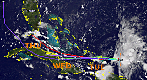
However, starting around Thursday, it should encounter much drier mid-level air, and somewhat cooler ocean temperatures.  I would bet that any strides it makes toward organization today and Wednesday will be halted or undone on Thursday and Friday.  It doesn't do much good to look beyond that period yet, since neither humans nor models have a reliable idea what condition the vortex will be in at that point.  The plot below shows model forecast tracks over the next five days, but keep in mind there is no official NHC forecast yet since it's not even a Depression.


This far out, the long-term track is immensely uncertain.  It's worth pointing out that on average, a storm in this location would take about 12-14 days to reach southern Florida (for example), or 5-6 days to even reach the Lesser Antilles.  So it's nothing to get concerned about now, but as always, warrants watching!

For disturbances this far away from the U.S., we rely on satellite data and any ships or buoys that might be in the vicinity -- traditional manned reconnaissance aircraft cannot reach these remote corners of the basin.  However, for a second year, NASA will be conducting a field program called HS3 (Hurricane Severe Storm Sentinel) in which two unmanned Global Hawk drones fly over tropical cyclones in the Atlantic to collect data on the storm structure and environment.  In tomorrow's update, I'll describe this program in more detail.

18 July 2013

The Sequester's Worrisome Impact on Hurricane Hunters

Today's update isn't on a storm, but rather on a situation involving how well we monitor storms this season.  Please check it out on the Capital Weather Gang's blog and share with anyone you think may be interested!

The sequester’s worrisome impact on hurricane hunters


11 July 2013

Possible regeneration of Chantal?

Chantal officially dissipated into an open wave a few hours after my update on Wednesday.  Since then, it has brought heavy rain to Jamaica, Cuba, and Haiti, and now, there are hints of at least a mid-level circulation center emerging on the northern coast of Cuba.

It is still very disorganized, but enviromental conditions are expected to improve dramatically along its path on Friday, so it's not out of the question that it could regain a heartbeat.


The map below shows the area of interest with a 3-hourly surface wind analysis overlaid... clearly depicting curvature in the winds centered on central Cuba (south of Andros Island).  To help monitor the precipitation movement, I have long radar loops available from Camauguey, Cuba and Miami, Florida:
 http://andrew.rsmas.miami.edu/bmcnoldy/tropics/radar/

(marinetraffic.com)
The afternoon update on the various track forecasts from "cheap" and dynamical models shows this disturbance moving generally northward along the Gulf Stream, affecting Florida, Georgia, South Carolina, and North Carolina in the coming days.  By far, the biggest threat will be heavy rain and resulting flooding.  The majority of the worst weather will be east of the "center"... so over the Bahamas and the ocean.

(NCAR)
The easterly wave I've been mentioning in the far eastern Atlantic is still there, but is getting engulfed by dry air and sliding north... now centered about 300 miles WEST of the Cape Verde islands.  This no longer looks like a candidate for tropical cyclogenesis in the foreseeable future.


07 July 2013

Early season tropical wave heading toward Caribbean

An unseasonally strong easterly wave exited the African coast on July 3, and has been making its way across the deep tropics.  As of this writing (9am EDT), the almost-Depression is centered near 9N 42W, or about 1400 miles east of the Windward Islands.  The first image below is a zoomed-out satellite image to show the disturbance in relation to landmasses, and the second is cropped in to see the detail.

 
Conditions are favorable to this to develop further and could easily be upgraded to Tropical Depression 3 today or tomorrow (if it becomes a tropical storm, the next name on the list is Chantal).  On its current trajectory, it should reach the Lesser Antilles sometime on Tuesday... the intensity at that point is anyone's guess at this point, unfortunately.  Intensity forecasts of pre-Depression systems are very difficult, mostly because so much is possible: it could encounter unforeseen hostile shear or dry air and fall apart in two days, or it could rapidly intensify to a hurricane in two days. 

A variety of model forecasts... the green ones are very simple models that are not skillfull, while the others are more skillfull and are much more sophisticated.  The track with the black diamonds (XTRP) is just an extrapolation of the current motion.  None of these are official forecasts, and are just shown to give an idea of where the storm could track. (SFWMD)
As I mentioned, this is quite early in the season to have a strong easterly wave like this, and going back to 1851, I could only find one other storm that formed or passed within 100 miles of this disturbance's location in all of July: Tropical Storm Arthur 1990.  However, if one removes the July restriction, the list opens up to include infamous storms: Flora 1963, Joan 1988, and Ivan 2004.

Stay tuned for updates!