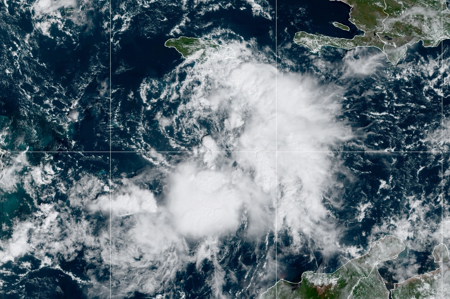
 Tropical Storm Lisa formed today in the central Caribbean, just south of Jamaica. This has been a feature of interest for about six days already, but it failed to develop near the Lesser Antilles and the eastern Caribbean. Even today, it looks marginal on satellite, but aircraft data confirmed the organization and intensity necessary to upgrade it to a tropical storm.
Despite the extremely warm ocean water in the western Caribbean, Lisa continues to face some environmental challenges to intensification. There's quite a bit of dry air to the west, and some of that is wrapping into the circulation now and will continue to linger. The storm is also in fairly strong vertical wind shear as evident in the satellite animation above -- the low-level center is completely exposed and the thunderstorm activity is all displaced to the east and south.
Over the next couple of days, the shear is expected to relax somewhat, and that in turn will reduce the amount of dry air that reaches the storm center. This 3-day forecast from the American GFS model shows the mid-level humidity in the colored shading, and it illustrates the gradual moistening of the storm environment before it makes landfall.

The model guidance is fairly clustered on the track, but more scattered on the intensity. For track, Lisa will continue to head west across the Caribbean, reaching Belize midday Wednesday. For intensity, the large majority of models keep it as a tropical storm, but there's an outside chance that it could reach hurricane intensity prior to landfall. The official forecast (as of 11am EDT) is on that high end and indicates a minimal Category 1 hurricane at landfall... if model trends continue to drop, the subsequent NHC forecasts will certainly reflect that.

Lisa is the season's 12th named storm... you have to go back to 2015 to find so few storms by the end of October, and in terms of Accumulated Cyclone Energy (ACE), the season is at about 73% of average for the date.

Elsewhere, the Atlantic is quiet and there's no sign of new development within the next week or so.
- Visit the Tropical Atlantic Headquarters.
- Subscribe to get these updates emailed to you.
- Follow me on Twitter


