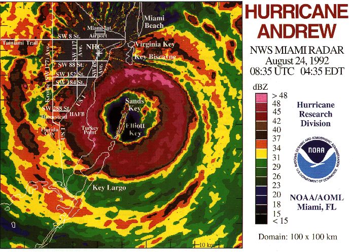
Today is the 18-year anniversary of Hurricane Andrew's catastrophic landfall near Miami. The eye crossed the coastline at Homestead with a pressure of 922mb. Wind measurements are uncertain, as nearly all anemometers were destroyed, but the strongest gust observations that exist are around 175mph.
http://en.wikipedia.org/wiki/Hurricane_Andrew
http://www.nhc.noaa.gov/gifs/1992andy.JPG
And, here are some very nice radar loops saved by my friend and hurricane chaser Michael Laca in Miami: http://www.youtube.com/watch?v=ZgoqyumbXLE
At 21Z yesterday, Danielle was upgraded to a hurricane, the second of the season. The storm has continued to intensify, now a Category 2 storm with 85kt winds and a 973mb central pressure. It is forecast to reach major hurricane status later today and tomorrow. The track forecast has not changed... still heading WNW then beginning to recurve by 60W.
The easterly wave just off the coast of Africa has also gotten better organized, though isn't quite a Depression yet (as of 14Z). Its estimated intensity is 25kts and 1008mb. It is expected to develop quickly, and most likely become the 3rd hurricane of the season in a few days as it heads WNW. The next name on the list is Earl.
Please visit my tropical Atlantic headquarters.
No comments:
Post a Comment