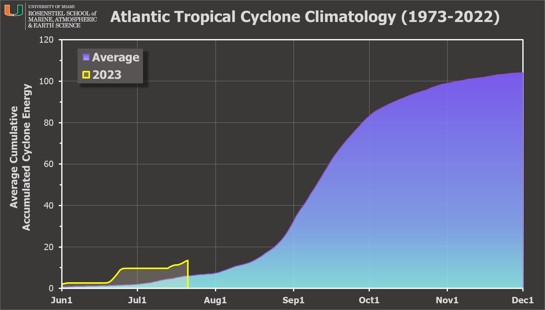
I didn't initiate a thread of blog posts on Don when it first formed last Friday. It's been a lackluster middle-of-nowhere storm that really didn't warrant paragraphs of writing. But, it's not going away, and it is the fourth-earliest fifth* named storm on record. Using the past 50 years (1973-2022) as the baseline, Don formed 45 days before the average date of fifth storm formation!
Don is a mid-range tropical storm located between Bermuda and the Azores and is not expected to affect land in its future. It is just about to complete a large week-long loop before heading north into cooler water and dissipating near Newfoundland early next week.

You probably noticed Invest 95L on the track map above. That is an easterly wave that exited the African coast on Monday the 17th and is now centered about 1300 miles east of the Lesser Antilles. The National Hurricane Center is giving it a 40% probability of development within a week as it heads west across the deep tropics.
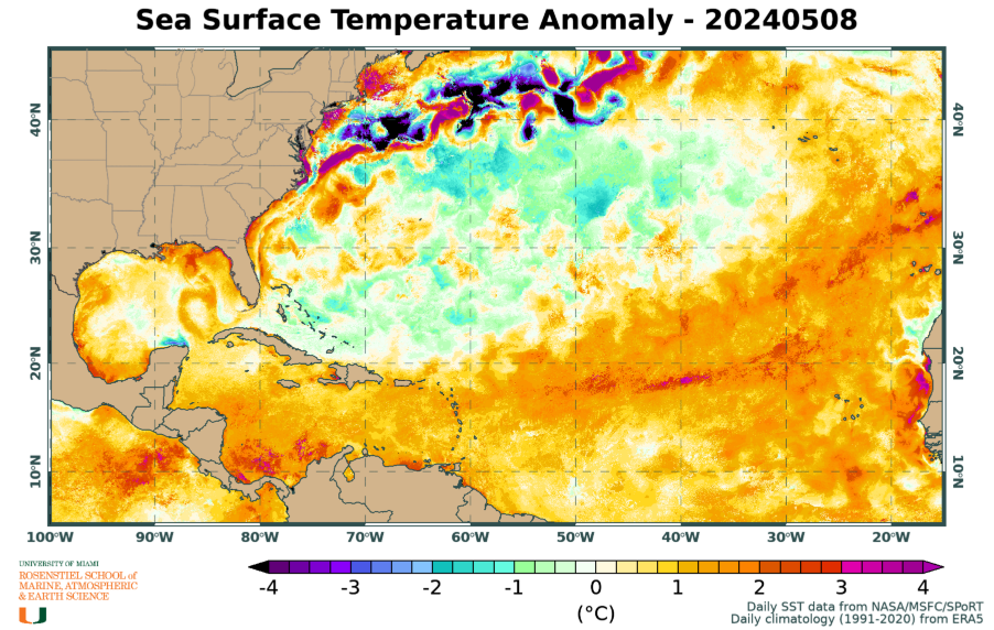
In this satellite animation, Invest 95L is the feature in the middle... but I also overlaid contours of the sea surface temperature -- the ocean is VERY warm ahead of it and those ocean temperatures are certainly relevant. Much of the Atlantic is anomalously warm, and this region is no exception. Those anomalies are expanding the favorable areas for development for this time of year, and making areas that normally would already be favorable even more so.

The disturbance does have some dry, dusty Saharan air to contend with in the coming days, so the intensity forecast is not straightforward. However, model guidance generally indicates it will reach the Lesser Antilles around Tuesday at tropical storm intensity or possibly Category 1 hurricane. (On the intensity chart, you can disregard the gray one ("SHIPS") as that is a statistical-dynamical model that assumes the system is already a tropical cyclone. Since it is not, it's getting an artificial boost there. However, qualitatively, that forecast does indicate a favorable environment for intensification.)

Beyond then, it will be in the Caribbean and will encounter stronger vertical wind shear... but how strong will the storm be by then? Should this end up developing into a tropical storm, the next name on the list is Emily.
As far as the seasonal update on Accumulated Cyclone Energy (ACE) goes, 2023 is at about 220% of average for the date, again using the past fifty years as the climatological baseline.