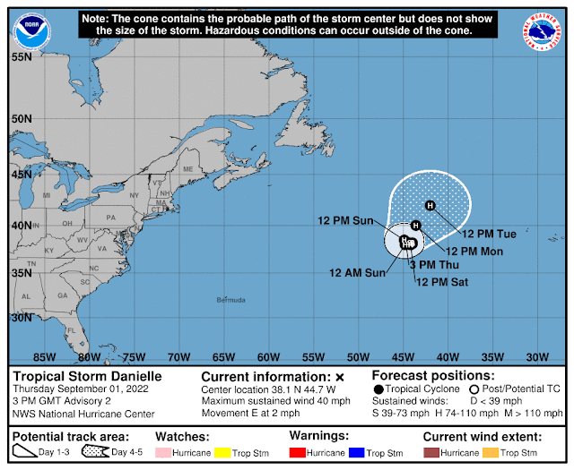
The last named storm, Colin, formed and dissipated on July 2. The Atlantic has been incredibly quiet since then, but Tropical Storm Danielle has just formed on the first say of September. However, you may be surprised to see that Danielle is not anywhere near the tropics, but is actually just west of the Azores, way up at the top-center of the satellite image shown above. I'll discuss the other two areas of interest later.
It is just a minimal tropical storm now, but is forecast to become the season's first hurricane this weekend. It is also not expected to travel much in the near future. The last time it took this long to get a first hurricane was 2013, and that was on September 11.
The next feature is Invest 91L, the same wave I discussed in my previous post last Friday. It's now centered about 600 miles east of the Lesser Antilles, and has been very slow to get organized. But, NHC is giving it an 80% chance of formation within the next five days. If it becomes a tropical storm, the next name on the list is Earl.
In this satellite animation, I am showing Invest 91L on the west side, and Invest 94L on the east side (over Cabo Verde).
Finally, Invest 94L is near Cabo Verde and will be a victim of dry air... there's minimal model guidance that indicates it will be a feature of interest for much longer. NHC is giving it a 30% probability of becoming a tropical depression in the next couple of days, then that's likely the end of it.
We happen to be halfway through the hurricane season today in terms of time, but in terms of ACE (Accumulated Cyclone Energy), we are climatologically only one-third through the season. Compared to the average over the past 50 years, this year's activity is down to 9% for the date! Even with an active named storm now, it would take a steady 70-kt Category 1 hurricane just to keep pace with climatology this time of year.
- Visit the Tropical Atlantic Headquarters.
- Subscribe to get these updates emailed to you.
- Follow me on Twitter


No comments:
Post a Comment