Since my previous post on Tuesday, Fred did indeed become a tropical storm just south of Puerto Rico. And so, having the sixth named storm form so early in the season puts 2021 in the company of 2020, 2017, 2012, 2005, and 1995. Those just happen to be a collection of some of the most active and infamous hurricane seasons on record.
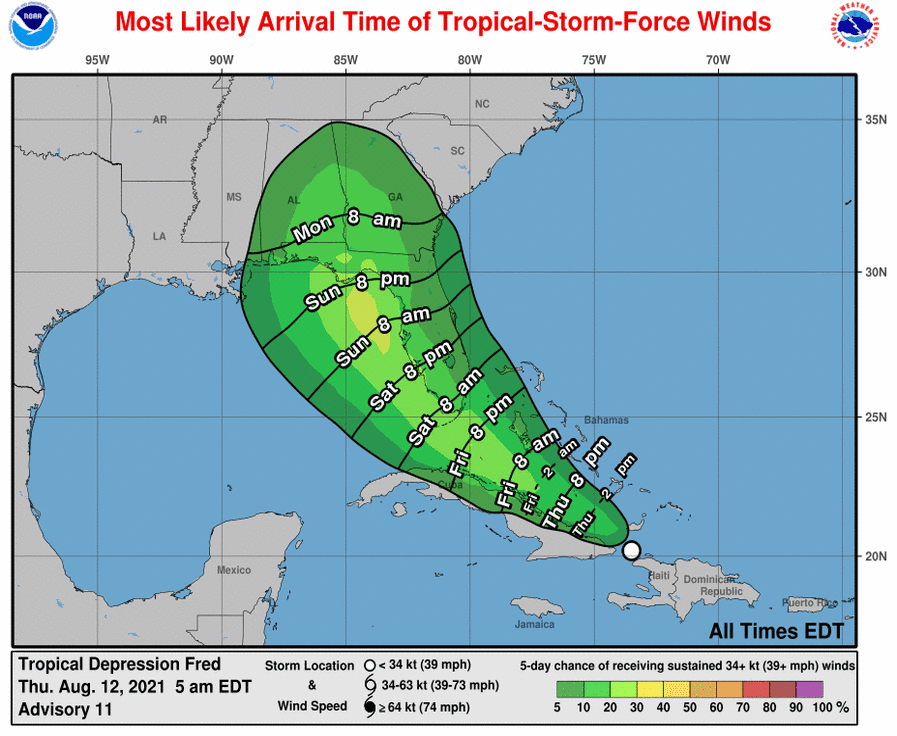
Since then, the not-so-organized Fred passed directly over the mountainous island of Hispaniola on Wednesday, and what has emerged on the other side is a ragged mess of clouds -- barely clinging to tropical depression status. As of Thursday morning, Tropical Depression Fred's exposed low-level center is located just north of the eastern tip of Cuba.

Given its current lack of organization and the forecast proximity to Cuba, it's really hard to see a way that this can intensify much before impacting south Florida on Saturday morning. Not surprisingly then, the tropical storm wind speed probabilities are fairly low for Cuba, the Bahamas, and south Florida, but increase a bit once it enters the Gulf of Mexico, where it does have a shot at strengthening some more.


If this one becomes a named storm, the next name is Grace. The average date of the seventh named storm is September 3rd, so it would be a couple weeks ahead of an average season if it reaches that status in the next few days. By the way, the only seasons since 1851 to have seven named storms by August 15th (three days from now) are 2020, 2017, 2011, 2005, 1995, 1936, and 1933.

As of Thursday morning, the season's total ACE (Accumulated Cyclone Energy) is at 115% of average for the date, using the past 50 years as the baseline. We are entering the time of year where it's easy to slip behind average if there's not at least one named storm going. The 2021 season has been above-average right from the beginning.

Thank you!
ReplyDelete