
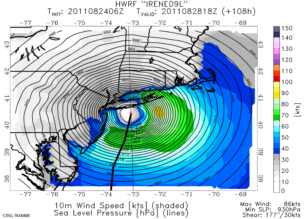
Irene has also begun to turn toward the northwest, and the current motion is northwest at 10kts. It is in an ideal environment for additional strengthening, and is forecast to reach 115kts (Cat 4) by Thursday morning. The official track brings Irene over the remainder of the Bahamas through Thursday night, then heading a bit more north... perhaps scraping by coastal NC on Saturday. More noteworthy however, is the track after that. If the current model runs and official forecast verify, Irene will hit Long Island NY and/or coastal New England -- and still as a powerful hurricane. One representative model run (HWRF) has an ominous forecast valid Sunday afternoon:
Aircraft are frequently flying into and around this storm to sample its structure and environment, hopefully resulting in accurate forecasts of intensity and track. You can find the latest track forecast, watches, and warnings at http://www.nhc.noaa.gov/storm_graphics/AT09/refresh/AL0911W5+gif/143914W_sm.gif
Elsewhere, a very strong easterly wave exited Africa on Aug 22 and is now centered near 12N 28W. It already has a vigorous mid-level circulation and is in a favorable environment for development. However, the present steering currents out there are expected to lift this system northwestward long before it's a threat to any land. If named, the next name is Jose.
Please visit my tropical Atlantic headquarters.
No comments:
Post a Comment