The disturbance I mentioned in Saturday's post was upgraded to Subtropical Storm Nicole early Monday morning. This is the season's 14th named storm, which is the average number during a full season.

As a bit of an introduction, there are three classifications of cyclones based on their structure, energy source, and other factors: tropical, subtropical, and extratropical. Those approximately correlate to the latitude bands in which they exist, but there's a lot of overlap... and even the classification can be tricky because the boundaries between the classifications are continuous, not discreet. Anyway, a subtropical storm doesn't look like the classic symmetric, compact thing we associate with a tropical storm, but the impacts can be the same. In other words, don't downplay a storm just because it's labeled "subtropical".

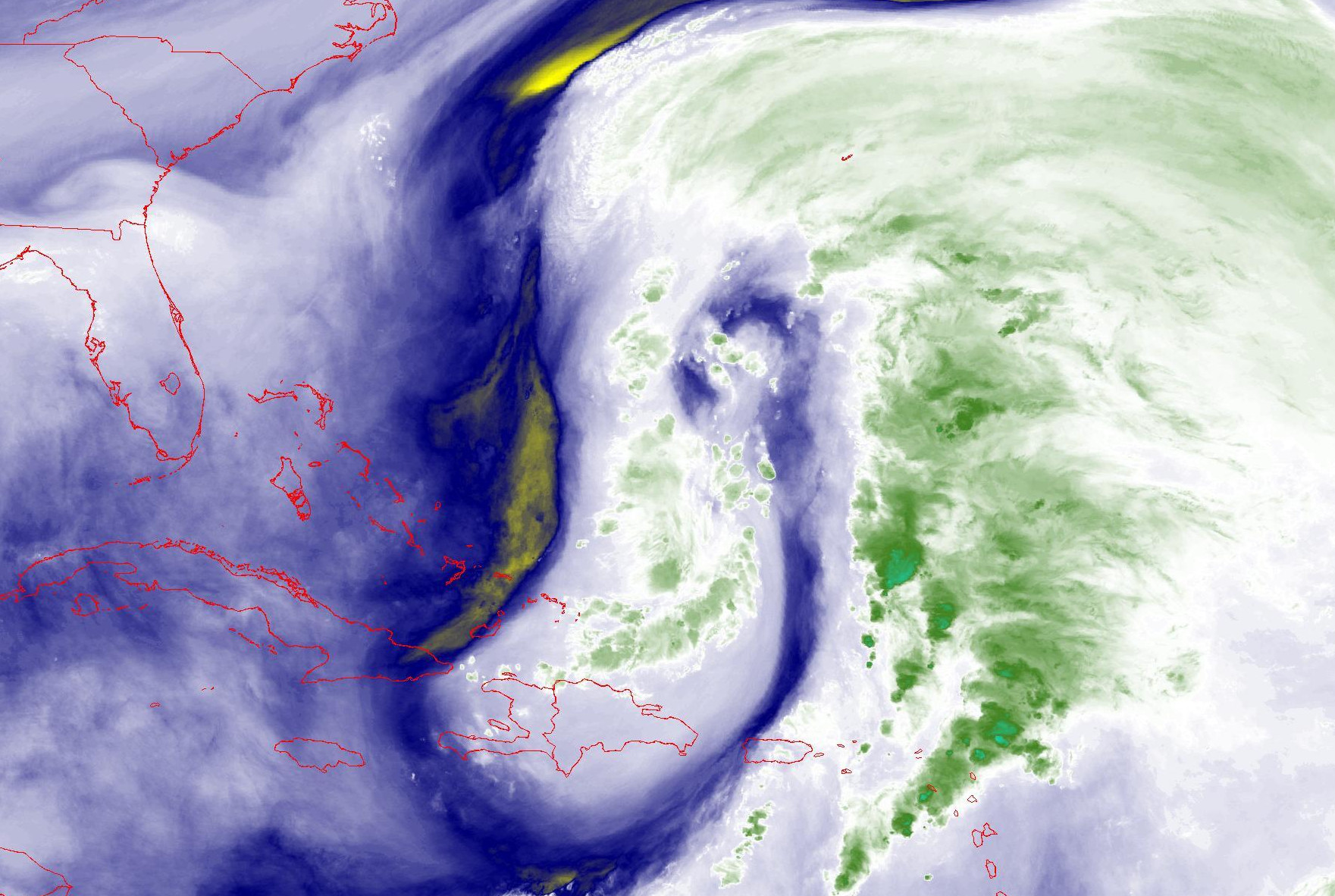
Nicole is presently centered about 450 miles north of Hispaniola, and 650 miles east of Miami, Florida. The wind field is very large, but also very lopsided (that's part of the subtropical classification). It is expected to transition to a tropical storm by Wednesday, and that means it should become more symmetric, but the wind field will still be expansive.
As always, do NOT use the "cone of uncertainty" for anything other than uncertainty in the track forecast. Notice that right now, almost the entirety of tropical storm conditions (the orange blob) is outside of the cone.

And it's that expansive wind field that is the big problem in the coming days. We are looking at several days of significant coastal flooding from North Carolina to Florida from the storm, but then we also have already-high tides for a few days around Tuesday's full moon. This is going to be a big deal, so it shouldn't be underestimated because it's "only" a tropical storm. The animation below is a forecast of significant wave height (shaded contours), surface wind (maroon barbs), and swell direction (green arrows).
 |
| This product is updated every six hours; you can find the most recent at http://bmcnoldy.rsmas.miami.edu/wavewatch/ |
Tropical storm watches are in effect for extreme southeast and northeast Florida, with hurricane watches for the northern Bahamas and central and south Florida (from Broward County north). Based on the 10am EST forecast, the tropical storm wind speed probabilities and earliest reasonable time of arrival are shown below.

The ensemble spread in track forecasts spans from the Florida Keys to Cape Canaveral, with the most likely in the West Palm Beach area. Impacts will be worse north of the center, and not as bad south of the center, so if it does end up making landfall in the West Palm Beach area, Miami and Fort Lauderdale would fare much better than places like Melbourne, Daytona, and Jacksonville.

Finally, in addition to the widespread threat of tidal flooding, Nicole will deliver a long swath of heavy rain from Florida up to New England over the next five days.

- Visit the Tropical Atlantic Headquarters.
- Subscribe to get these updates emailed to you.
- Follow me on Twitter
No comments:
Post a Comment