Let this be a lesson in model confidence: one day ago Tropical Storm Lisa's prospects for intensification were not too high, and the rest of the Atlantic looked pretty quiet with just low chances of formation near Bermuda (I didn't even bother mentioning it). Today, Lisa is a strengthening mid-range tropical storm and Tropical Storm Martin formed well east of Bermuda.

Although Lisa is still battling some westerly wind shear, the appearance is drastically more symmetric compared to yesterday, so the dry air I mentioned did not sneak into the circulation as much as expected, and the extremely warm ocean helped to give it a kick.
Lisa is still expected to make landfall in Belize on Wednesday evening, and the odds of it reaching hurricane intensity prior to then are higher now... several more dynamical models are on board with that scenario. It could re-emerge over the Bay of Campeche on Friday-Saturday, but the model guidance is really scattered on how it evolves after a couple days over land.
The last few hurricanes to make landfall in Belize were Nana (2020), Earl (2016), and Richard (2010).

Martin, the season's 13th named storm, has been a trackable feature for several days now, but looked fairly benign and the models were not too bullish on it. But in the past day it really got organized in a hurry and is a bona fide tropical cyclone.

It too could become a hurricane in the near future, but its time is limited before it transitions to a potent extratropical cyclone over the far north-central Atlantic.
Martin is a new name in this list, replacing Matthew which was retired after the 2016 season.

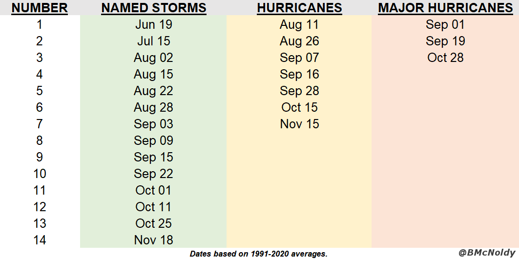
Climatologically, the season's 13th named storm forms on October 25, so this is just a week behind that average date. There have been five hurricanes so far this season, so if Lisa AND Martin make it, that would bring the total up to seven which is the average number during a full season.
- Visit the Tropical Atlantic Headquarters.
- Subscribe to get these updates emailed to you.
- Follow me on Twitter
No comments:
Post a Comment