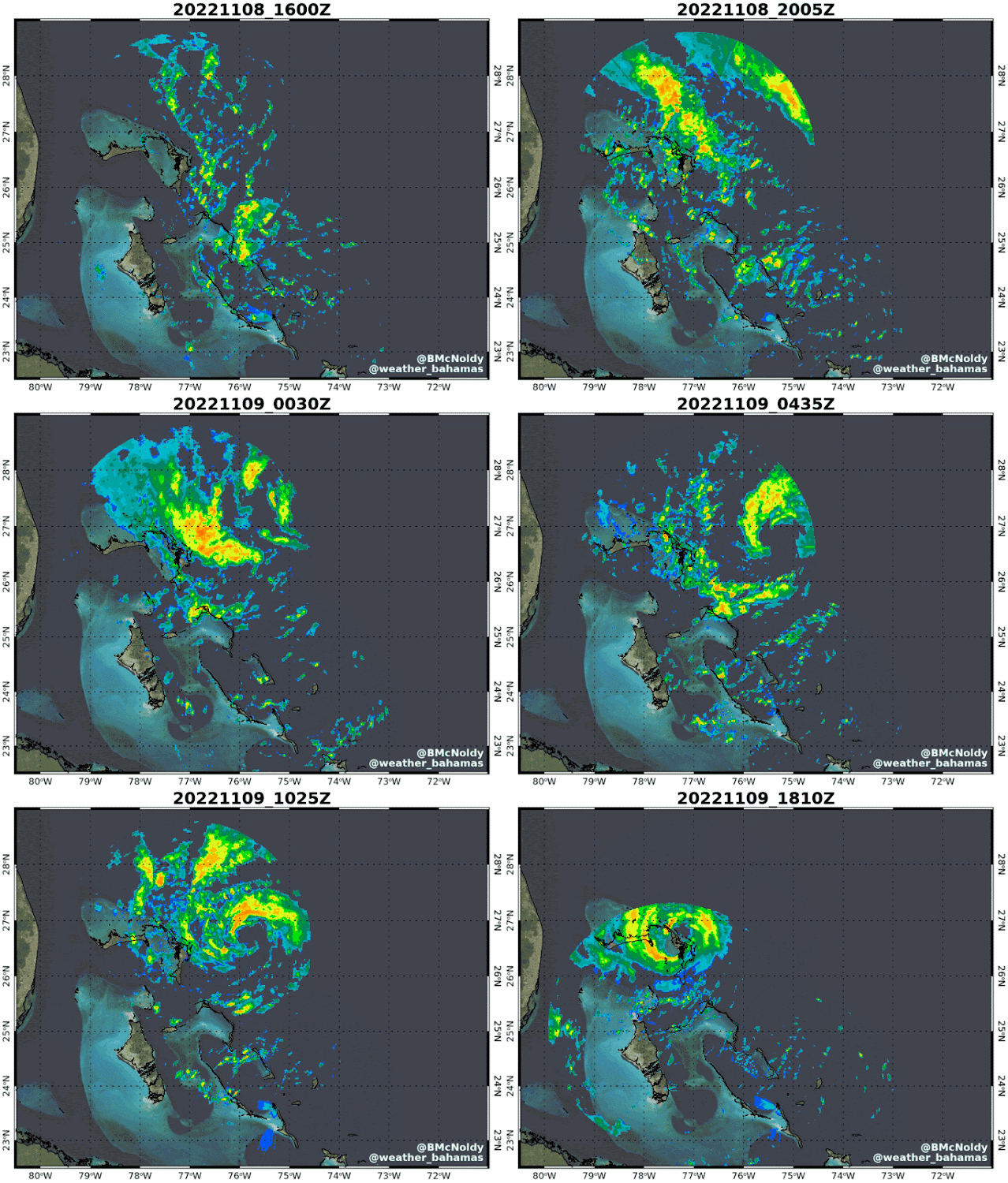
Tropical Storm Nicole is crossing over the northern Bahamas midday Wednesday, and is headed for the southeast Florida coast late Wednesday night, perhaps as a Category 1 hurricane. If it does end up being a hurricane at landfall, it would be just the second hurricane to make landfall in south or central Florida during November in historical records... the one and only previous one was in 1935.
I have several updating radar animations that cover the Bahamas, eastern Florida, and there is one that will be longer and covers the US east coast: https://bmcnoldy.rsmas.miami.edu/tropics/radar/. An example from the Bahamas is shown here.
Nicole is a very large storm, so heavy rain and stronger winds will arrive at locations long before the center is anywhere close, and those conditions will last longer too. As of Wednesday morning, tropical storm force winds extend as far as 460 miles from the center. It's forecast to travel northward along the east coast, dropping heavy rain along its path, and causing coastal flooding along the way too. Although it will lose its tropical classification, it will still be capable of producing significant impacts!
One key point that seems like it can't be made too often is that the track forecast cone (a.k.a. "cone of uncertainty") is not used to show where impacts will be experienced. Clearly, the vast majority of impacts are outside of the cone. Never use the cone to determine what hazards you will be exposed to.
Impacts will be far-reaching, primarily in the form of flooding from heavy rain and storm surge-induced coastal flooding... winds will of course be fairly strong, but generally not very destructive. This set of Hurricane Threats and Impacts (HTI) graphics is valid through midday Friday, and you can see the distribution and threat level of the various hurricane-related hazards: wind, surge, rain, and tornado.
The rest of the Atlantic is quiet, so once Nicole is no longer tropical in a couple days, maybe that will be it for the season... maybe. The Accumulated Cyclone Energy (ACE) is at about 79% of average for the date.
- Visit the Tropical Atlantic Headquarters.
- Subscribe to get these updates emailed to you.
- Follow me on Twitter


No comments:
Post a Comment