I have a radar loop from Martinique that nicely captured the passage of the storm over the central Lesser Antilles. The image below shows the storm at 10Z sitting right over St. Lucia. You can find the full loop here.
As the storm passed over, St. Lucia reported a minimum surface pressure of 1005mb, peak sustained winds of 36kts, a peak wind gust of 55kts, and light rain. This was about as benign of a tropical storm passage as they could have hoped for.

Now Ernesto begins its journey across the Caribbean Sea. It's presently in nearly 20kts of shear and surrounded by rather dry mid-level air, so those factors alone will keep it weak and disorganized for another day or so, but after that, environmental conditions are expected to improve. Now, dynamical and statistical-dynamical models agree on a hurricane in the Caribbean within the next five days. Some of the leading intensity guidance we have suggests a Category 3 storm in five days in the far western Caribbean... poised to enter the Gulf. For the latest official NHC forecast, visit http://www.nhc.noaa.gov/
The track guidance shown below indicates rather good agreement among models, and the intensity consensus at 72h (early Monday near Jamaica) is a Category 1 hurricane, and a Category 2 hurricane in 5d near western Cuba or northern Yucatan. Clearly, this is a storm worth watching very closely.
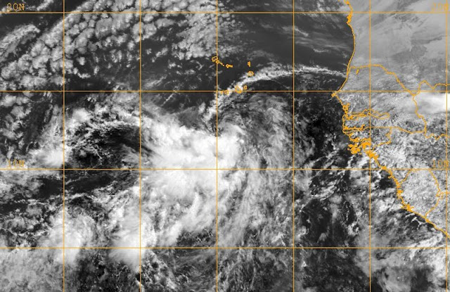
Elsewhere (yes, there's more!), an easterly wave that was generated over the Ethiopian Highlands back on July 27 exited the African coast on August 1, and is now located just south of the Cape Verde Islands near 12N 25W. There is a 1006mb Low embedded within the wave, but conditions in the longer term are not very favorable for development, and the global models (no regional models have run on it yet) do not keep it around. There is a lot of shear and a lot of dry air (Saharan Air Layer) in its future, but we shall see how resilient it can be. If named, the next name on the list is Florence.
- Visit the Tropical Atlantic Headquarters.
- Subscribe to get these updates emailed to you.
- Follow me on Twitter


No comments:
Post a Comment