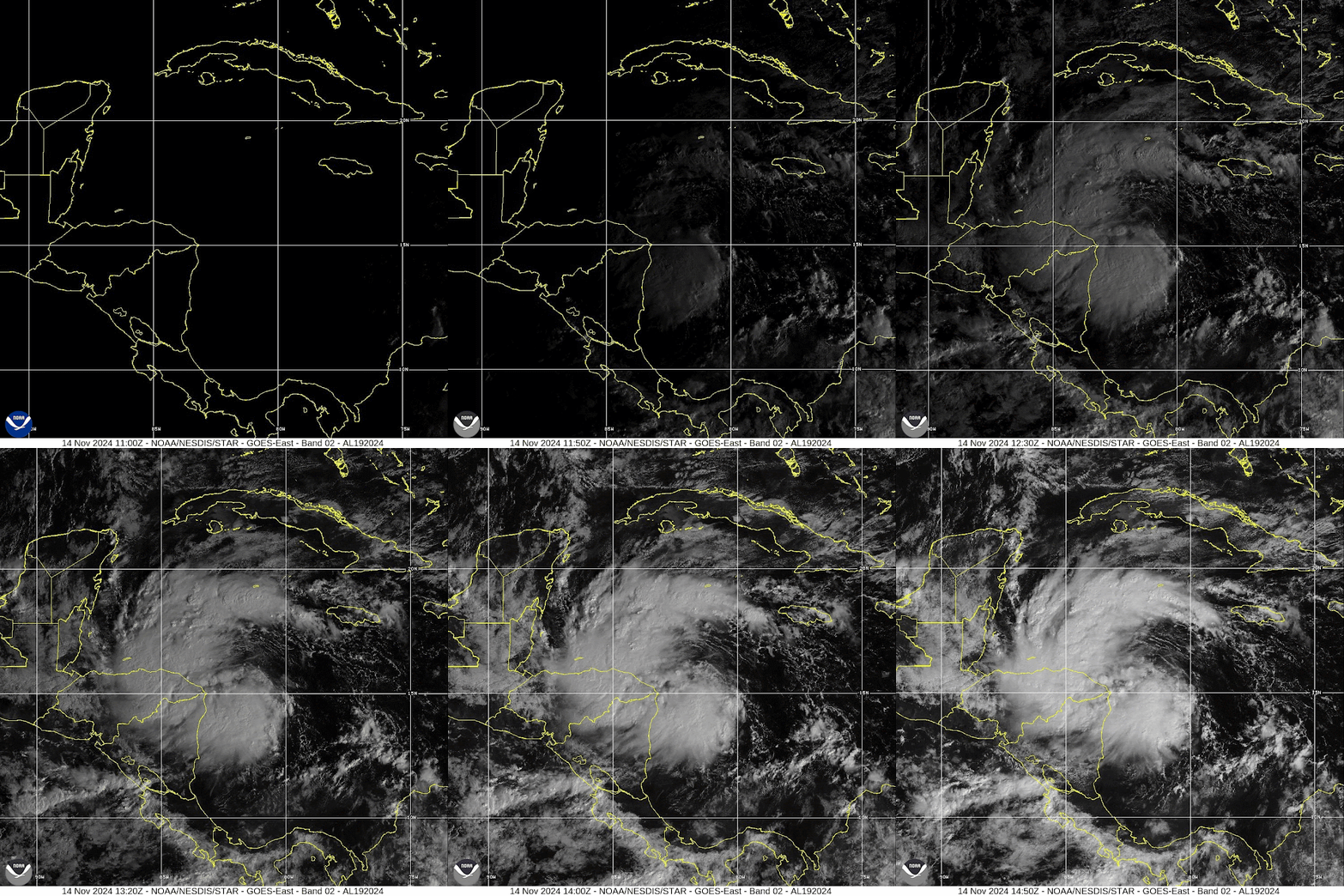
On Thursday morning, a late-season African easterly wave just intensified to become Tropical Depression 19. This was located way back by Cabo Verde on November 1 and then made a slow trek across the deep tropics... it's currently centered off the eastern tip of Honduras. It is very close to becoming the season's 18th named storm, Sara.
This is a very precarious location for a developing tropical cyclone. On one hand, it's over extremely warm water and in low vertical wind shear, but on the other hand, it's really close to land. Heavy rainfall will be a big hazard regardless, but how much can the winds intensify given these competing factors? The model guidance and the NHC forecast indicate a balance, where it can reach tropical storm intensity but not much beyond that for the next 3-4 days before running into the Yucatan peninsula on Sunday. Once over the Yucatan, it will weaken.
After it emerges from the Yucatan, there's a large spread of model scenarios. Many of them more or less dissipate it and that's the end of the story. The rest re-intensify it to some degree over the Gulf and it gets ushered to the northeast toward Florida by a potent mid-latitude trough and cold front. So, Florida could get some impacts from this around Wednesday, but as of right now, it appears those impacts would be relatively minor. A hurricane landfall appears very unlikely, but it's worth keeping a close eye on this one.
These two maps show the latest storm tracks from the American model ensemble (left) and the European (right). To help provide some context of probabilities, the left one has 30 members and the right one has 50 members.
Although unlikely, IF this should end up making landfall in Florida at hurricane intensity, it would join a very short list of November hurricane landfalls in that state. The only previous ones in the history books are:
Unnamed - Nov 4, 1935 - Category 2
Kate - Nov 21, 1985 - Category 2
Nicole - Nov 10, 2022 - Category 1
but none of those originated in the Caribbean Sea or the Gulf of Mexico.
And, if that happens, 2024 would tie the record set in 1886 of SIX landfalling hurricanes on the U.S. Gulf coast (the current five are Beryl, Debby, Francine, Helene, and Milton.
And finally, for those keeping close tabs on the season stats... through today there have been 17 named storms, 11 hurricanes, and 5 major hurricanes. The average counts through this date are 13, 6, and 3. In terms of Accumulated Cyclone Energy (ACE), that's up to about 134% of average for the date. And if the season ended today, it would be in the top 11% of all seasons back to 1851.
As of now, there's no other activity on the foreseeable horizon, but if we do get another storm this season, the next name after Sara is Tony.
- Visit the Tropical Atlantic Headquarters.
- Subscribe to get these updates emailed to you.
- Follow me on Bluesky


Hi Brian,
ReplyDeleteI’ve been following your updates since Helene, so thanks very much for your ongoing work. That said, i’m concerned that your GoM energy plots haven’t been updated since 11/14. Hopefully, that’s due to a relaxing vacation for you. Take care
Hi Chris, thanks for the message! Yes, the server I get the OHC data from has not had new files on it since the 14th, so I've been out of luck. Hopefully things will be back online soon!
DeleteTerrific news. Thanks
ReplyDelete