
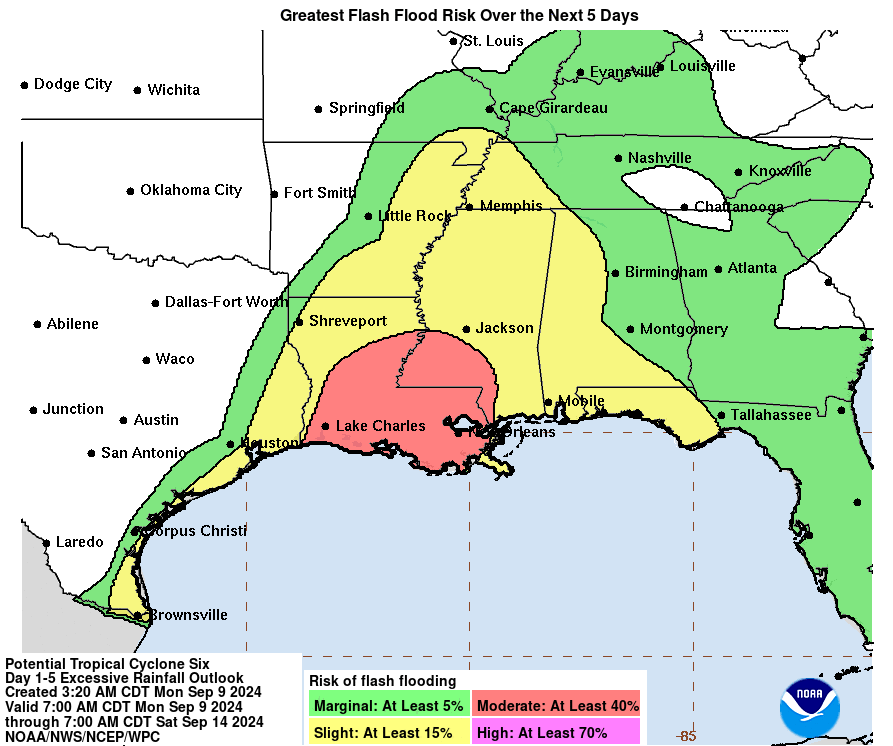
The system in the Gulf of Mexico, tagged as "Potential Tropical Cyclone Six" is close to becoming the season's 6th named storm, Francine, and poses a threat to the northern Gulf coast later this week. It's currently a bit disorganized, but model guidance is confidently showing a quick increase in organization today. The latest NHC forecast for this disturbance (a tropical cyclone has not formed yet) tracks it northward along the far western Gulf, reaching the coast sometime on Wednesday afternoon, likely as a hurricane. Remember: the cone itself does not show impacts, only a historic 2/3 likelihood of where the center of the storm will track.

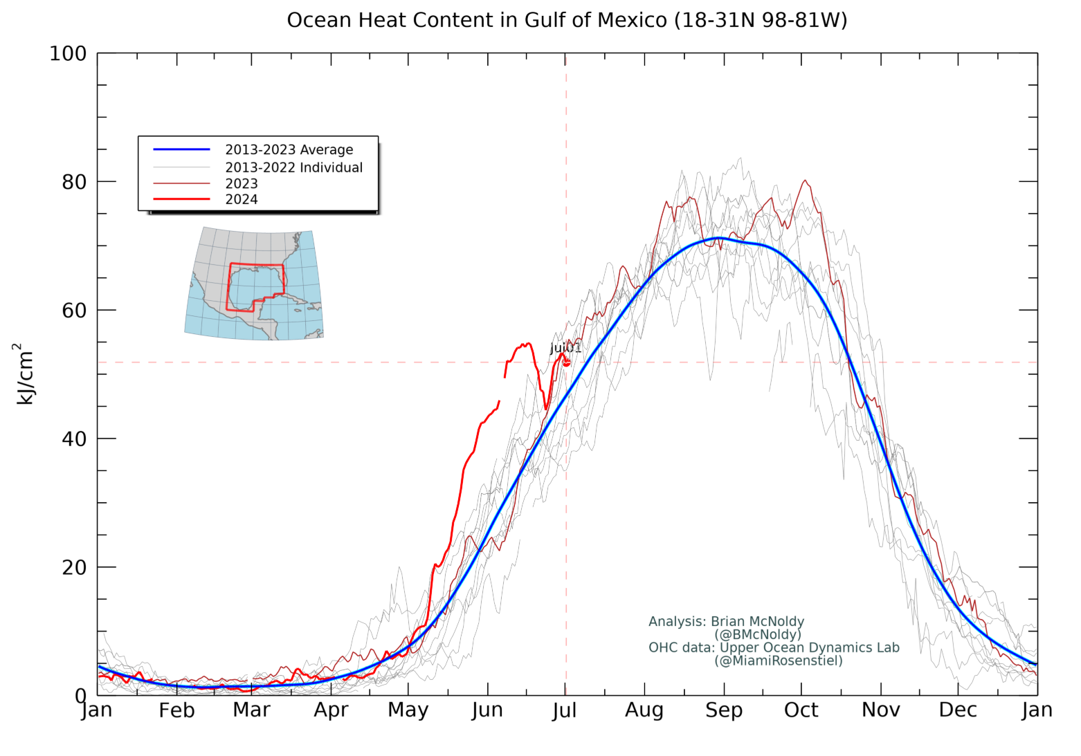
On that trajectory, it will pass over a patch of extremely anomalously high ocean heat content tomorrow. In addition, sea surface temperatures along its path are 30-31°C, so the ocean under future-Francine is primed to fuel and sustain anything. The ocean heat content averaged over the entire Gulf is the highest it's been on record for the date.

NHC forecasts it to become the season's 4th hurricane on Wednesday, and although its window of favorable environmental conditions is relatively brief, it appears there will be an opportunity for rapid intensification from midday Tuesday through midday Wednesday.
Regardless of exactly how much it's able to intensify in the next couple of days, the potential for significant flash flooding from heavy rainfall is there over parts of the southern US.
Now for a quick briefing of the two easterly waves in the deep tropics between the Caribbean and Africa. Both of these have been given a 60% probability of forming within the coming week by NHC, and both are expected to continue tracking toward the west-northwest. Since neither of these pose a threat to land through early next week (slim chance of Leeward Islands this weekend), we'll just keep an eye on them as see how they evolve this week. The long-range model guidance is not too bullish on either of them. But given the time of year, every disturbance in the deep tropics warrants some attention.

This week is the climatological peak of hurricane season, and although we have no named storms right now, that's likely going to change quickly.

Looking at the season's overall activity in terms of ACE (Accumulated Cyclone Energy), even if Francine does form today, 2024's ACE will slip a hair below the climatological value for the first time since June 29. But based on NHC's forecast, that will be rectified by tomorrow and 2024 will be back above average. This time of year it takes a decent amount of activity just to keep pace with the average.

No comments:
Post a Comment