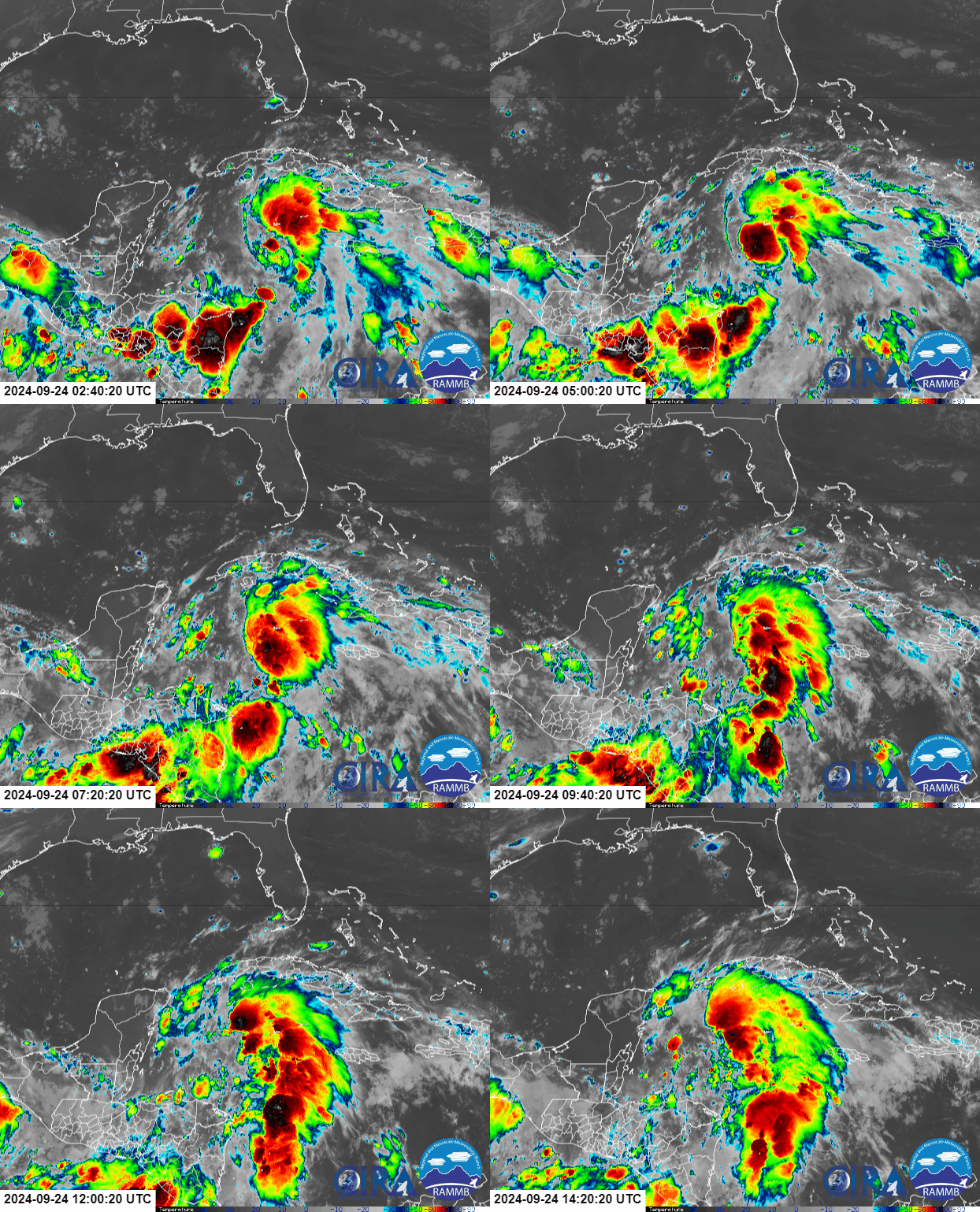
The appearance on Tuesday morning is still lopsided and sheared, but as it moves toward the Gulf the wind shear is expected to relax and it should look much more symmetric.
The organizing storm is forecast to pass through the Yucatan Channel during the day on Wednesday, then encounter very favorable environmental conditions for rapid intensification. It's quite rare for NHC to explicitly forecast RI (conventionally defined to be an increase in intensity of at least 35mph in a 24 hour period) because by definition, it's an outlier. But they are, and not even as aggressively as some of the model guidance is. Helene could easily go from a minimal tropical storm this morning to a Category 3 or 4 hurricane on Thursday before making landfall.
A nice alteration to the 22-year-old "cone of uncertainty" graphic is the inclusion of inland wind-related watches and warnings. This experimental feature has been put to the test already this season, but not like it will be with Helene. Helene is going to pick up speed in the Gulf and be cruising northward quite fast when it makes landfall. This means that places hundreds of miles inland will still experience tropical storm and even hurricane-force winds before the storm's winds have a chance to decay. As the storm gets closer, these will extend further inland.
Helene's track, size, and intensity are going to help maximize the storm surge generated along the Florida coasts. The Big Bend region of Florida is shaped to funnel water onto land when a hurricane approaches, and the current forecast shows the potential for 15 feet of storm surge in that area.
This set of four maps is the suite of Hurricane Threats and Impacts graphics produced on Tuesday morning. Operational for every storm near land since 2015, these show threat levels for the four hurricane hazards: wind, storm surge, flooding rain, and tornado. These excellent impact-based maps are interactive and zoomable, and you can find the latest version at https://www.weather.gov/srh/tropical#hti. I've been a huge proponent of these since they were released experimentally in 2013 and I don't think they get enough visibility.
I have (and will add more) long radar loops to help track the structure and position of the storm at https://bmcnoldy.earth.miami.edu/tropics/radar/
By the way, Helene is still an original name in the set of rotating lists used for the Atlantic. It first appeared on a list in 1982, so this is its 8th time being on the list of names, but it's only the 6th time being used (the 1982 and 1994 seasons never got to the H name).
Elsewhere in the basin, there is an African easterly wave out near Cabo Verde that NHC is giving an 80% probability of becoming the next tropical cyclone in the coming week. Models generally indicate that this will turn to the north long before reaching the Lesser Antilles or any other land. But there's plenty of time to keep an eye on it. After Helene, the next name on this list is Isaac.
 On Tuesday morning, Invest 97L (later designated as Potential Tropical Cyclone Nine for the sake of issuing watches & warnings before it formed) was upgraded to Tropical Storm Helene. This is the eighth named storm of the season, and will very likely become the fifth hurricane of the season by Wednesday afternoon. Amazingly, this will be the fourth hurricane landfall along the US Gulf coast already this season, and it's not over yet!


No comments:
Post a Comment