17 September 2024

Watching western Caribbean for activity next week

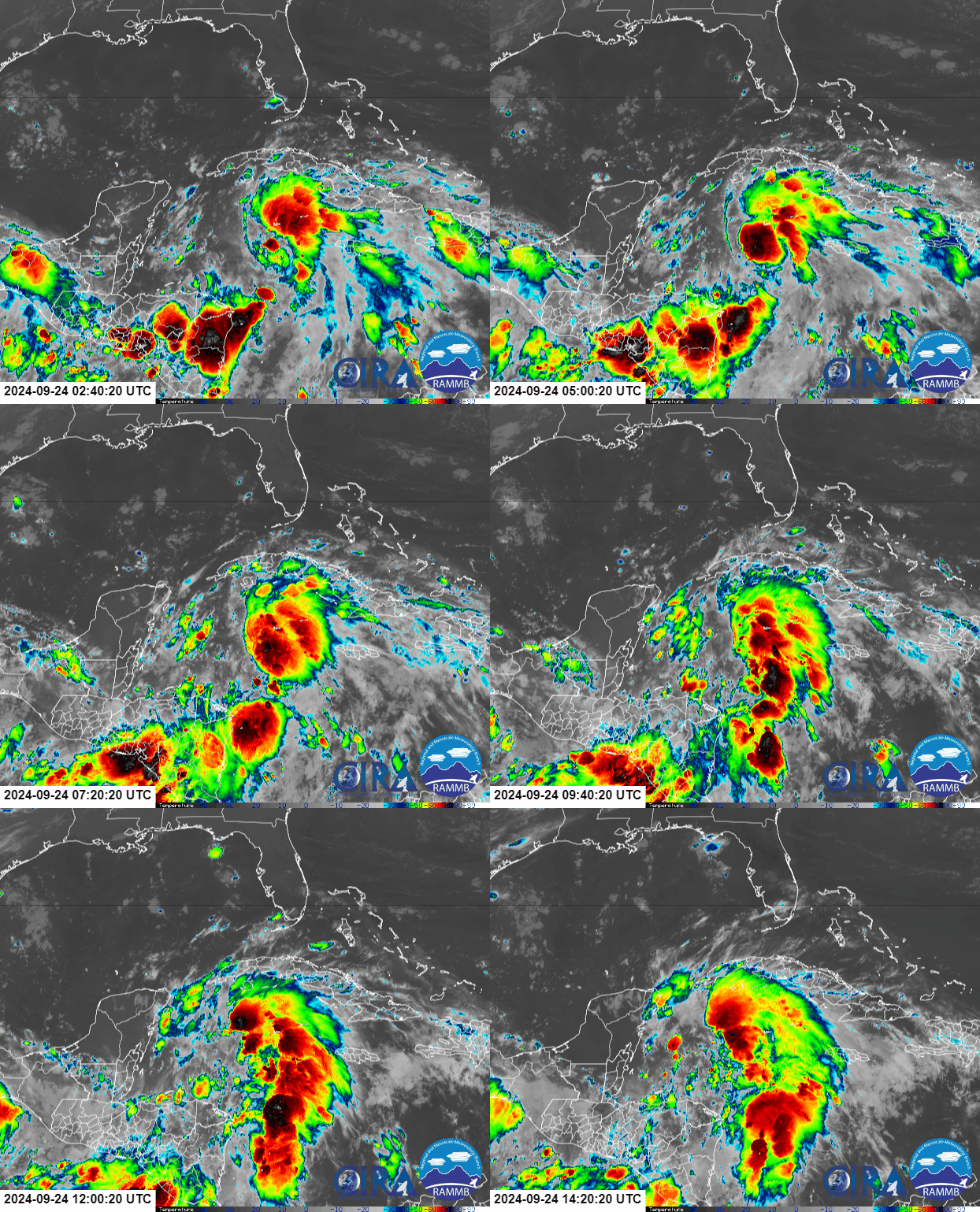
There is a growing signal among long-range global model ensembles that the next storm could start brewing in the western Caribbean in the coming days.  There is nothing to look at yet, but a broad low pressure system could take shape on Friday-Saturday east of Honduras then consolidate and track north from there.  The next name on the list is Helene.


This animation below shows trackable low pressure systems evolving from today through next Thursday from the most recent run of the American global model (GFS) ensemble.  Definitely don't pay attention to details, but you get the general idea of the formation area, and the approximate spread of possibilities as it heads north.  Based on this, the spread is roughly centered on the Florida peninsula with some members out over the Bahamas and out over the Gulf of Mexico by the middle of next week.  The European model's ensemble is similar but everything is shifted slightly west.


The key at this point is to monitor the various ensembles and look for inter-run and inter-model consistency and trends.  But for Cuba, Bahamas, Florida, and the northern Gulf coast, it's time to pay attention every day.

The water temperatures in the western Caribbean are extremely warm... record-breaking.  The figure below shows four panels: the left side is sea surface temperature (actual value on top, anomaly on bottom) and the right side is ocean heat content (actual value on top, anomaly on bottom).  All of this means that should anything form in the western Caribbean soon, the ocean will provide endless high-octane fuel for it.


The deep tropics continue to be much less active than normal, and certainly less active than anticipated this season.  Although the typical large-scale environmental factors are conducive for development, there is something odd happening over Africa.

From mid-August through early October, Africa tends to be a major source of tropical cyclone seedlings.  African Easterly Waves come off the continent every few days, and a small percentage of them usually become hurricanes.  This summer, the area of convergence that runs east-to-west across the continent has been displaced quite far north.  Instead of those waves coming off at the normal 10-15°N, they've been coming off at 15-20°N and immediately encountering cool water and dry air.  This also places frequent thunderstorms and heavy rain over the Sahara Desert resulting in tremendous flooding in central and western desert countries.


As such, the season's Accumulated Cyclone Energy (ACE) is down to about 83% of average for the date and slipping roughly 2% more behind each day without an active named storm.  That means if nothing forms through September 25, this season's ACE will be down to 70% of average.


The next chart shows how 2024 stacks up against previous years (again, through September 17).  It's nothing too notable... some recent years were much higher and some were much lower by now.


11 September 2024

Francine will be third hurricane landfall on the US Gulf coast this year

Shortly after my post on Monday, Francine did indeed form, and then was upgraded to the season's fourth hurricane on Tuesday night.  It is nearing Category 2 hurricane intensity, and will make landfall in Louisiana tonight.  Elsewhere, a strong easterly wave out near Cabo Verde could become Gordon by this weekend.


The NHC's experimental version of the "cone of uncertainty" graphic shows inland wind-related watches and warnings, removes the border around the cone, and eliminates the dotted treatment of the Day 4 & 5 part of the forecast... all-around some really nice improvements.


Of course, in addition to the wind-related watches and warnings, there are storm surge watches and warnings too, and as of the Wednesday morning forecast, a peak storm surge of 5-10 feet is possible from Intracoastal City over to Port Fourchon.  Tide schedules vary within this region, but water levels will be maximized if the peak storm surge arrives at or near high tide.


As mentioned in the title of the post, Francine will be the third hurricane to hit the northern Gulf coast already this year (Beryl and Debby were the others).  That's a lot... though there were five in 1886, four in 2020, 2005, and 1985... and three in 1934, 1915, 1888, and 1860.  So it's not unprecedented, but it's unusual and certainly not welcome! Oh, and the season's not over yet.

Once Francine makes landfall it will continue to move inland and weaken, dumping some hefty rain totals along the southern Mississippi Valley before rather quickly dissipating.  You can find the rainfall forecast maps (and other hazards) on NHC's website at https://www.nhc.noaa.gov/graphics_at1.shtml?start#contents

NHC has four other areas of interest highlighted for potential development in the coming week, but the only one I'll discuss here is the one presently near Cabo Verde... the others have very low probabilities of becoming tropical cyclones.


That wave, tagged as Invest 93L, exited the African coast on Monday and has a lot of model support for development very soon.  Persistent thunderstorm activity is located in a relatively small portion of the broad circulation, and it appears very close to becoming the season's 7th tropical cyclone.


As of now, global model ensembles indicate a west-northwest track for the next 5-6 days followed by a turn to the north somewhere near 50°W longitude (well before the Lesser Antilles).  They also suggest it will struggle to intensify too much until that north turn, after which it could become the season's 5th hurricane. At any rate, as of right now, it does not appear that future-Gordon will be a threat to land.

Catching up on the progress of the season's activity as measured by ACE, even with Hurricane Francine out there, 2024 is struggling to keep up with climatology... right at 98% of average for September 11.  Of course, there's still half of hurricane season ahead of us, and all indicators continue to point to it being above-average.

09 September 2024

Soon-to-be-Francine threatens northern Gulf coast this week

It has been an eerily quiet three weeks since advisories ended for Ernesto on August 20, but at the flick of a switch, the tropical Atlantic is lightning back up with activity.  There is a disturbance brewing in the southern Gulf of Mexico and a couple easterly waves east of the Lesser Antilles that I'll discuss here.  The next three names on the list are Francine, Gordon, and Helene.


The system in the Gulf of Mexico, tagged as "Potential Tropical Cyclone Six" is close to becoming the season's 6th named storm, Francine, and poses a threat to the northern Gulf coast later this week.  It's currently a bit disorganized, but model guidance is confidently showing a quick increase in organization today.  The latest NHC forecast for this disturbance (a tropical cyclone has not formed yet) tracks it northward along the far western Gulf, reaching the coast sometime on Wednesday afternoon, likely as a hurricane. Remember: the cone itself does not show impacts, only a historic 2/3 likelihood of where the center of the storm will track.


On that trajectory, it will pass over a patch of extremely anomalously high ocean heat content tomorrow.  In addition, sea surface temperatures along its path are 30-31°C, so the ocean under future-Francine is primed to fuel and sustain anything.  The ocean heat content averaged over the entire Gulf is the highest it's been on record for the date. 


NHC forecasts it to become the season's 4th hurricane on Wednesday, and although its window of favorable environmental conditions is relatively brief, it appears there will be an opportunity for rapid intensification from midday Tuesday through midday Wednesday.

Regardless of exactly how much it's able to intensify in the next couple of days, the potential for significant flash flooding from heavy rainfall is there over parts of the southern US.


Now for a quick briefing of the two easterly waves in the deep tropics between the Caribbean and Africa.  Both of these have been given a 60% probability of forming within the coming week by NHC, and both are expected to continue tracking toward the west-northwest.  Since neither of these pose a threat to land through early next week (slim chance of Leeward Islands this weekend), we'll just keep an eye on them as see how they evolve this week. The long-range model guidance is not too bullish on either of them. But given the time of year, every disturbance in the deep tropics warrants some attention.


This week is the climatological peak of hurricane season, and although we have no named storms right now, that's likely going to change quickly.


Looking at the season's overall activity in terms of ACE (Accumulated Cyclone Energy), even if Francine does form today, 2024's ACE will slip a hair below the climatological value for the first time since June 29. But based on NHC's forecast, that will be rectified by tomorrow and 2024 will be back above average.  This time of year it takes a decent amount of activity just to keep pace with the average.