 Unfortunately, I did not get a chance to write a post on Friday... and the reason it's unfortunate is that a very rare explosive intensification had just concluded with Hurricane Lee. Only two other storms intensified more rapidly than Lee did in the Atlantic: Wilma 2005 and Felix 2007. The sustained winds increased by 85mph in a day, going from a low-end Category 1 hurricane (80mph) to a Category 5 hurricane (165mph). There were frequent aircraft reconnaissance flights into the storm that sampled the intensity very well.
For posterity, the infrared satellite animation below spans the 24 hours from Thursday-Friday 5am EDT. Another interesting and related bit of weather trivia came to life on Friday: 2023 is now the first year in recorded history in which a Category 5 hurricane (or equivalent) occurred in every tropical cyclone basin in the world... see WaPo's Capital Weather Gang article for details. That's also rather remarkable.
.gif)


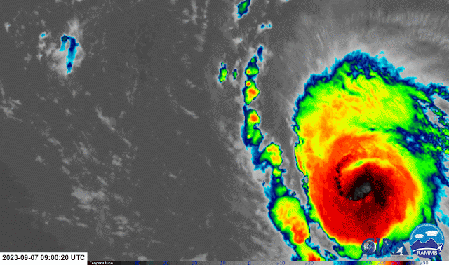
In the meantime, some moderate wind shear and eyewall replacement cycles have weakened the storm a bit, though it's still a formidable major hurricane with 115 mph peak sustained winds. As of Saturday at 5pm EDT, Lee is a Category 3 hurricane located north of the Leeward Islands and is forecast to regain Category 4 intensity on Sunday and Monday. The visible satellite below brings us back to current time (Saturday afternoon):
.gif)
The model guidance is solidly indicating that Lee will turn north on Wednesday, and the NHC forecast reflects that. It should remain a Category 3-4 hurricane through at least the next five days.

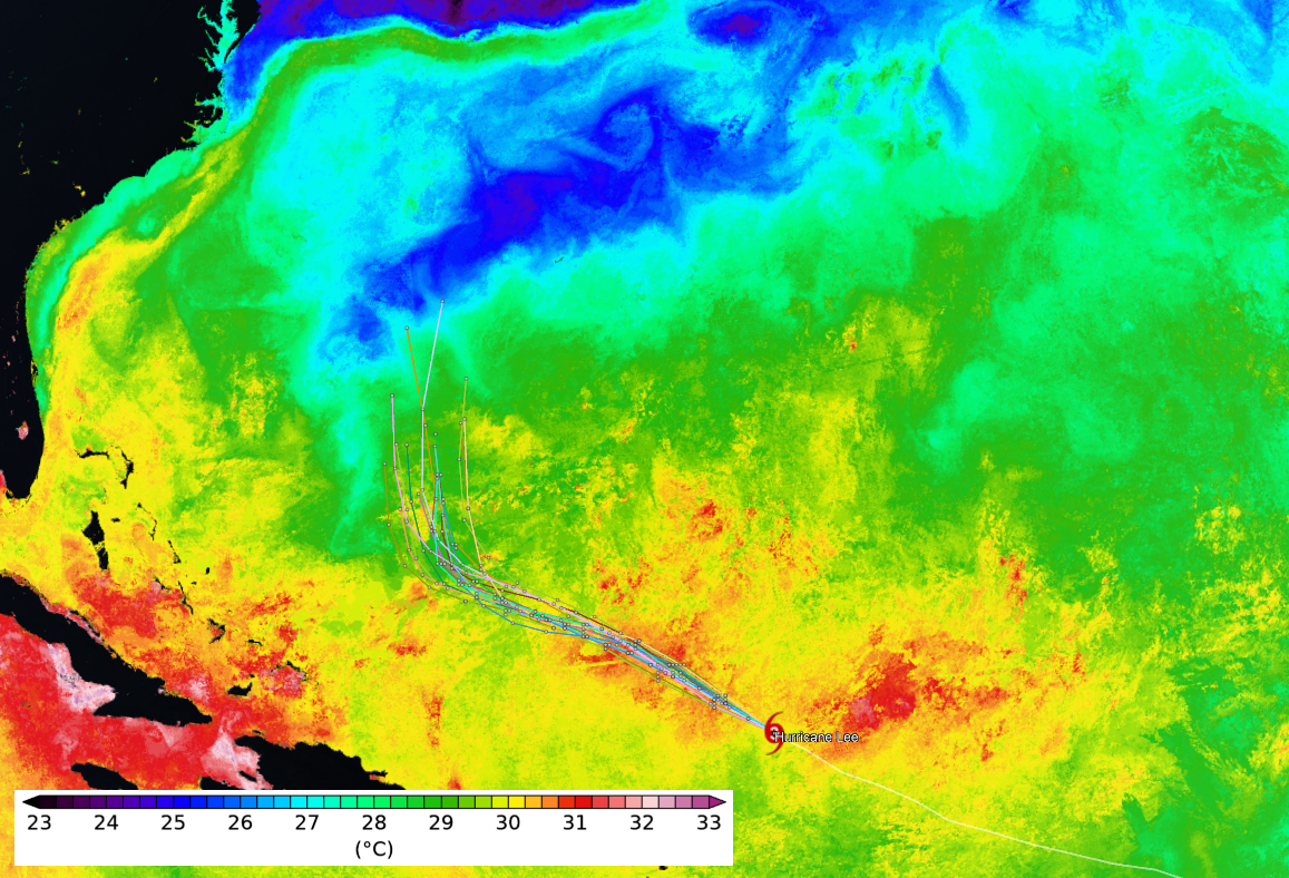
Then, on Friday-ish, Lee will pass over the cold wake that Hurricane Franklin left behind... and it's noticeably colder than the water it's been accustomed to so there is little doubt the hurricane will respond accordingly. This map shows today's sea surface temperature analysis with some model forecast tracks overlaid. Tranklin's cold wake is the blue streak that the tracks approach at the end of the forecast period.
Further east, and also on Friday, Tropical Depression 14 became Tropical Storm Margot, the 14th named storm of the season. It is located in the middle of the tropical Atlantic, far from land, and its forecast track keeps it far from land. It's expected to become the season's fifth hurricane by the middle of next week.

Not surprisingly, the Accumulated Cyclone Energy (ACE) got a big boost from Lee and will for the next week or so. As of today, it's roughly 130% of average for the date. Climatologically, the halfway mark of the season in terms of ACE is coming up on September 12.

As a side note, September 10 is the 6-year anniversary of Hurricane Irma's landfall in Florida... if you're interested in that storm's history, please visit https://bmcnoldy.earth.miami.edu/tropics/irma17/history.html
No comments:
Post a Comment