Lee is still major hurricane, and has been since Thursday afternoon ("major" is conventionally defined to be Category 3+). It's moving toward the west-northwest but the long-awaited north turn should commence later today or early Wednesday.

It's likely going to bring tropical storm conditions to Bermuda on Thursday, then to eastern New England and eastern Canada on Saturday. It's too soon to know exactly where the center of the storm will go, but it will be a large storm with a broad wind field... areas far from the center will experience impacts. That said, the model consensus track has been unwavering with a landfall point near western Nova Scotia on Saturday night into Sunday morning.

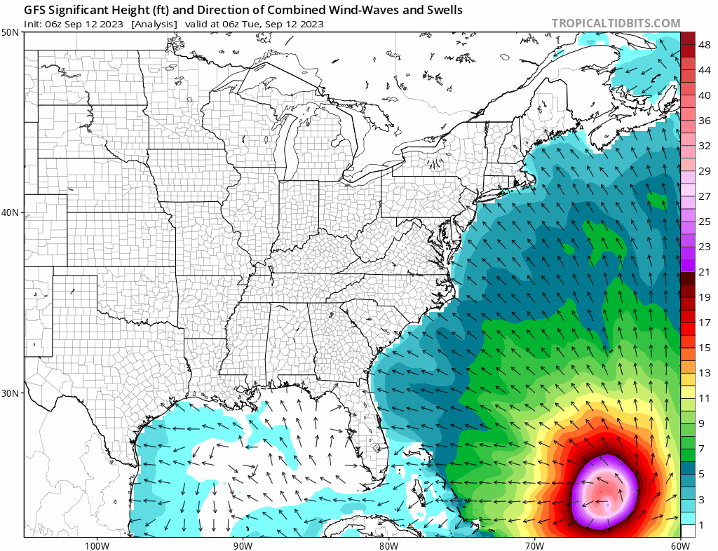
The U.S. east coast, Nova Scotia, and Newfoundland are going to experience some significant impacts from Lee in the coming few days: primarily coastal flooding from storm surge. To add to the flooding, tides are amplified surrounding Thursday's new moon. The animation below shows the predicted "significant wave height" from the GFS wave model, out to next Tuesday morning. With the new moon's assistance, this multi-day onshore swell energy is going to create big problems from Florida to Newfoundland.
Margot was upgraded to the season's fifth hurricane on Monday afternoon but it not going to affect land. It's intensifying and is nearly a Category 2 hurricane as of Tuesday morning. It will continue heading north into cooler waters and gradually dissipate in a week or so.

There was a little bit of a traffic jam leaving Africa, and two easterly waves (Invests 97L and 98L) are very close to each other and they might end up merging. This sloppy beginning could still produce a tropical cyclone, and the model guidance supports that. NHC is giving it a 70% chance of development within a week. The GFS ensemble track forecast out to next Tuesday morning is shown below to give a sense of the spread with this so far.
It is certainly something to keep an eye on... should it become a tropical storm, the next name on this list is Nigel. Nigel is a new name on the list, replacing Nate from the 2017 season.

Climatologically, September 12 is the halfway point of the season in terms of Accumulated Cyclone Energy (ACE). Through today's date, this year's ACE is the highest since 2017, and actually exceeds the full-season total of many recent years (2015, 2014, 2013, 2009, 2007, 2006, 2002, etc). It's at 143% of average for the date, and 73% of the full-season average value.


No comments:
Post a Comment