
Rapid intensification is a specific term that we use to describe the upper end of tropical cyclone intensification rates -- roughly the top 5% or so. That translates to an increase in intensity of at least 35 mph in a 24 hour period. Sam just did that and became the season's 7th hurricane. It was a tropical depression with 35mph peak winds yesterday morning and is a Category 1 hurricane with 75mph peak winds a day later.

The National Hurricane Center is forecasting Sam to become a Category 4 hurricane on Sunday, but there are error bars around that just like there are for track. As it intensifies over very warm water and negligible vertical wind shear, it will be moving slowly around the southern end of the subtropical ridge, not even reaching the longitude of the Lesser Antilles until late next week!

Looking ahead a little bit, let's suppose Sam becomes a major hurricane on Saturday (Category 3+)... the list of years with four major hurricanes by September 25th during the satellite era is relatively short but impressive: 2017, 2010, 2005, 2004, 1999, 1996, 1969.
There are still important differences among long-range models, and the NHC track tends to be a blend of them. The Leeward Islands and eastern Greater Antilles should still be paying very close attention to Sam, as it could potentially impact those islands as early as next Thursday. The latest ensemble forecasts from ECMWF and GFS are shown below for reference.

Six aircraft from NOAA and the Air Force will be flying through and around this hurricane nonstop starting on Saturday, and the data they collect get ingested into models, which should help to increase forecaster confidence in the guidance.
In one week, the two models have noticeably different depictions of the mid-level steering patterns, though both now suggest that Sam does not make a direct hit on the Caribbean islands (the ECMWF was showing that for many consecutive runs).

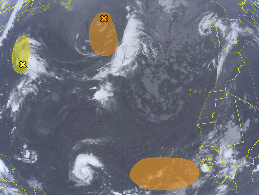
Aside from Sam, there are three other areas of interest with the potential to become tropical cyclones in the next five days: ex-Odette in the north-central Atlantic, an easterly wave that's still over Africa, and a non-tropical low near Bermuda. When the time comes, the next name on the list is Teresa (and if you enjoy hurricane history, here's a tidbit on Twitter regarding the original set of six lists that we still use).
No comments:
Post a Comment