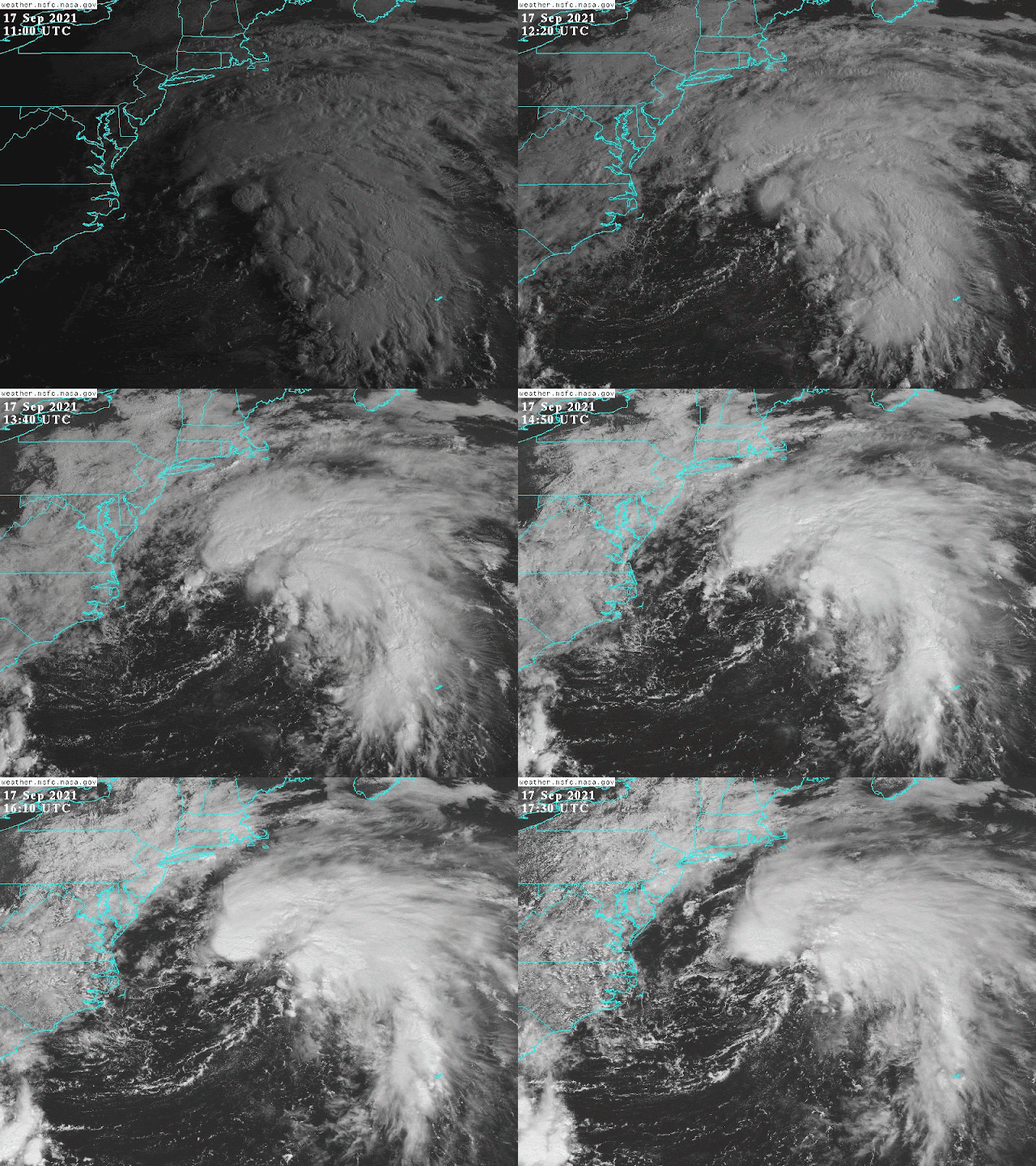
The western system, Invest 96L, is now centered just 150 miles off the North Carolina coast and appears quite close to becoming the season's next tropical or subtropical cyclone. In the satellite animation below, it's easy to see the clouds rotating around a low-level center, but all of the thunderstorm activity is displaced to the north and east. It is expected to head off toward the northeast, intensifying as it does so... transitioning to a strong extratropical cyclone by the end of Saturday.
If it develops into a tropical or subtropical storm in the short window remaining, the next name on the list is Odette. Reaching 15 named storms is above average for an entire season, let alone by mid-September... the only seasons with 15+ named storms before September 19th are 2020, 2011, and 2005!
The wave that we've been watching since it left the African coast four days ago, Invest 95L, is now centered about 1200 miles east of the Lesser Antilles and is zipping westward at 20 mph. It has struggled to develop, but NHC still gives it a 70% probability of formation within the next five days, somewhere in the shaded area in the map at the top.
If it does form, the model guidance generally keeps it pretty weak and just north of the Caribbean on Monday-Tuesday, then some start showing intensification as it turns north. There's not a lot of confidence in anything longer-range than Monday-Tuesday because it's so weak and disorganized now. Certainly the northeast Caribbean should be watching it closely, but there's a lot of time to wait and watch for any potential US east coast or Bermuda encounters.
Finally, a new easterly wave has existed the African coast, but it's likely to turn to the northwest and find itself over cool water in less than a week.
The ACE (Accumulated Cyclone Energy) is now at about 124% of average for the date... it would actually slip below average for the first time this year on September 28th if nothing else is named by then, which is unlikely.


interesting!
ReplyDelete