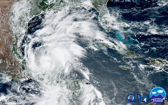
Tropical Storm Amanda formed in the East Pacific back on May 30, then tracked north into Guatemala where its circulation dissipated. The remnants then crossed into the Bay of Campeche on June 1 and organized into Tropical Depression 3 later on the first official day of hurricane season. Today, June 2, it has further strengthened into Tropical Storm Cristobal, the third named storm of the 2020 Atlantic hurricane season. Climatologically, the third named storm forms on August 13th, so this is about ten weeks ahead of par during a season that is expected to see above-average activity. In fact, this is the earliest formation of the third named storm on record!
Cristobal is forecast to remain nearly stationary in the Bay of Campeche for another 3-4 days before gradually drifting north across the Gulf of Mexico. Heavy rainfall will continue in southern Mexico, Belize, and Guatemala. Then the uncertainty sets in. Recent runs from the European model's ensemble favor development in the Gulf and a strong tropical storm (a hurricane is not off the table either) making landfall in the Texas-Alabama span of coastline this weekend.
The one-week cumulative rainfall forecast from the same model's deterministic run shows a wide area of high rainfall totals:
This is clearly something that interests in the U.S. have some time to watch, but let this be a reminder to everyone in a hurricane-prone area to use this first week of hurricane season to make your preparations and plans for the coming six months.


Yippie, a link I could click through and didn't have to copy manually.
ReplyDelete