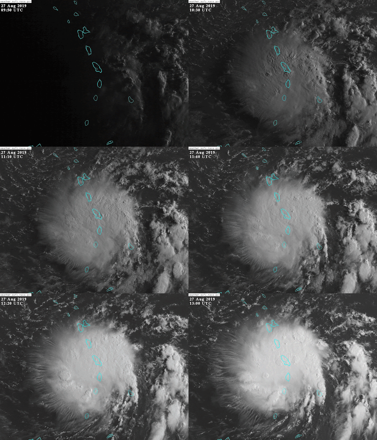
Dorian has weakened a little since yesterday, and is crossing into the eastern Caribbean as of Tuesday morning. At 8am EDT, it's a tropical storm with 50 mph sustained winds, and its tropical storm force winds only extend an average of 32 miles from the center -- it's tiny. It's in range of a radar in Martinique, and that confirms a ragged structure but recently getting better organized:
However, the satellite presentation is beginning to tell another story. In the satellite loop at the top of the post, that presentation is referred to as a "Central Dense Overcast", or CDO. It features a dome of whispy cirrus outflow clouds neatly radiating away from the center, and a couple curved rainbands forming, but still no open eye. It can be a precursor to intensification and formation of an eye, so let's watch for that today. It still has a LOT of dry air surrounding it to contend with though.
The latest official forecast from NHC no longer brings Dorian up to hurricane intensity within the next five days, but it's important to understand that not only are there error bars around intensity forecasts (just like there's a cone around track forecasts), the upcoming encounter with Puerto Rico and Hispaniola introduces an enormous amount of uncertainty. Will it dissipate or rebound on Thursday? I wish I knew!
And while you're thinking about the "cone of uncertainty" graphic, don't forget to check out my previous post about the cone -- it often gets misinterpreted.
Based on the NHC track and intensity forecast (and historic error distributions of both), this product shown below is the probability of tropical storm force winds within the next five days (shaded) and the most likely arrival time of those winds (lines). This threshold is important because all outdoor preparations should be completed by the time tropical storm force winds begin.
The same global model ensembles that I included in yesterday's update are included again here for reference. They have trended a bit stronger, and bit more into the Gulf rather than up the US east coast. We'll see how the next cycle looks... it's important to never take individual models or runs literally.
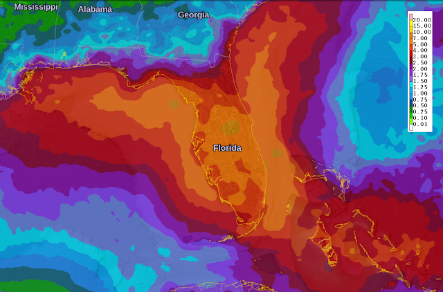
Regardless of what Dorian does in terms of intensity, it's very likely to at least provide a very wet weekend across Florida. The map below shows forecast seven-day rainfall totals; the bulk of that comes on Friday through Sunday.
Elsewhere, that pesky disturbance that was over south Florida last weekend (Invest 98L) was finally upgraded to Tropical Depression 6 on Monday afternoon. It's presently centered about 400 miles west of Bermuda, and will zip up toward Nova Scotia and Newfoundland on Friday into Saturday. If it does strengthen just a little more, it would be Tropical Storm Erin (or Subtropical).
- Visit the Tropical Atlantic Headquarters.
- Subscribe to get these updates emailed to you.
- Follow me on Twitter


No comments:
Post a Comment