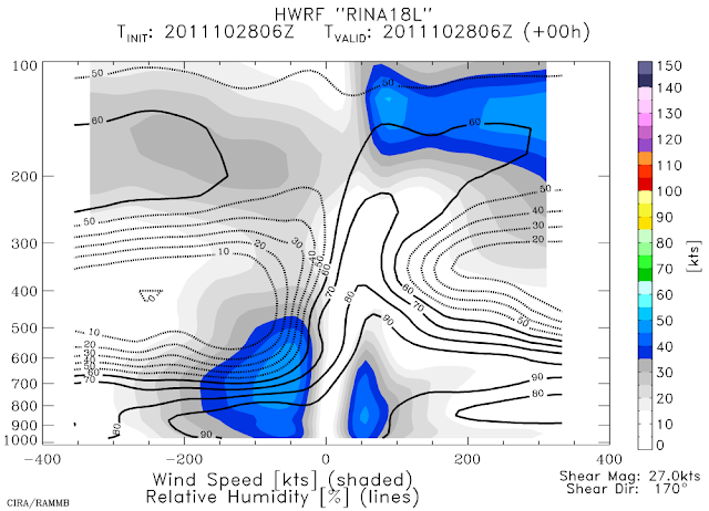
The image below shows a vertical cross-section taken along the shear vector (southerly) from one of the regional hurricane models (HWRF's 06Z analysis). The fields shown on there are the wind speed (shaded) and relative humidity (lines). It's easy to see how weak and shallow the vortex is, and the intrusion and overriding of very dry air... the analyzed shear is 27kts too. This is not an environment that a storm can redevelop in.
Rina is forecast to lose its remaining tropical characteristics and degenerate to a remnant low very shortly, meandering around in the same vicinity due to weak steering flow.
Please visit my tropical Atlantic headquarters.
Subscribe to get these updates emailed to you.


No comments:
Post a Comment