25 October 2024

Déjà vu: watching the western Caribbean again for potential development next week

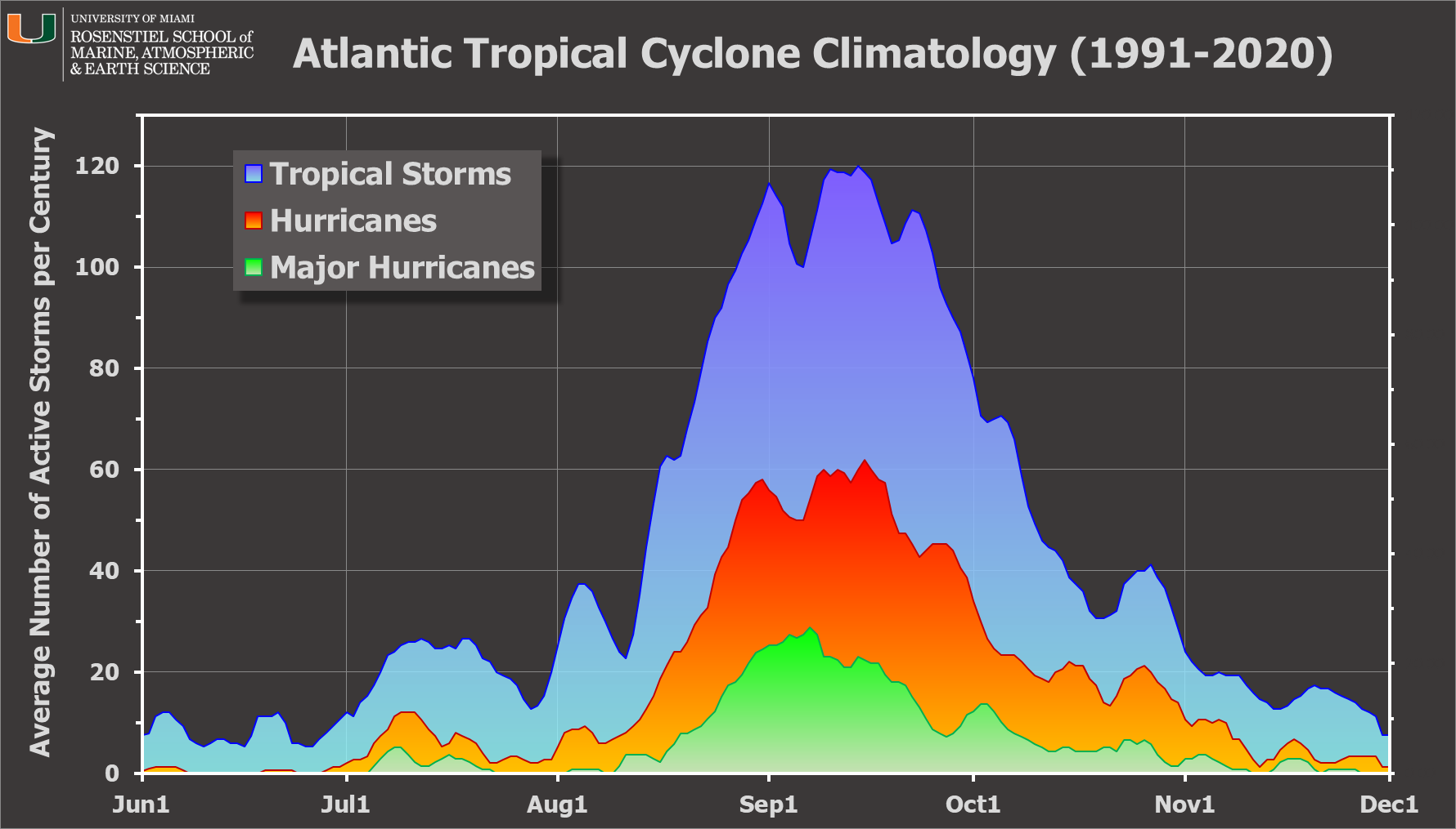
Models have been hinting at something developing in the western Caribbean for a few days now, and the time and place fits in well with climatology. The next name on the list is Patty.

This map below shows the historical formation locations during the first ten days of November, and the western Caribbean certainly stands out as a hot spot.


Tracks of low pressure systems from the American (left) and European (right) model ensembles are shown below out through the next ten days.  The European model ensemble has not done so well with genesis this year, so I'd put much more weight on the more bullish American model's ensemble.

That one shows development of a coherent low pressure system on Tuesday-Wednesday next week, then a general track toward the north with some intensification.  The spread in solutions becomes quite large even in one week (next Friday), so it's too soon to speculate about what happens beyond that.


What we can learn from this is that there is a consistent signal in the models for something to develop in the western Caribbean by next weekend.  We will need to watch this closely because conditions are more than ample to support a strong hurricane.  The ocean heat content averaged over the Caribbean is still near-record high and far above any other year except for 2023.

It's important to not let our guard down at this late point in hurricane season... it's not over yet.  There is no shortage of examples of November hurricanes -- just in the last 25 years there have been 17 of them, including 6 major hurricanes: Lenny (1999), Michelle (2001), Paloma (2008), Otto (2016), Eta (2020), Iota (2020).

There have been 7 names retired from November hurricanes: Lenny (1999), Michelle (2001), Noel (2007), Paloma (2008), Otto (2016), Eta (2020), Iota (2020).

Notice something about those two lists? All six major hurricanes that occurred during November over the past 25 years were impactful enough to have their names retired. Hopefully whatever comes of this system of interest does not get added to that list.


21 October 2024

Nadine and Oscar form over the weekend

Since my previous post a week ago, the two systems I discussed did become named storms.  The disturbance in the western Caribbean became Tropical Storm Nadine on the morning of the 19th, then made landfall in Belize and dissipated a day later.

Much more impressively, the wave I mentioned in that post, Invest 94L, finally developed north of the Dominican Republic.  It left the African coast on October 10, and as of 5am EDT on Saturday the 19th it had a 30% chance of formation according to NHC.  They increased that to 60% at 8am, then at 11am it was upgraded to Tropical Storm Oscar.  Amazingly, at 2pm it was upgraded again to a hurricane.  The peak winds increased from 40 to 80 mph in just three hours, and 40 to 85 mph in six hours.  This was all from data collected by aircraft reconnaissance.

For posterity, I have a 12-hour satellite loop below, spanning 8am-8pm EDT on October 19.  This captures the formation of both Nadine and Oscar, as well as Nadine's landfall and Oscar's rapid intensification.


This explosive intensification occurred near the Turks and Caicos Islands as it was headed for the eastern tip of Cuba.  Since making landfall in Cuba it has weakened to a tropical storm but is producing extremely heavy rainfall as it stalls prior to an anticipated northward turn.  It is not forecast to regain hurricane intensity as it heads toward Bermuda by the end of the week.


Oscar is one of the more notable examples in recent memory of model failure to capture genesis and then intensification even at extremely short lead times.  It was also really tiny.  James Franklin, former head of the Hurricane Specialist Unit at NHC, wrote this on Sunday: "Up until Oscar, no storm had a largest R64 of less than 10 n mi.  I believe that makes Oscar (R64=5 n mi) the smallest hurricane we know of."

There is nothing else of interest in the coming week, so after this rapid-fire development of the 14th and 15th named storms, things will slow down.  We still have 40 days remaining in hurricane season, so we still need to be paying attention though.

For an update on seasonal activity to-date, there have been 15 named storms, 10 hurricanes, and 4 major hurricanes.  The average in a full season is 14, 7, and 3.  In terms of ACE, that's at about 131% of average for the date.

There have been two Category 5 hurricanes so far (Beryl and Milton) which is extraordinary -- the other seasons with 2+ known Category 5s were 2017, 2007, 2005, 1961, 1933, and 1932.  

Of the 15 named storms, 10 of them made landfall somewhere.  All of this combines to put 2024 way toward the top end of hurricane seasons.


14 October 2024

Late-season African easterly wave could become the next storm this week

Since my previous update last Wednesday, Milton made an extremely rare landfall as a Category 3 hurricane near Tampa (Sarasota)... the only previous times this was known to have happened were 1921 and 1848.  Milton was also the fifth hurricane to make landfall on the U.S. Gulf coast; the only other time there were more was in 1886 (6).  And, Leslie finally dissipated on Saturday after spending an impressive ten days as a tropical cyclone in the central Atlantic.  The season's track map spanning Alberto through Milton is shown below.

Today's post is primarily on a late-season easterly wave that exited the African coast last Thursday morning (Oct 6th) and has continued to show some signs of development.  This time of year, we don't typically see these easterly waves have much success in developing... we're normally focused much more on the western Caribbean and the Gulf of Mexico.  As you see on the map below, there is actually an area of interest brewing in the western Caribbean as well which NHC is giving a 20% chance of formation in the coming week.


But, NHC is giving the easterly wave -- tagged as Invest 94L -- a 60% probability of becoming the season's next tropical cyclone in the coming week as it heads west toward the Windward Islands.  The tracks generally continue west to west-northwest for the foreseeable future, and the intensity generally remains weak.  In some form, it will reach the Windward Islands or just north of there on Friday. I think we need to wait until it actually develops to bother looking much beyond five days.


Regarding the future disturbance in the western Caribbean, long-range model ensembles have been hinting that it will develop and then drift westward into the Yucatan peninsula then perhaps into the Bay of Campeche.

The next two names on the list are Nadine and Oscar.  Both of those names are still original from the 1982 list, so this year would be their 8th time on a list... though Nadine has only been reached three of those times (2000, 2012, 2018), and just two times for Oscar (2012, 2018). 

As of today, neither of these features look too concerning, but it's certainly worth keeping an eye on them.  The historically-active first half of October is now behind us, but even the second half has had some infamous storms, so it's way too soon to stop paying attention.