31 October 2022

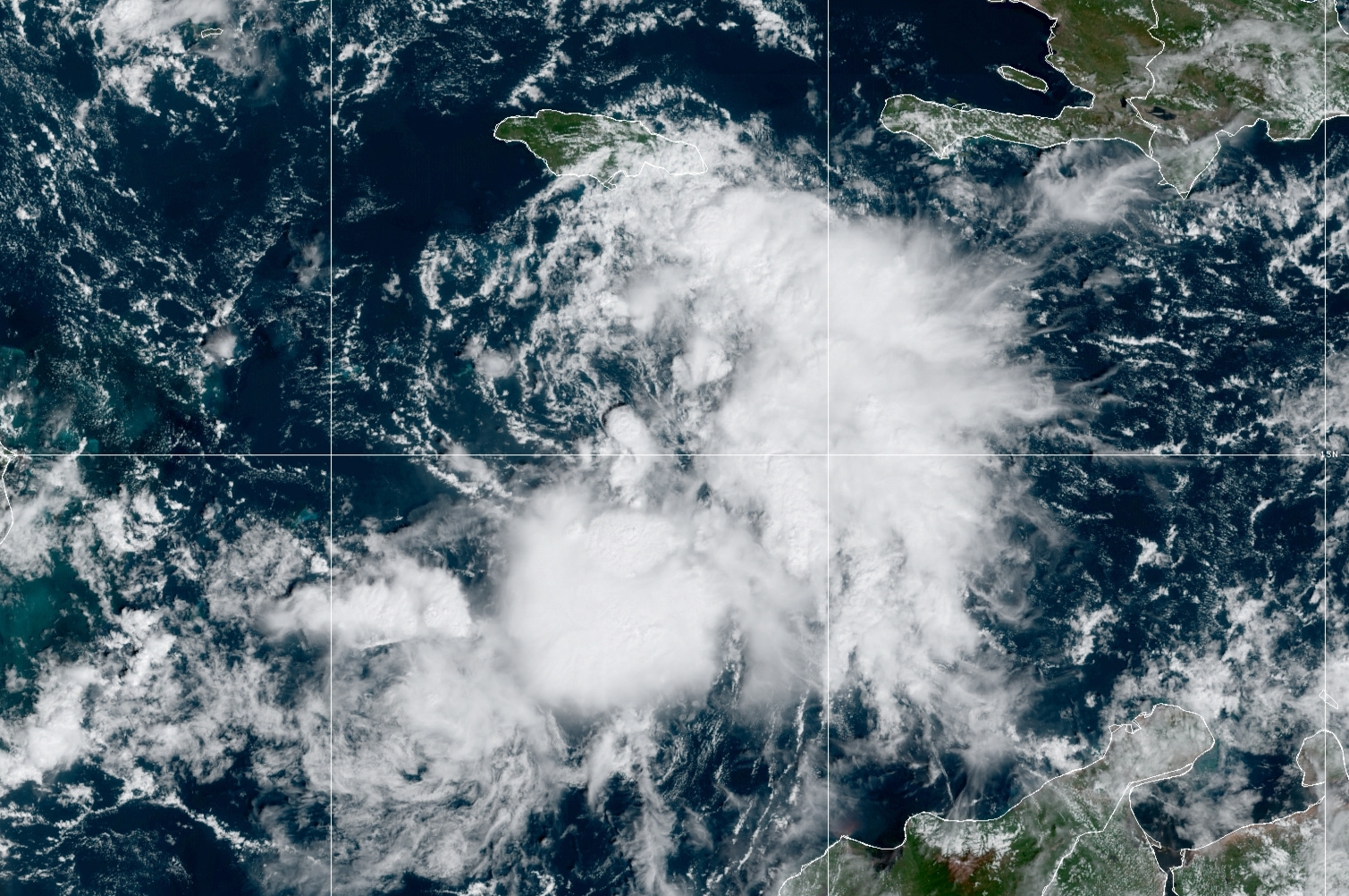
Season's 12th named storm forms on Halloween

Tropical Storm Lisa formed today in the central Caribbean, just south of Jamaica.  This has been a feature of interest for about six days already, but it failed to develop near the Lesser Antilles and the eastern Caribbean. Even today, it looks marginal on satellite, but aircraft data confirmed the organization and intensity necessary to upgrade it to a tropical storm.


Despite the extremely warm ocean water in the western Caribbean, Lisa continues to face some environmental challenges to intensification.  There's quite a bit of dry air to the west, and some of that is wrapping into the circulation now and will continue to linger.  The storm is also in fairly strong vertical wind shear as evident in the satellite animation above -- the low-level center is completely exposed and the thunderstorm activity is all displaced to the east and south.  

Over the next couple of days, the shear is expected to relax somewhat, and that in turn will reduce the amount of dry air that reaches the storm center.  This 3-day forecast from the American GFS model shows the mid-level humidity in the colored shading, and it illustrates the gradual moistening of the storm environment before it makes landfall.


The model guidance is fairly clustered on the track, but more scattered on the intensity.  For track, Lisa will continue to head west across the Caribbean, reaching Belize midday Wednesday.  For intensity, the large majority of models keep it as a tropical storm, but there's an outside chance that it could reach hurricane intensity prior to landfall.  The official forecast (as of 11am EDT) is on that high end and indicates a minimal Category 1 hurricane at landfall... if model trends continue to drop, the subsequent NHC forecasts will certainly reflect that.


Lisa is the season's 12th named storm... you have to go back to 2015 to find so few storms by the end of October, and in terms of Accumulated Cyclone Energy (ACE), the season is at about 73% of average for the date.


Elsewhere, the Atlantic is quiet and there's no sign of new development within the next week or so.


12 October 2022

Karl forms and threatens Mexico with heavy rain

First, a bit of catching up: I was on vacation last week and didn't write anything about Hurricane Julia which formed near Aruba, tracked west and developed into a hurricane as it made landfall in central Nicaragua, and then had a complicated evolution over Central America.

Like Bonnie back in early July, Julia made landfall in Nicaragua and traversed the country intact, maintaining its identity as a tropical storm in the East Pacific.  Julia made another landfall in El Salvador then dissipated over Guatemala, but a part of the circulation split off to the west and is an area of potential development (Invest 99E) in the East Pacific while another part split off to the north and became Tropical Storm Karl on Tuesday afternoon.


The map above shows an infrared satellite image from Wednesday morning, but I superimposed the tracks of Hurricane Julia, Tropical Storm Karl, and Invest 99E for reference to illustrate the interesting split that Julia's remnants experienced.

Julia was the season's 10th named storm and 5th hurricane, so Karl is the season's 11th named storm -- it is not expected to reach hurricane intensity as it drifts back south into the Veracruz area of Mexico over the next couple days.  The greatest threat is heavy rain resulting in flooding and mudslides.


The season's storm tally as of October 12 is at 11 named storms, 5 hurricanes, and 2 major hurricanes (Category 3+).  This table shows the average dates by which these milestones occur... you can see that by now, an average season would have 12 named storms, 5 hurricanes, and 2 major hurricanes, so 2022 is really close to those marks.


We can also look at the season's activity in terms of Accumulated Cyclone Energy, or ACE, which is a metric that doesn't depend on the number of storms, but on the overall intensity and duration of whatever storms there are.  By this metric and the same baseline as before (1991-2020), the season is only 79% of average for the date.


Elsewhere, the Atlantic basin is quiet with no activity in the foreseeable future.

30 September 2022

Ian's third and final landfall in South Carolina


Fifteen days after leaving the African coast, Ian's last few hours are here.  It became a tropical depression on the 23rd, made landfall in western Cuba as a Category 3 hurricane on the 27th, then in central Florida as a Category 4 on the 28th, and now in South Carolina as a Category 1 on the 30th.


Although Ian is on the cusp of becoming an extratropical cyclone, it still poses the same threat (remember Sandy in 2012?).  It's a Category 1 hurricane with 85 mph peak sustained winds, and made landfall between Charleston and Myrtle Beach on Friday afternoon at about 2pm local time.  Ian will dissipate over the Carolinas and Virginia in the next day or so, and after dropping a few inches of rain over those areas, that will be the end of it.


Storm surge was and is the primary threat today, and some areas have definitely experienced severe coastal flooding today.


There is another wave of interest just moving off the African coast today.  Like Ian, it's coming off at a very low latitude, but unlike Ian, it's likely to turn to the northwest within a week.  After that, there's some divergence in the model guidance so it's just something we'll need to keep an eye on now and then -- it's very far from any land.  If it becomes a tropical storm, the next name is Julia.


September was extremely active... of the nine named storms so far this season, six of them formed in September.  In terms of ACE, September accounts for 94% of the total at this point, two-thirds of the way through the season.  And compared to the average over the past fifty years, 2022 is now at 97% of the average value for the date.


As of Friday afternoon, these next two images show the history of NHC forecasts for Ian: track on top then intensity below.  The observed track and intensity is the thick black line, and each six-hourly forecast is shown by a colored line.

As it relates to the Florida landfall, the "cone of uncertainty" always contained the eventual landfall point... every advisory for all five days from Ian's formation on the 23rd to its landfall on the 28th.  The cone is designed to show where the center of the storm should track, with 2/3 likelihood.  Having that long to prepare for what was forecast to be a major hurricane landfall is very good, but it doesn't stop the damage from happening, unfortunately.  All people can do is get out of its way.