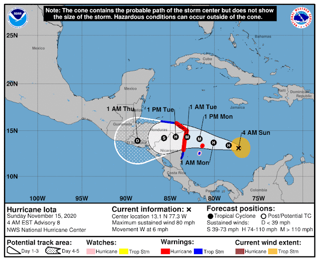
Since my previous update on Wednesday, the tropical wave in the Caribbean was upgraded to Tropical Depression 31 on Friday morning, then again to Tropical Storm Iota on Friday afternoon, making it the season's 30th named storm. On Sunday morning, it was upgraded to Hurricane Iota, the season's 13th hurricane. The only other known season with 13 hurricanes was 2005 -- it ended up with 15.
Iota is tracking toward the west, which will bring it to northern Nicaragua in a couple days. You may recall that Eta just made landfall in this same part of Nicaragua on November 3 as a Category 4 hurricane; another Category 4-5 landfall only two weeks later is just unthinkable, but that appears to be exactly the situation. The wind, the flooding rain, the storm surge... all coming back to the same places in Central America. Unlike Eta, there is no indication that Iota will turn north out of Guatemala and head back over the western Caribbean.
Also, Eta made landfall in the Big Bend area of Florida on Thursday as a tropical storm, and Tropical Depression Theta is hours away from dissipating as a low-level swirl north of the Canary Islands. There are no other features of interest on the map right now, but when the time comes (and I'm sure it will), the next name on the list is Kappa.
To call the 2020 track map crowded would be an understatement. It's literally two seasons crammed into one, and it's not over yet. While the official season spans June 1 through November 30, these hyper-active seasons tend to ooze out of those artificial start and end bounds.


No comments:
Post a Comment