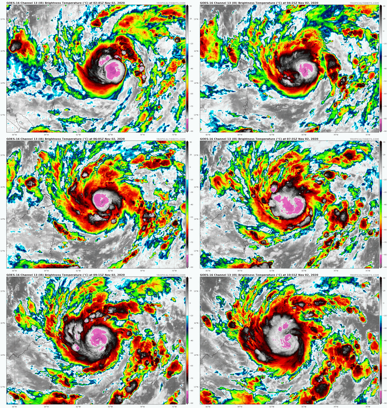
It is getting organized in a hurry now... this swath of microwave satellite data from earlier today reveals the precipitation structure under the cloud tops, and there's most definitely a compact eye and eyewall in there. It's not out of the question that this sneaks in at Category 3 intensity (it would be the season's 5th major hurricane if it does).
Once it slams into Nicaragua tonight, it will pass over Honduras, weaken quickly over the mountainous terrain, and slow down as it loses the environmental steering currents in a few days. Aside from the immediate threats of storm surge and hurricane-force wind along the Nicaraguan and Honduran coasts, the flooding and mudslides caused by heavy rain are a major concern in the entire region.
It's that slowing down so close to the western Caribbean powder keg that actually presents some challenging uncertainty. For the past few days, long-range global models have been indicating that Eta might not simply dissipate over Central America. It (or its remnants) could eventually get tugged northward, back over the steamy water in the western Caribbean, and toward Cuba in a week or so.
Here is what such a complicated scenario looks like at the moment. The left panel is from the 50-member European model's ensemble and the right is from the 20-member American model's ensemble. Both have tracks displayed out to 10 days where possible (240 hours). Both agree on the track into Honduras, and the slowing down. Then, the majority of members from both turn the storm north in 4-5 days, followed by a re-intensification and track toward Cuba.
Should that happen, the door is open for it to enter the Gulf of Mexico, hit south Florida, or pass further east over the Bahamas sometime early next week. But first, we need to see if it survives its encounter with central America.
Only three prior hurricane seasons are known to have had 12 or more hurricanes: 2010, 2005, and 1969. So with a month still remaining in the official hurricane season, this is quite impressive.
 Since my previous update on Friday morning, the wave in the eastern Caribbean was upgraded to Tropical Depression 29 on Saturday afternoon, then to Tropical Storm Eta on Saturday night. This made it the season's 28th named storm which ties the 2005 record. Then, on Monday morning, it was upgraded again to Hurricane Eta, the 12th hurricane of the season. It is less than a day from making landfall on Nicaragua.


No comments:
Post a Comment