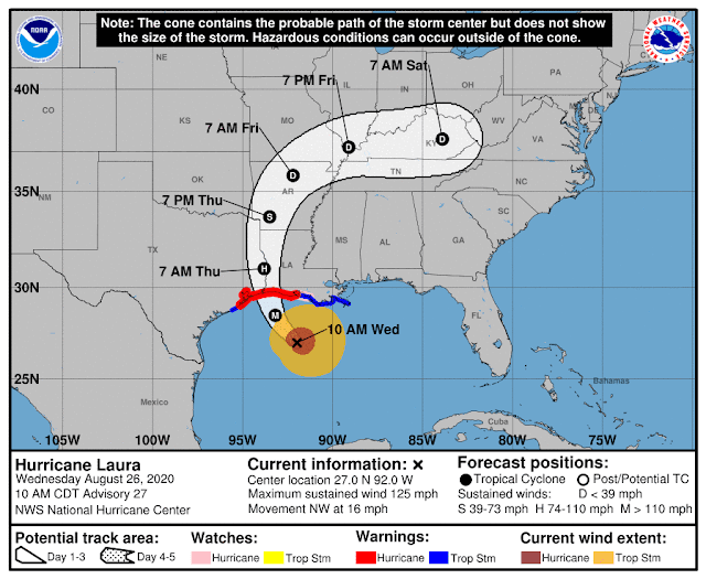
Landfall is expected near the Texas-Louisiana border at about 1am CDT, which just so happens to coincide with high tide in that area. The latest message from the NWS states: "Unsurvivable storm surge with large, destructive waves will cause catastrophic damage from Sea Rim State Park, TX, to Intracoastal City, LA. Surge could penetrate up to 30 miles inland." The peak storm surge graphic is shown below, and highlights the area of western LA that could see a 15-20-foot surge:
The storm is well within radar range now, particularly from Lake Charles LA and Houston TX...I have an assortment of long, updating loops at http://bmcnoldy.rsmas.miami.edu/tropics/radar/. Tropical storm force winds have already reached the coast, as have outer rainbands.
As of the 11am EDT advisory, tropical storm force winds extend about 175 miles from the center on the east side, while hurricane force winds extend about 70 miles from the center. After landfall tonight, it will continue north, then interact with an approaching trough and turn toward the east on Friday. It could still be a coherent low pressure by the time it exits the US over the mid-Atlantic states on Saturday night and re-strengthen over the ocean on Sunday (though likely as an extratropical cyclone).
Unlike Harvey, which made landfall in Texas as a Category 4 hurricane three years ago today, Laura is not going to stall and dump five feet of rain. But, as with any tropical cyclone, heavy rain and inland flooding is a big concern. Laura is no different.


No comments:
Post a Comment