 |
| Surface wind streamlines as of Wednesday morning. Two circulation centers are apparent: one on each side of the Isthmus of Tehuantepec. (earth.nullschool.net) |
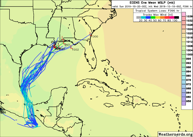
The most recent European model ensemble indicates a pretty decent chance of this developing in the coming days as it heads north to northeast. Some of the ensemble members have a trackable low pressure center near the northern Gulf coast on Saturday, but none are strong (shown here). If this becomes a tropical storm, the next name on the list is Nestor. Nestor was introduced to this list in 2013 after Noel '07 was retired.
As I shared yesterday, there's a short list of seven named storms that developed in the western Gulf of Mexico after October 1 since 1960. The one that took off toward the northeast into Florida's Big Bend region was Josephine in 1996.
Tropical Depression 15, the one that was way out by Cabo Verde, has dissipated and never reached tropical storm status and so was never named.
As of today, the Atlantic has had 13 named storms, 5 of which became hurricanes, and 3 of those became major hurricanes (Category 3+). I whipped up a seasonal tracking map through today to refresh your memories on when and where things happened.
- Visit the Tropical Atlantic Headquarters.
- Subscribe to get these updates emailed to you.
- Follow me on Twitter


No comments:
Post a Comment