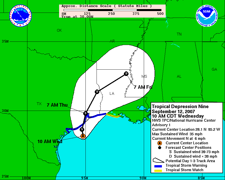
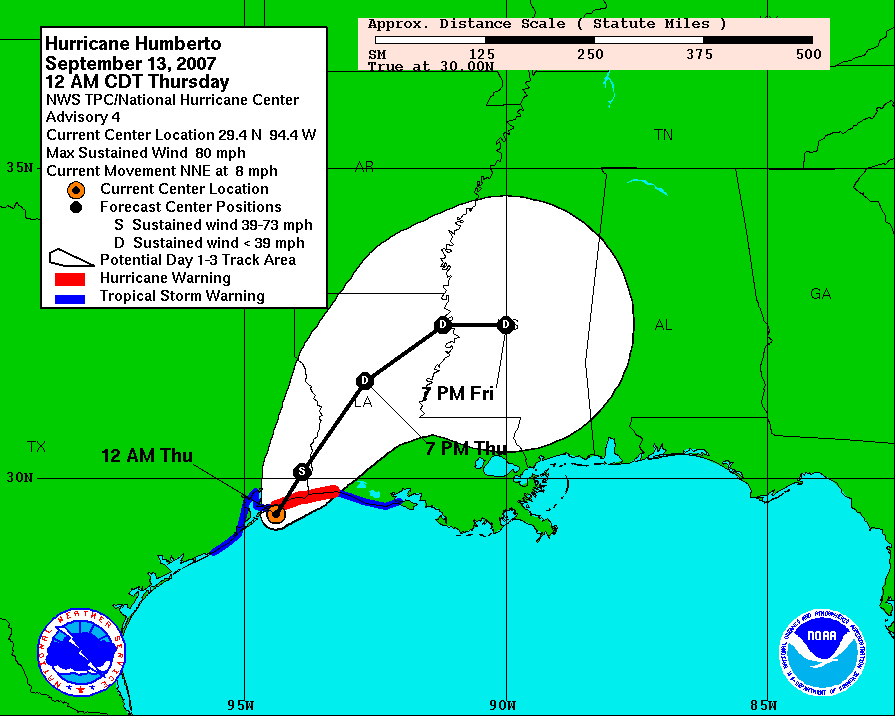
Well, Humberto was a surprise for everyone. There is not a forecaster I know of who would have called for a weak Depression to reach hurricane strength in less than a day and just miles offshore. Wednesday at 15Z, tropical storm warnings were posted for the areas near the newly-formed TD9 (http://www.nhc.noaa.gov/archive/2007/graphics/al09/AL092007_3W_001_0.GIF). The first hurricane warning was posted at 05Z on Thursday morning, just 2 hours before landfall, and without a hurricane watch ever being issued (http://www.nhc.noaa.gov/archive/2007/graphics/al09/AL092007_3W_004_0.GIF). It made landfall at about 07Z as a 75kt hurricane --10kts beyond minimal hurricane strength-- near High Island TX.
This intensification rate is astounding and unprecedented for a storm so close to land. Sustained winds went from 45kts to 75kts in just 18 hours, AND did so near the metropolitan area of Galveston/Houston. Rapid intensification is a challenge to predict, but when it's so close to land, a lot is at stake, and a wrong forecast can cost lives. So far in this storm, one death has been reported: a man outside watching the weather had a metal roof fall on him. It also doubtlessly affected some of the many unprepared oil refineries in that area.
There is a radar loop available at http://einstein.atmos.colostate.edu/~mcnoldy/tropics/humberto07/Humberto_12-13Sep07.gif which shows the whole evolution of Humberto... from weak tropical storm at about 1530Z Wednesday through a 75kt hurricane at 09Z Thursday and ending as a weakening hurricane over land at 13Z Thursday.
TD8 is still holding its ground as a depression, and struggling against hefty vertical wind shear. If and when the shear lets up even a little, all other conditions appear very favorable for it to intensify substantially. It should track a bit north of the Caribbean Sea, which leaves it in the southwest part of the basin by early next week, at which point, the US should a close eye on it. The next name on the list is Ingrid.
Please visit my tropical Atlantic headquarters.
No comments:
Post a Comment