This post marks the end of my 28th year writing these updates on tropical Atlantic activity. During that time, I have written approximately 1410 posts spanning 481 tropical cyclones, 212 hurricanes, 97 major hurricanes, and 53 retired storm names. I know some of you reading this have been following along the entire time, but whether you've been reading these posts for 28 days or 28 years, I truly appreciate your continued interest!
 |
| Tracks of all tropical and subtropical cyclones during 2023. Each storm's peak intensity, lowest central pressure, and total Accumulated Cyclone Energy is provided in the table on the right. |
The Atlantic hurricane season officially ends on Thursday, and it was a busy one. Heading into the season, we were looking at an odd combination of two significant competing factors: a developing strong El Niño and record-breaking warm ocean temperatures.
With a lack of historical analogs from which we could gain insight, it was not obvious if one factor would dominate or if they would essentially balance each other out. It turned out that the super-charged ocean was the dominant influence, and the seasonal activity ended up well above average.
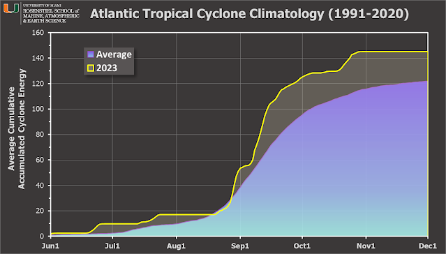
There were 20 tropical storms, 7 of which became hurricanes, and 3 of which became major hurricanes (Category 3+ on the Saffir-Simpson Scale). Using a climatology from 1991-2020, the average numbers of each are 14, 7, and 3. The Accumulated Cyclone Energy (ACE) ended up at about 119% of average... essentially identical to the 2008 and 2021 seasons by this metric.
Although there was a fairly long gap in activity as we headed into the heart of the season from July 26 to August 19, the Atlantic then had non-stop activity from August 20 through October 6... a remarkable 48 days spanning Emily through Philippe.
Next, I'll pick out some of the highlights from the season that stood out to me.
Bret and Cindy both formed in mid-June out near 40°W from African easterly waves. That is quite unusual, and not something we would typically see until a couple months later. In fact, having two simultaneous active "main development region" storms in June was unprecedented. It seems to me that the exceptionally-warm ocean and lack of Saharan air layer plumes allowed these early MDR storms to form. [see "Bret and Cindy usher in a historic day for the tropical Atlantic"]
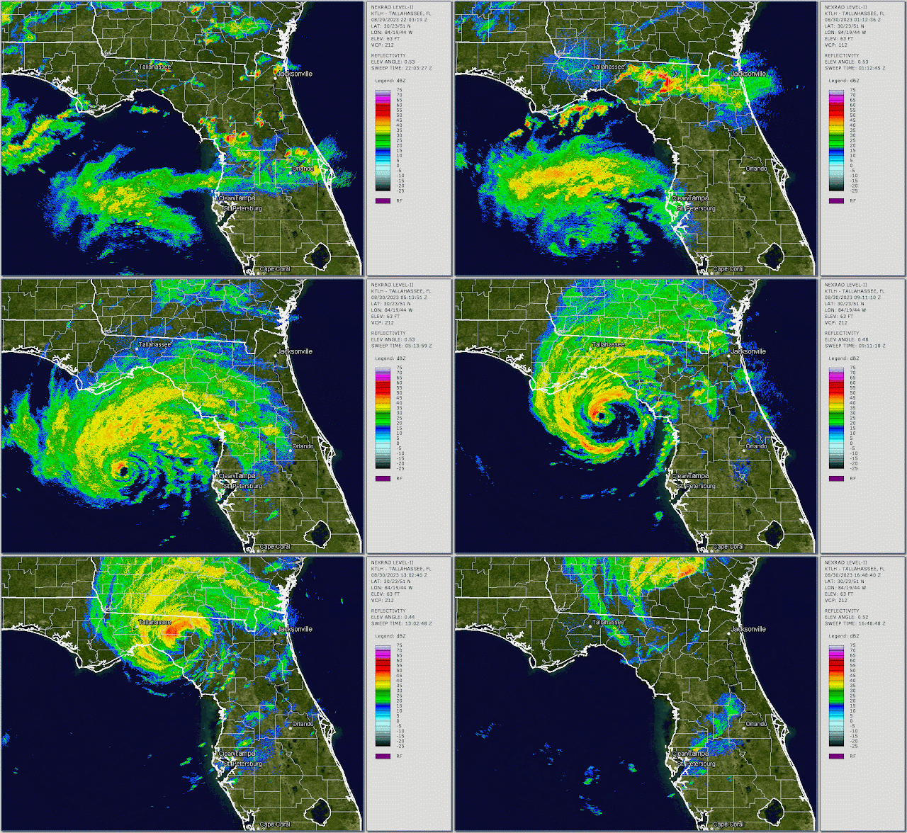
One of the three major hurricanes this season was Idalia. It formed near the northeastern tip of the Yucatan Peninsula and then rapidly intensified to a Category 4 hurricane as it headed for Florida, then made landfall in the Big Bend region as a Category 3 hurricane just four days after it formed. The area had not experienced a major hurricane landfall since 1896. [see "Idalia rapidly intensifies and makes landfall, Franklin weakening"]
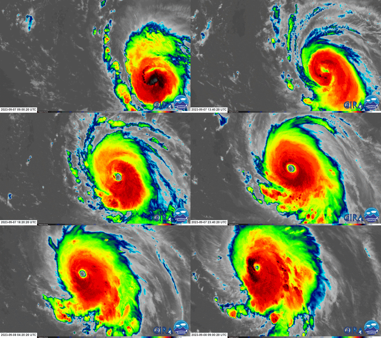
Lee was the season's only Category 5 hurricane, and that intensity was fortunately achieved over the open ocean east of the Leeward Islands. It intensified VERY rapidly... 85 mph in a day... going from a Category 1 hurricane to a Category 5 hurricane. Over the past 50 years in the Atlantic, only about 2.7% of tropical cyclones reach Category 5 intensity, so they are noteworthy.
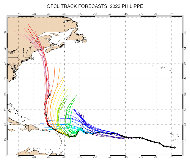
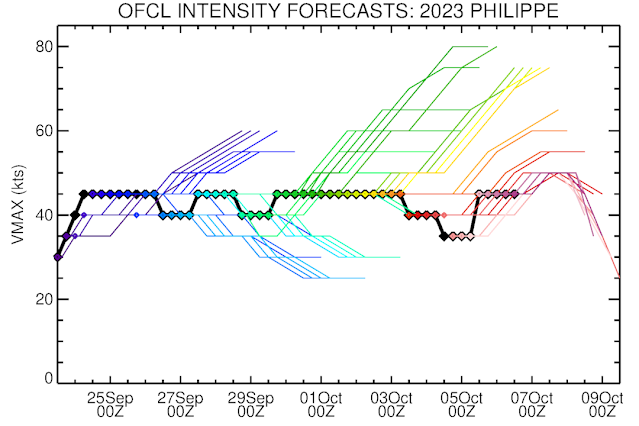
Tropical Storm Philippe, which many of you might not even remember, was a real headache for forecasters. Model guidance was consistently showing a north turn, which it did not make until several days later, and the intensity was curiously steady although the model guidance indicated periods of strengthening and weakening. The average five-day track forecast error for Philippe was 2.4 times the average error at that lead time... pretty brutal.
Another aspect of the season that stands out when you look at the track map at the top of this post is that there were no hurricanes in the Caribbean Sea, and with the exception of Idalia for 1.5 days, no hurricanes anywhere west of 72°W. A weaker-than-normal Azores High helped to allow storms to turn north well before reaching the U.S. or even the Caribbean.
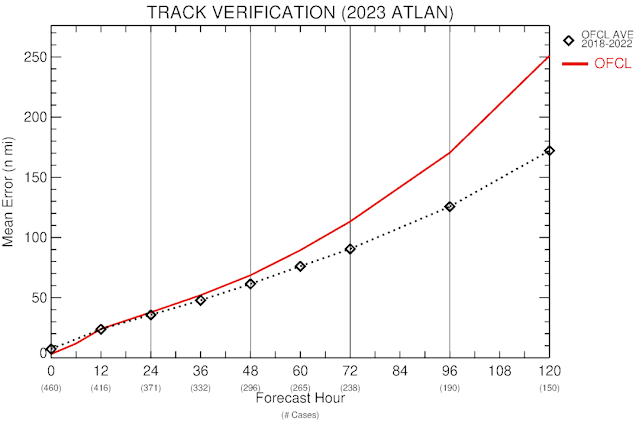
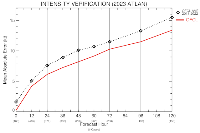
The season presented forecast challenges, primarily in track. I singled out Philippe above, but there were other troublesome ones in the mix. The two charts below show the preliminary verification statistics for the 2023 Atlantic season -- track on top then intensity below. At each lead time, the difference between the NHC forecast and the observed value are averaged together to create these. I also include NHC's average errors over the previous five seasons for context (the black dashed line). As you see, the NHC's track forecast errors were higher than their own average at every lead time, but the intensity errors were lower. Progress is not always linear.
Looking ahead to next season, the list of names is "List 4" and begins with Alberto, Beryl, and Chris. This is the list that was first used in 1982 and repeated every six years since then. The list has had six names retired from it over the years: Gilbert and Joan in 1988, Keith in 2000, Sandy in 2012, then Florence and Michael in 2018. The 2024 version of the list features two new names: Francine and Milton which replace Florence and Michael.
No comments:
Post a Comment