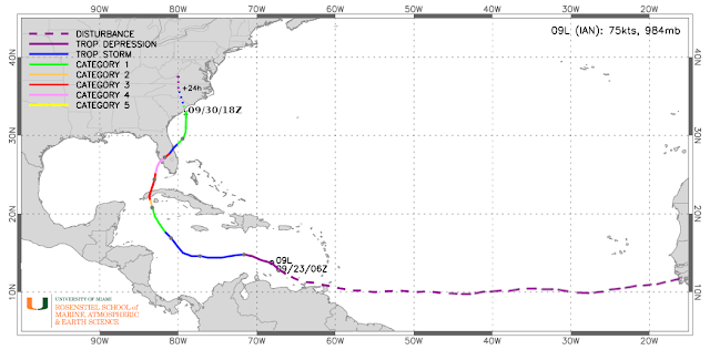
Fifteen days after leaving the African coast, Ian's last few hours are here. It became a tropical depression on the 23rd, made landfall in western Cuba as a Category 3 hurricane on the 27th, then in central Florida as a Category 4 on the 28th, and now in South Carolina as a Category 1 on the 30th.
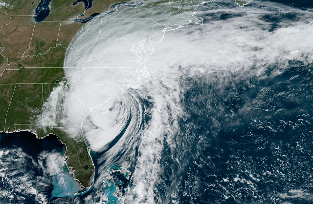
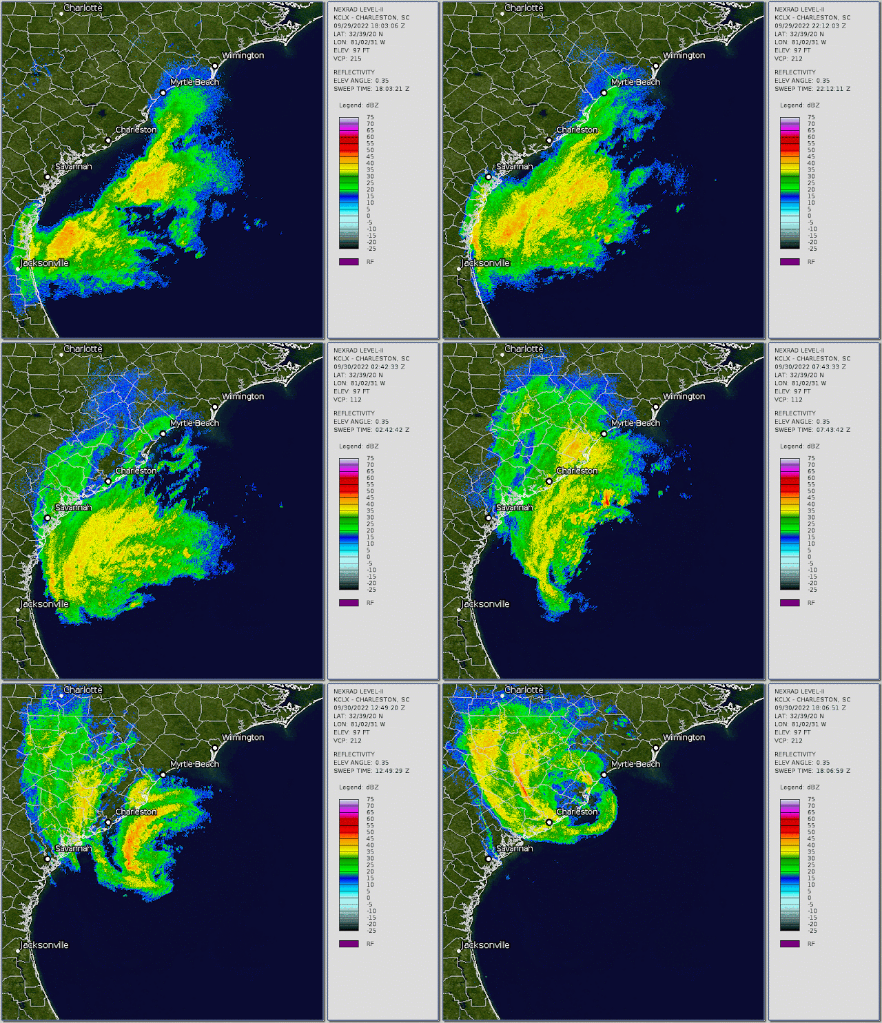
Although Ian is on the cusp of becoming an extratropical cyclone, it still poses the same threat (remember Sandy in 2012?). It's a Category 1 hurricane with 85 mph peak sustained winds, and made landfall between Charleston and Myrtle Beach on Friday afternoon at about 2pm local time. Ian will dissipate over the Carolinas and Virginia in the next day or so, and after dropping a few inches of rain over those areas, that will be the end of it.
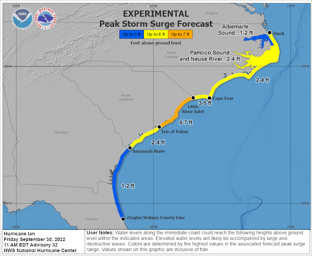
Storm surge was and is the primary threat today, and some areas have definitely experienced severe coastal flooding today.
There is another wave of interest just moving off the African coast today. Like Ian, it's coming off at a very low latitude, but unlike Ian, it's likely to turn to the northwest within a week. After that, there's some divergence in the model guidance so it's just something we'll need to keep an eye on now and then -- it's very far from any land. If it becomes a tropical storm, the next name is Julia.
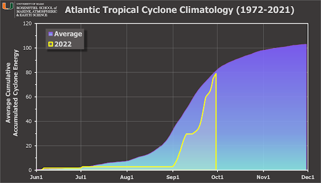
September was extremely active... of the nine named storms so far this season, six of them formed in September. In terms of ACE, September accounts for 94% of the total at this point, two-thirds of the way through the season. And compared to the average over the past fifty years, 2022 is now at 97% of the average value for the date.
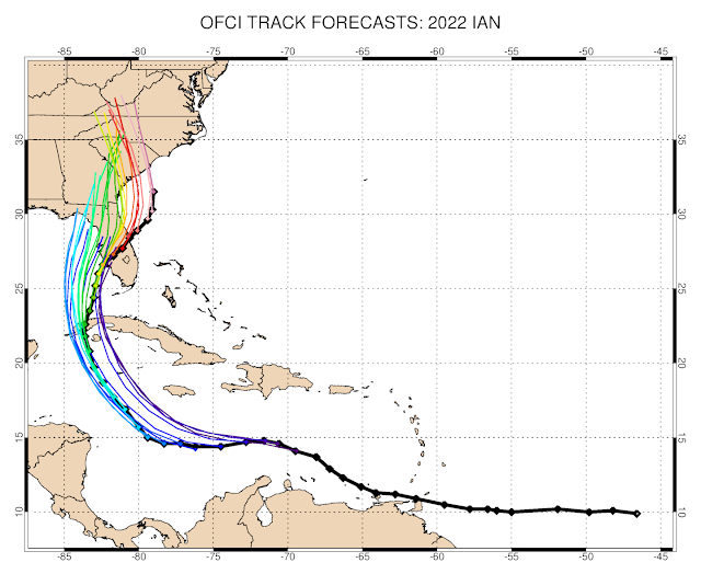
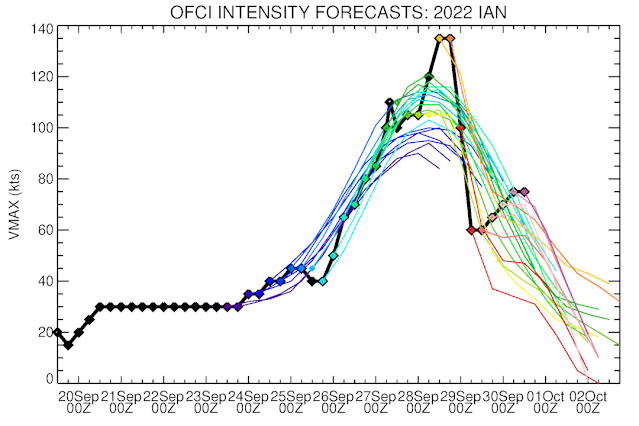
As of Friday afternoon, these next two images show the history of NHC forecasts for Ian: track on top then intensity below. The observed track and intensity is the thick black line, and each six-hourly forecast is shown by a colored line.
As it relates to the Florida landfall, the "cone of uncertainty" always contained the eventual landfall point... every advisory for all five days from Ian's formation on the 23rd to its landfall on the 28th. The cone is designed to show where the center of the storm should track, with 2/3 likelihood. Having that long to prepare for what was forecast to be a major hurricane landfall is very good, but it doesn't stop the damage from happening, unfortunately. All people can do is get out of its way.
.gif)
No comments:
Post a Comment