30 November 2016

Most active Atlantic hurricane season in six years comes to an end

Today is the last official day of the Atlantic hurricane season. Since I started writing and posting updates on tropical Atlantic activity in 1996, I've written approximately 1,100 updates spanning 328 tropical cyclones, including 153 hurricanes, 69 major hurricanes, and 38 retired storm names. I was honored to have been asked to write blog posts for the New York Times for four years and for the Washington Post for five years and counting.  Thank you for your continued interest!

My 21st annual season summary is available on the Capital Weather Gang blog:

Most active Atlantic hurricane season in six years comes to an end


22 November 2016

Otto very close to becoming season's 7th hurricane

Just to keep everyone on their toes during the final homestretch of hurricane season, Tropical Storm Otto is lurking in the southwest Caribbean Sea.  Yesterday morning, it was just a tropical depression, and then was upgraded to a tropical storm later in the day as expected.  As of Tuesday morning, it is nearly a hurricane with peak sustained winds of 70 mph.


Otto is still on track to make landfall near the Nicaragua/Costa Rica border on Thanksgiving, then cross over into the eastern Pacific where it is expected to dissipate.  Hurricane watches have been issued for the area, while tropical storm watches and warnings cover much of Panama's northern coast.  If the center hits Costa Rica, it would be that country's first hurricane landfall on record.


The water temperature east of Nicaragua and Costa Rica is quite warm, around 28°C, which is plenty to sustain a hurricane.  The vertical wind shear has also decreased noticeably in the past couple of days.

The area where Otto is forecast to make landfall is sparsely populated, but as with all landfalling tropical cyclones, the risk of heavy rain and resulting flooding extends far from the center, and the mountainous areas of Nicaragua and Costa Rica could see 10-15 inches of rain in the coming days.


This is the 7th time that the name Otto has been on a name list since 1980, and it only got used in the past 3 of those 7 times (2004, 2010, 2016).  The next name on the list is Paula, though it's very unlikely that another named storm will form this year.


21 November 2016

Rare late-season tropical depression spins up in the Caribbean

My Monday update on newly-formed Tropical Depression 16, which could become Tropical Storm Otto today or tomorrow, is available on the Capital Weather Gang blog:

Rare late-season tropical depression spins up in the Caribbean


01 November 2016

One month after Matthew: A harrowing account from Haiti

Today's post is by a special guest: a woman who experienced the full fury of Hurricane Matthew in western Haiti.  Cheryl Nichols contacted me the day before the hurricane struck to thank me for giving Haiti attention in a blog post I wrote that day.  It was too difficult and too late to leave, so she sheltered in place.  I was thinking about her the morning Matthew made landfall there, hoping I'd hear from her again once electricity and communication lines were back up. Sure enough, three weeks later, I did, and what follows is her account and photos of the event.

Satellite image of Hurricane Matthew on the morning of October 4th, just as it was making landfall on southwest Haiti.
Nearly one month ago, on October 4th, Category 4 Hurricane Matthew hit the southwest Haitian peninsula of Grand Anse with a vengeance. I had arrived in Jeremie, the capital of and largest town in the Grand Anse on the 25th of September to teach English at UNOGA (Universite de Nouvelle de Grand Anse) for a three week session. This was my third visit to UNOGA in the last five years.

The weekend before the storm, I started tracking it as it passed through the lower Caribbean, just north of Colombia. The path of the storm seemed to indicate that it would turn northwest toward Jamaica, then Cuba.  Not being a meteorologist, I don’t know how many storms did what Matthew did: it seemed to take an almost right-hand turn and head due north, right toward Haiti.

Map of Matthew's track, with an inset map showing Jeremie's location on the peninsula.
As you may know from news reports and social media, Jeremie was ‘ground zero’ as the storm came ashore.

Radar loop from Guantanamo Bay showing Hurricane Matthew's eyewall passing over the western tip of Haiti and the eastern tip of Cuba. The city of Jeremie is on the northern side of the peninsula on the bottom of the images.
A Haitian professor, myself, and one of our students had stayed in the guest house in Jeremie to wait out the storm. I was sure the house would hold because it had stood for over a century enduring many storms in its history. Matthew, however, was its undoing. Just as the house started to collapse, the three of us managed to escape and our student had the presence of mind to get us through the brunt of the storm to a neighbor’s house where the family gave us not only shelter but dry clothes, food, beds, and comfort. I will be forever grateful to these two Haitian men who saw to my safety during the storm and my welfare for the several days following.

The guest house before (left) and after (right) the storm.  In the photo on the right, you can see the second floor had collapsed into the first floor.  Large trees are snapped or uprooted. (photos by Cheryl Nichols)
View of the Caribbean, which was previously blocked by trees. (photo by Cheryl Nichols)
I was able to get a ride to Port au Prince the following Sunday, very sad to leave Jeremie at a time when there were such great needs. Although I couldn’t help with the immediate rebuilding, I’ve been able through a network of family and friends, to raise money for both relief and long term redevelopment.

I am now in the north of Haiti in Gros Morne where I had planned to come for three weeks following my time in Jeremie. I am still reflecting on all that has happened to so many people that I have come to know and love over the last five years. I was grateful to have been part of this tragedy, to be a presence so that Haitians know they are not forgotten, and that a wider world cares about and wants to help them in an enduring way.

If you would like to support the recovery efforts, a couple "low overhead" charitable groups that I recommend and support are:

Haitian Connection
Catholic Relief Services

Cheryl teaching English in Haiti.

26 October 2016

No — hurricane intensity is not exaggerated to scare people

This post is a joint effort with my long-time friend, colleague, and fellow CWG contributor, Phil Klotzbach.  We discuss why a hurricane's peak winds are rarely, if ever, observed by a weather station or buoy in this Capital Weather Gang post:

No — hurricane intensity is not exaggerated to scare people


25 October 2016

"Major Hurricane" Amnesia in the U.S.

October 24th marked the 11-year anniversary of the last "major" hurricane to make landfall on the United States.  On the morning of October 24, 2005, Hurricane Wilma hit the southwest Florida peninsula as a Category 3 storm, and since then, no other hurricane Category 3 or stronger has made landfall on the U.S. -- a span that is unprecedented in the historical records.


Hurricanes are rated solely by the strongest wind speed found in the storm, not by size, rainfall, storm surge, fatalities, cost, or whether or not they make landfall. A major hurricane is conventionally defined to refer to a Category 3, 4, or 5 on the Saffir-Simpson Hurricane Wind Scale... those storms which from an engineering perspective will create "devastating" or "catastrophic" damage to buildings, trees, and infrastructure.  The term "major" is not a socio-economic label, it applies to hurricanes anywhere based on their peak winds.

Since Wilma, there have been 29 major hurricanes observed in the Atlantic, 11 of which made landfall as major hurricanes on other countries, including Mexico, Cuba, Bahamas, Haiti, Nicaragua, and Bermuda.  The U.S. has just gotten lucky to the point where 11 hurricane seasons have gone by and none of those 29 major hurricanes have crossed our shores.

Tracks of 27 of the 29 major hurricanes that have been observed in the Atlantic since Hurricane Wilma.  Hurricanes Gaston and Matthew from 2016 are not shown.
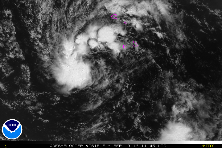
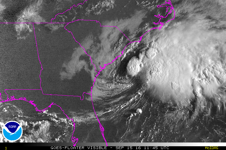
There have been close calls, most notably Ike in 2008, which made landfall near Galveston with peak wind speeds just shy of the Category 3 threshold.  Sandy in 2012 hit Cuba as a major hurricane, but by the time it made landfall on New Jersey, it was not technically a hurricane anymore, and even if it had been, it would have been a Category 1 storm. Recently, Matthew was a very close call... it hit Haiti and Cuba at Category 4 intensity, and was a Category 4 hurricane just off the Florida coast, but the eye and eyewall remained offshore, sparing coastal cities the worst of the storm's fury and avoiding an official landfall.  By the time it made landfall in South Carolina, it was a Category 1 storm.

A hurricane of any intensity is going to be destructive if it makes landfall somewhere.  By the time a tropical cyclone is organized enough to be classified as a hurricane, it is a significant storm capable of producing inundating storm surges and tremendous rainfall if it is near land.  It does not take a "major" hurricane to do those things -- Ike, Irene, Sandy, and Matthew prove that point well.  In fact, over 75% of all hurricane-related fatalities in the U.S. are caused by storm surge and rainfall, while just 8% are linked to wind.  This is why it is never a good idea to shrug off a hurricane because it's "only" a Category 1.  There's more to the story than the category! 
Fraction of tropical cyclone related fatalities in the U.S. caused by various factors from 1963-2012. (Rappaport 2014)
So why make a distinction between Category 1-2 hurricanes and Category 3-4-5 hurricanes?  Once sustained wind speeds reach over 110 mph, the damage caused by wind increases notably and dramatically.  Then, in addition to the water-based problems cause by storm surge and flash flooding, you also have widespread power loss, roof removal/damage, uprooted trees, etc.

If you have experienced the devastation caused by just the water-based facet of Category 1-2 hurricanes such as Ike, Irene, Sandy, and Matthew in the U.S., you can appreciate that a hurricane of any intensity means business.  But the stakes are increased even higher when the destructive wind speeds are added from a Category 3+ hurricane.

The 2016 season ends in five weeks, and something could still happen to end the U.S.'s major hurricane "drought", but the odds are historically very slim in November... so the record span will likely reach well into 2017.


12 October 2016

Hurricane Nicole heading for Bermuda

Nicole formed eight days ago, just as Matthew was hitting Haiti and Cuba, so its existence was overshadowed by Matthew for much of its lifetime. But since Sunday, it has been the only active storm in the Atlantic, and is poised to strike Bermuda as a Category 2 hurricane on Thursday.

Wednesday morning sunrise on Hurricane Nicole.
As of the 8am EDT advisory, Nicole's peak winds are up to 100 mph, and it is just 320 miles from Bermuda.  "Landfall", or closest approach, is expected on Thursday afternoon, but rainbands are already reaching out to the island. A hurricane warning is in effect, and in addition to the winds, 4-8" of rain is forecast, as well as significant storm surge.


I have long, updating radar loops from Bermuda available at http://andrew.rsmas.miami.edu/bmcnoldy/tropics/radar/

Bermuda has had an unusually rough past decade compared to climatology there, with six hurricane encounters: Karl 2016, Joaquin 2015, Gonzalo 2014, Fay 2014, Igor 2010, and Florence 2006.  For a tiny speck in the ocean, I'm sure they're hoping for the unlucky streak to end after Nicole.

By the numbers, the season thus far has had 14 named storms, 6 hurricanes, and 2 major hurricanes (defined to be Category 3+ on the Saffir-Simpson scale).  Climatologically by this date, an average season would be at 10 named storms, 5 hurricanes, and 2 major hurricanes.  And then in terms of ACE, or Accumulated Cyclone Energy, the season is now at about 127% of average for October 12th.  Matthew contributed an impressive 43% of the season's total, and just two storms (Gaston and Matthew) contributed 65% of the total.

The next name on this season's list is Otto, but as of now, there is no new activity expected in at least the coming week.


09 October 2016

Matthew transitions to a powerful extratropical cyclone off NC coast

A storm that we've been watching since it left the African coast as an easterly wave back on September 22nd has finally transitioned to an extratropical cyclone off the North Carolina coast.  The extratropical cyclone is centered just east of Cape Hatteras and still contains 75mph winds (Category 1 hurricane if it were still tropical) and is still producing significant storm surges in the area.


Hurricane Matthew, the first Category 5 hurricane in the Atlantic in nine years, left a trail of destruction in its path, from Haiti, Cuba, and Jamaica, up into the Bahamas, and finally the southeast United States. It remained a major hurricane (Category 3+ on the Saffir-Simpson scale) for a full week, which is very rare.

After two days of hugging the southeast coastline, Matthew did officially make landfall in the U.S., just north of Charleston, SC late Saturday morning as a Category 1 hurricane.

The record 11-year major hurricane "drought" in the U.S. continues, perhaps into at least next year, but let's not count this season out just yet.


In northern Florida, Georgia, South Carolina, and North Carolina, the wind speed was not the primary problem, or even secondary.  As usual, the flooding produced by the tropical cyclone was/is the big problem, caused by storm surge and by rainfall.  Kudos to the NWS and NHC for accurate storm surge and rainfall forecasts leading up to the event.

Keep in mind that the Saffir-Simpson scale (Category 1-5) only applies to the peak wind speed found in the storm, typically right near the center in the eyewall.  It does not contain any information on how large the wind field is, how much rain will fall, how deep the storm surge will be, etc.  The message to remember is "there's more to the story than the category".

3-day rainfall totals, from Thursday morning through Sunday morning (10/6-10/9). 
I have a long list of radar loops that cover much of Matthew's journey and lifecycle, from its genesis in the Windward Islands to its extratropical transition over eastern North Carolina: Tropical Cyclone Radar Loops

A series of excellent brief updates spanning the past couple of days can be found on the Capital Weather Gang blog.  Ex-Matthew is forecast to track eastward out to sea -- the loop scenario that appeared in forecasts for a few days did not come to fruition; the approaching trough was too strong.

If you recall a post I wrote back on September 28th, just as Matthew earned its name, I compared the long-range forecast track to that of 1954's Hurricane Hazel (which also occurred in October).  The outcome is remarkable... the genesis location, the abrupt right turn in the central Caribbean, the landfall on the western tip of Haiti, and a landfall in northern South Carolina.  Matthew just crept in closer to the Florida coastline and was stronger at its SC landfall.

[Matthew’s track is eerily similar to Hurricane Hazel’s in 1954]

Remarkable similarities between two October major hurricanes: Matthew 2016 and Hazel 1954.

Elsewhere, Tropical Storm Nicole is still drifting around further east in the Atlantic, and is forecast to accelerate and head for Bermuda on Thursday.


The next name on this year's list is Otto, but there is no new activity on the foreseeable horizon.


05 October 2016

The 11-year major hurricane "drought" in the U.S. could end this week

My morning update on Hurricane Matthew is available on the Capital Weather Gang blog.  If you are on the east coast of Florida, complete your preparations by tonight. If you don't hear from me in the coming days, I probably lost power and/or can't send emails!

Hurricane Matthew turns to Florida and it could make landfall as a Category 4


04 October 2016

U.S. East Coast on high alert after Matthew strikes Haiti as strongest hurricane in 52 years

Matthew had made landfall in Haiti, and is now set to rake across Cuba and the Bahamas.  The entire U.S. east coast should be watching this storm very closely, especially Florida and North Carolina.

East Coast on high alert after Matthew strikes Haiti as strongest hurricane in 52 years


30 September 2016

Matthew explodes into major hurricane

Hurricane Matthew has rapidly intensified, and is now a Category 3 storm packing 115 mph winds.  You can read my full update on the Capital Weather Gang blog:

Matthew explodes into major hurricane


29 September 2016

Matthew strengthens to a hurricane as it traverses the Caribbean

Matthew now has peak winds of 75 mph, making it the fifth hurricane of the season.  It is centered about 300 miles south of San Juan, and tracking west at 15 mph.


The storm has encountered unexpectedly high wind shear, which has slowed down its intensification rate, but it is still managed to achieve hurricane intensity.  It is the season's fifth hurricane, and only the fifth hurricane to form in the Caribbean in the past five years (the others were Rina '11, Ernesto '12, Sandy '12, and Gonzalo '14).

A band of strong wind shear lies ahead of it now, which is actually not uncommon in the central Caribbean... but it should pass through it by Saturday.


As mentioned yesterday, the long-range forecast track is rather similar to Hazel (1954), but if we start the comparison from the point where Matthew should turn northward, the forecast track out to 5-7 days also resembles Sandy (2012).

Matthew is still expected to continue its westward track through the Caribbean for another 2-3 days, then the model guidance starts to diverge.  Some models immediately commence with a northward turn, while others leave it lingering in the Caribbean for at least another day or two, delaying the turn and reducing the predictability.


In this plot of model runs from late last night, the tracks appear to be somewhat clustered, but the timing is quite different.  I used this map rather than the most recent because it includes a leading global model, labeled ECMF on here (dark red line).  Notice that both the ECMF and UKM lines show a track that is further south and much slower than the others.  Any time a tropical cyclone is moving very slowly, it is a sign of weak steering currents and relatively low predictability.

In terms of intensity, nearly all models agree that it will maintain hurricane intensity through the weekend, and then strengthen some more as it heads for Haiti/Jamaica/Cuba.  The official NHC 5-day forecast is shown here:


Some key "cone of uncertainty" refreshers:

1) The cone does not indicate the actual level of confidence or predictability.  The cone is a fixed size all season long, for all storms and all forecasts.  In some situations, the realistic uncertainty in the track forecast is greater than what the cone portrays, and sometimes it's less.

2) The cone is only designed to enclose the storm's position with 2/3 probability... there is historically a 1/3 chance the center will track outside of the cone.

3) The cone does not indicate where the impacts will be experienced.  Impacts from a hurricane will extend beyond the cone, even for a perfect forecast.

For now, any U.S. impacts are too uncertain to worry about, and would be at least 5-6 days away at the earliest (south Florida would be the closest).  But in the shorter term, Jamaica, Haiti, and Cuba are in Matthew's sights early-mid next week, and heavy rain is a risk even far from where the center tracks.


28 September 2016

Tropical Storm Matthew forecasts are eerily similar to Hurricane Hazel in 1954

As promised, the second post today revisits the 1954 hurricane season, one that changed how the United States views the threat of hurricanes and funds the science to better predict them.  One storm from that infamous season was Hazel, which took a track that closely resembles the long-range model guidance for recently-formed Matthew.  The post is available on the Capital Weather Gang blog:

Tropical Storm Matthew forecasts are eerily similar to Hurricane Hazel in 1954


Tropical Storm Matthew forms and enters Caribbean

The disturbance we've been tracking since Friday was upgraded to Tropical Storm Matthew today, just as it crossed the Windward Islands and entered the eastern Caribbean Sea.  There will be two posts on it today, the first covers the storm and forecasts, while the second one will explore a haunting similarity that Matthew's forecast track has with an infamous storm from 1954: Hurricane Hazel.  Thanks for reading and sharing!

Tropical Storm Matthew may pose a threat to the U.S. coast next week


23 September 2016

Karl strengthens, hurricane watch issued for Bermuda

Both Karl and Lisa are still active, but Karl is taking the spotlight as it approaches Bermuda.  It is also on an intensification trend, and could become the season's fifth hurricane later today or tomorrow.

Satellite image of Tropical Storm Karl.  Bermuda is the magenta speck just north of the center of the image.
As of 11am EDT, Karl's maximum sustained winds were 60mph, and it had begun the turn to the north... moving north at 12 mph.  It will make its closest approach to Bermuda tonight, and Bermuda is under a tropical storm warning and a hurricane watch. I have long, updating radar loops available at http://andrew.rsmas.miami.edu/bmcnoldy/tropics/radar/


There are four aircraft monitoring this storm through the day and night: the NOAA P-3 and AF C-130 (they fly right into it to gather key data about the vortex), and the NOAA G-IV and NASA's unmanned GlobalHawk (they fly over and around it to gather environmental data).

Further east, Lisa is barely clinging to tropical storm status as it faces strong wind shear.  The satellite appearance tells the story: the low-level circulation is completely exposed, and the little thunderstorm activity that is still occurring is displaced far to the northeast. It is forecast to weaken to a tropical depression later today, and then dissipate completely sometime tomorrow.


Finally, another easterly wave just exited the African coast on the 22nd.  It doesn't look like much now, but global models have been bullish on developing this one in the deep tropics in 5-7 days and tracking it through the Caribbean.  More on this next week... the next name on the list is Matthew.


20 September 2016

Lisa forms in eastern Atlantic, Karl may threaten Bermuda

Although very little has changed with Tropical Storm Karl, the disturbance I've been mentioning since last Friday was upgraded to Tropical Depression 13 on Monday afternoon, and then again to Tropical Storm Lisa on Tuesday morning.  Lisa is the season's 12th named storm, while in an average season, only 12 named storms form through the end of November!

Tropical Storm Lisa on Tuesday morning.
Lisa is centered just west of the Cabo Verde Islands, and is forecast to turn toward the northwest and head into a more hostile environment.  It may have the next few days to exist as a tropical storm, but model guidance and the NHC forecast indicate that it will weaken this weekend.  It is no threat to land.


About 1500 miles to the west, Tropical Storm Karl remains somewhat disorganized and sheared, but is expected to strengthen in a couple days as it recurves toward Bermuda.

Tropical Storm Karl... the yellow shading highlights low-level clouds and the white indicates higher clouds associated with thunderstorms.
The map below shows track forecasts from a variety of regional and global dynamical models, and while the recurvature scenario is extremely likely, the exact timing will determine how close the storm gets to Bermuda.  As I mentioned yesterday, Bermuda has had three hurricanes pass very close in the past couple of years: Joaquin '15, Gonzalo '14, and Fay '14.


As it looks now, Bermuda has a very high chance of experiencing at least tropical storm force winds.  NHC forecasts Karl to reach hurricane intensity by Friday, and perhaps reach Category 2 status by Saturday as it passes by Bermuda.


19 September 2016

Karl still a tropical storm, and Lisa could form later today

Since my last update on Friday morning, the only remaining features of interest are Tropical Storm Karl and Invest 96L.  Both are located in the central and eastern Atlantic and do not pose a threat to land in the near future.


Tropical Storm Karl is centered about 900 miles east of the Leeward Islands and moving toward the west at 15 mph.  Environmental conditions are expected to gradually become more favorable for some strengthening this week, and the National Hurricane Center forecasts it to reach hurricane intensity in about three days.  As of Monday morning however, it is still embedded in dry air and strong wind shear.

Models are in excellent agreement on the storm passing well north of the Leeward Islands, then recurving by about 65°-70°W (the NHC forecast track follows the model consensus).  The primary concern then becomes Bermuda... Karl could reach Bermuda as a hurricane by Saturday.  The last hurricanes to pass over or close to Bermuda were Joaquin in October 2015 and then Fay and Gonzalo in October 2014 -- only 6 days apart from each other.


Invest 96L is very close to becoming Tropical Depression 13 or even Tropical Storm Lisa... probably later today.  Other recent years that had the 12th named storm form so early in the season are 2012, 2011, 2005, and 1995; all very active years (climatologically, there are only 7 by this date).


In the medium-long range, it does not appear that this system will be a threat... most models do not develop it much after this week, and they indicate that it will turn northward into the central Atlantic.


16 September 2016

Atlantic now has three named storms for first time in four years

Ian, Julia, and Karl are all tropical storms now, a level of activity not seen in the Atlantic since 2012 when Isaac, Kirk, and Leslie were all active. However, it will be hard to touch the record of four simultaneous hurricanes in the Atlantic: Georges, Ivan, Jeanne, and Karl in 1998 (note that Georges, Ivan, and Jeanne have since been retired).

Infrared satellite image of the Atlantic basin on Friday morning. (CIMSS)
Contrary to model guidance, nature decided that Julia was not finished yet, and it was re-upgraded to a tropical storm on Thursday afternoon.  The official forecast still calls for it to weaken and remain nearly stationary though, so it is not expected to become a threat to land.


Ian is still clinging onto tropical cyclone status, though barely.  This is the last you'll hear about it, but it did hang around long enough to assist with the "three simultaneous named storms" statistic!

And last but not least, Tropical Depression 12 was upgraded to Tropical Storm Karl, the 11th named storm of the season.  In an average season, the 11th named storm forms on October 28!  But as before, the overall activity as measured by ACE (Accumulated Cyclone Energy) is still lagging behind... roughly 74% of average for this date.  In other words, the season has had a lot of weak storms: they get named but don't get very strong or last for very long.


Karl is expected to remain relatively weak for the next several days, but by the middle of next week it could be in a position to intensify as it heads west. This graphic below shows a three-day forecast of the surface pressure and mid-level humidity -- Karl is the low pressure near 47°W surrounded by dry air (the next easterly wave behind it may also get named next week... it would be Lisa).


 In the longer range, most models still agree that it will get stronger and track toward the west-northwest.  It's too early to say if it will recurve toward Bermuda or keep a heading more toward the U.S.  Shown here is a plot of track forecasts from the GFS ensemble (a global dynamical model run multiple times with slightly different initial conditions to simulate uncertainty).  The lines are colored by intensity.  At this point, the majority have it recurving before it reaches 70°W, but that can change.


15 September 2016

Julia, Ian, and TD12 are scattered across the Atlantic

Today's update will be brief, as very little has changed since yesterday.

Surface wind field showing the circulations of the three active tropical cyclones in the Atlantic. (earth.nullschool.net)
Julia did eventually drift offshore after I wrote yesterday's post, and it also weakened to a tropical depression. It is expected to dissipate this weekend, but should remain virtually stationary the entire time due to a lack of steering flow.  This morning it is centered 85 miles east of the SC/GA border, with the "business end" (heavy rain, and thunderstorms, and strongest winds) displaced to the east of the center and away from land.

Sunrise over Tropical Depression Julia on Thursday morning.
Ian is still a moderate tropical storm with 50 mph peak winds, but remains embedded in a high-shear environment. The center is about 750 miles south-southeast of Newfoundland, but as you can see in the satellite image below, a frontal boundary is forming to its south, a tell-tale sign that it is transitioning to an extratropical cyclone.  NHC will likely cease writing advisories on it today or tomorrow.


And finally, Tropical Depression 12 is still forecast to battle with dry air for the next few days, but probably have a shot at intensification next week.  Should it reach tropical storm status, the next name on the list is Karl. It's presently not looking very ominous... just a low-level swirl with some widely scattered thunderstorm activity to its south.


The long-range forecasts are worth paying some attention to, at least to start watching for trends and consistency.  The plot below shows track forecasts from a variety of dynamical models out to 5-7 days, as well as the NHC forecast (black line).  There is general agreement that it will continue its westward motion and reach the area north of the Leeward Islands by late next week.  It is far too early to say anything certain about the intensity at that time, but for what it's worth, today's model runs indicate it would not be a hurricane at that point.


Stay tuned!


14 September 2016

Julia forms over Florida, Ian still a tropical storm, TD12 forms over Cabo Verde Islands

The peak of hurricane season isn't failing this year.  There are two active tropical storms, and a new tropical depression off the coast of Africa.


The tenth named storm of the season, Julia, formed near Jacksonville FL on Tuesday night.  It actually formed over land, and the center has not spent any time over water, and probably never will.  This is extraordinary, and from what I can tell, unprecedented.  While there are a dozen examples of Atlantic tropical cyclones forming inland near a coastline (Agnes 1972 over the Yucatan Peninsula, Leslie 2000 over northern Florida are two examples), they did eventually track over water and strengthen. Julia can be traced back to an easterly wave that left the African coast on September 1st.

Tropical Storm Julia on Wednesday morning.  Previous center locations are marked with red dots.
Julia is expected to weaken to a depression later today over South Carolina... the primary threat is heavy rainfall, and parts of eastern SC could receive 6-10" of rain over the next few days as it crawls northward.

During an average season (using a 1981-2010 climatology), the 10th named storm forms on October 10th, so this season is now about 3.5 weeks ahead by that measure.  But in terms of ACE (Accumulated Cyclone Energy), the season is still at roughly 73% of average for this date.

In the far eastern Atlantic, over the Cabo Verde Islands, Tropical Depression 12 has formed and could get named in the next day or two.  The next name on the list is Karl, a name that was on one of the original six lists of names in 1980.


Models strongly favor this depression to develop to at least a tropical storm, and they also agree on a track toward the west over the next 5 days.  On this general trajectory, the system would reach the Lesser Antilles by late next week. But it will likely struggle with wind shear and dry air for the next three or so days.

A selection of global and regional dynamical model forecast tracks for TD12, valid out through Monday morning.
Finally, as expected, Tropical Storm Ian has not intensified, and is embedded in strong vertical wind shear in the middle of the Atlantic.  It is no threat to land, and is forecast to transition to an extratropical cyclone by the weekend.

Visible satellite image of Tropical Storm Ian on Wednesday morning.
Forecast track of Ian over the next five days. (NOAA/NHC)