
There are two areas of interest in the Atlantic that could become tropical cyclones in the coming week. The first is near the northern Bahamas and the second is just south of Puerto Rico. The one near the Bahamas (Invest 96L) has a hostile environment ahead of it, but the one in the eastern Caribbean (should soon be tagged as Invest 97L) is one to keep a close eye on. The next -- and final -- two names on this year's regular list are Vince and Whitney.
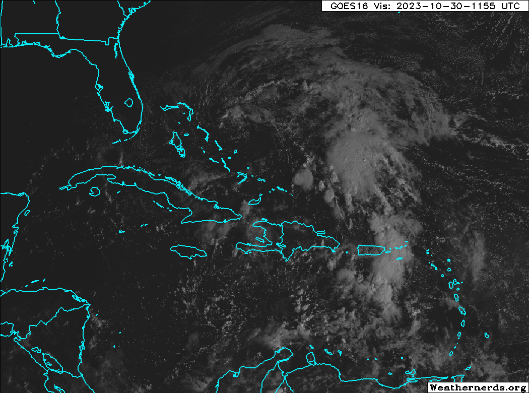
The discussion of Invest 96L will be very brief. It's already encountering drier air and stronger vertical wind shear and both are expected to only become less favorable for development in the coming days. Model guidance is in good agreement on it remaining very weak... either never form or perhaps briefly become a low-end tropical storm. It will zip off to the northeast away from land and dissipate.

The feature in the eastern Caribbean is very poorly defined right now, but should gradually consolidate in the next couple of days. There's a large difference between how the American and European model ensembles handle its future. This first animation is a 10-day forecast from the American model's ensemble system. The swarm of low pressures starts appearing on Wednesday and they track westward across the Caribbean. The majority run into central America and subsequently dissipate, and about six of the members turn north and hit Cuba as a hurricane. After Cuba, the Bahamas or even south Florida would be potential areas of concern. The timing of the potential encounter in south Florida would be next Tuesday-Wednesday, but there is a LOT of uncertainty in this right now.

Switching over to the same animation from the European model ensemble, very few of the members do anything with it, and the ones that do are decidedly weaker than in the American ensemble.

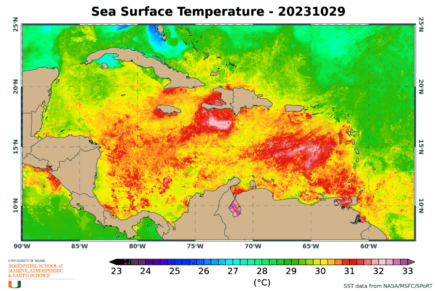
But one thing is for certain: the Caribbean Sea is still extremely warm (1-2°C warmer than average for the date) and that warm water is deep, resulting in huge values of ocean heat content. These factors will give a nudge to development and intensification, and be able to sustain a storm of any intensity.
Without a named storm out there, the Accumulated Cyclone Energy (ACE) is no longer accruing, and as of today, the 2023 tally is about 126% of average for the date. But, as described in this post, we probably aren't done for the year yet. Hurricane season officially ends on November 30.

Historically, the 2023 season sits rather high in the ranking for the date (in the top 12%):

- Visit the Tropical Atlantic Headquarters.
- Subscribe to get these updates emailed to you.
- Follow me on Bluesky and X
No comments:
Post a Comment