Since my previous post on Thursday, Tammy reached Category 1 hurricane intensity prior to its approach to the Leeward Islands, but the eyewall passed just barely to the east of the islands. It has been tracking northwest -> north since then, and unfortunately, that enormous uncertainty in the track forecast I pointed out on Thursday has not gotten any closer to being reduced.
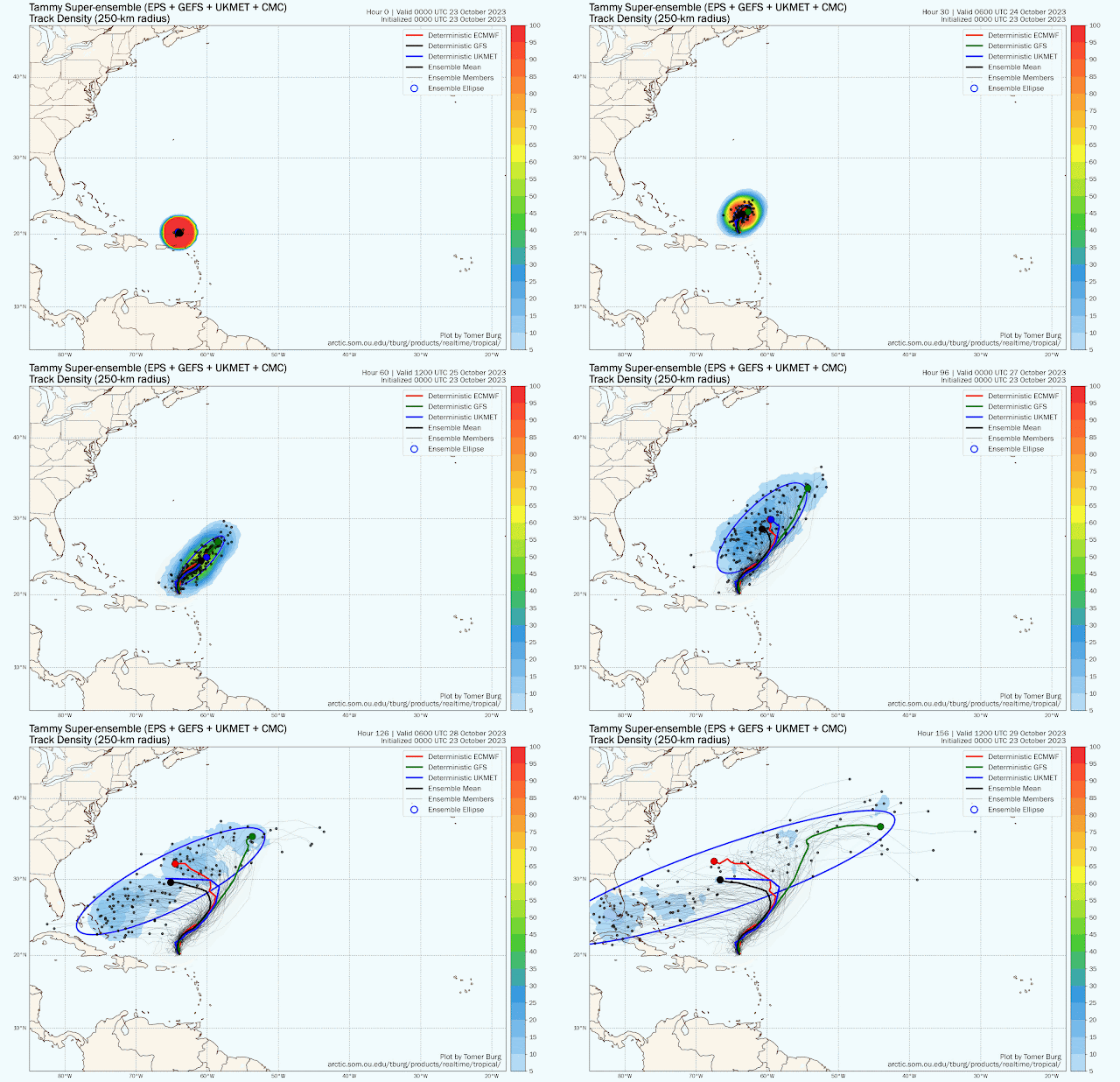
As of Monday morning, Tammy is a Category 1 hurricane centered about 250 miles north of the Virgin Islands and it's moving north at 7 mph. But by mid-week, models diverge significantly on the track forecast. Among global model ensemble members, roughly half bring Tammy west toward Florida and the other half stall or go east into the open Atlantic. But the greatest "track density" (shown below) is near south Florida on the 29th.
For the batch that reaches Florida, the timing as of now looks to be as early as Friday and as late as Sunday, with most making the closest approach on Saturday the 29th. It's worth pointing out that there is a full moon on the 28th, so water levels could create tidal flooding problems around every high tide for the few days surrounding that... even without help from Tammy.
Although it's still a long way out, the intensity guidance ranges from a very weak remnant to a Category 1 hurricane, so a tropical storm seems like a reasonable best guess for now if it makes the west turn. If it goes east, it has a chance at becoming a stronger hurricane. Most models show a fairly hostile environment if it goes west, so the odds of Tammy still being a hurricane by the weekend are pretty slim.
The official forecast from NHC drops it to tropical storm intensity by Thursday, and their track forecast is a compromise between the west and east scenarios, with a slight lean to the western ones. If one scenario starts to dominate in the model guidance, their track forecast will reflect that.
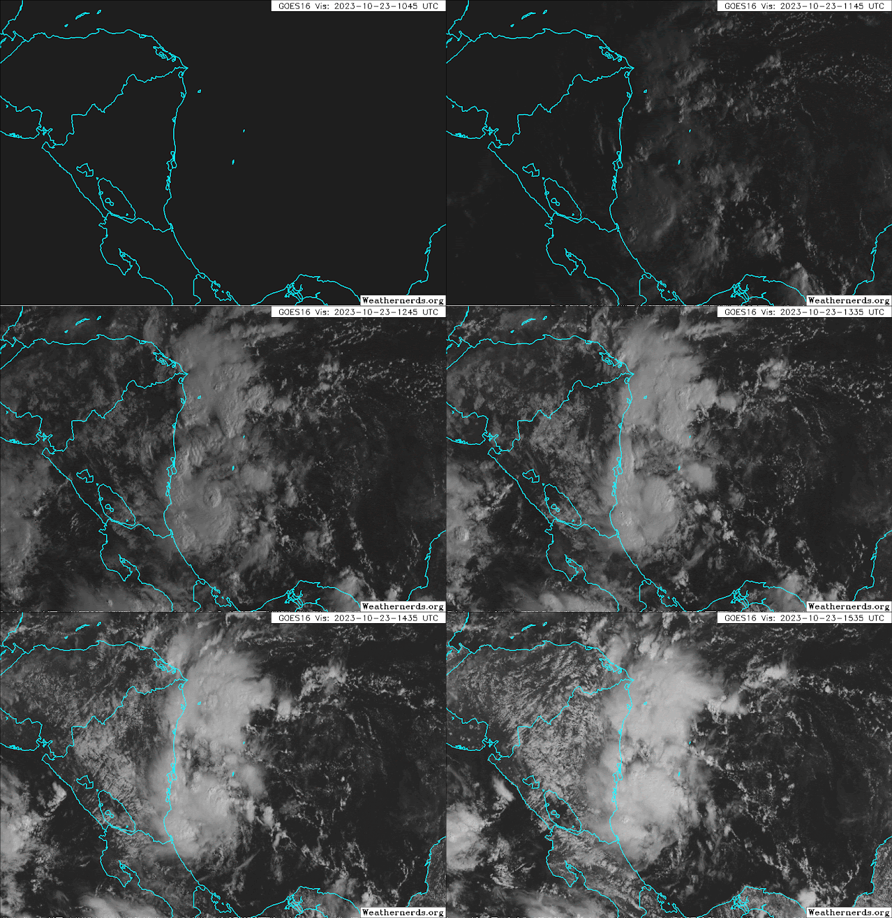
Elsewhere, Invest 95L is a disturbance brewing in the far western Caribbean... about to move inland over Nicaragua. It appears to be very close to becoming a tropical cyclone, and if it reaches tropical storm intensity, the next name on the list is Vince. Otherwise, it will cross Nicaragua and could become a tropical cyclone in the East Pacific.
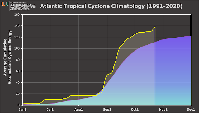
Looking at the Accumulated Cyclone Energy (ACE) through today, it's about 125% of average for the date and climbing higher above climatology each day while Tammy is around.
.png)


No comments:
Post a Comment