
Tropical storms Paulette and Rene are lurking in the central Atlantic. Paulette is far more impressive, while Rene is almost hard to spot. Their futures will be quite different too.

Rene may linger for several more days as a weak tropical storm, but Paulette is forecast to become a strong hurricane and perhaps threaten Bermuda by Monday.

Aside from Paulette and Rene, there is the strong wave over the Bahamas heading for Florida then the Gulf of Mexico, and the strong wave near Cabo Verde in the far eastern Atlantic. Both could be named in the coming days, and the next two names are Sally and Teddy. Another wave is just about to leave the African coast today, but I won't discuss that one any further yet in the interest of length.
The wave over the Bahamas is presently identified as Invest 96L, but could soon be transitioned to Potential Tropical Cyclone 19 (they are the same thing, but classifying an Invest as a PTC gives NHC the ability to issue tropical storm watches/warnings for it before it forms) or upgraded to Tropical Depression 19.
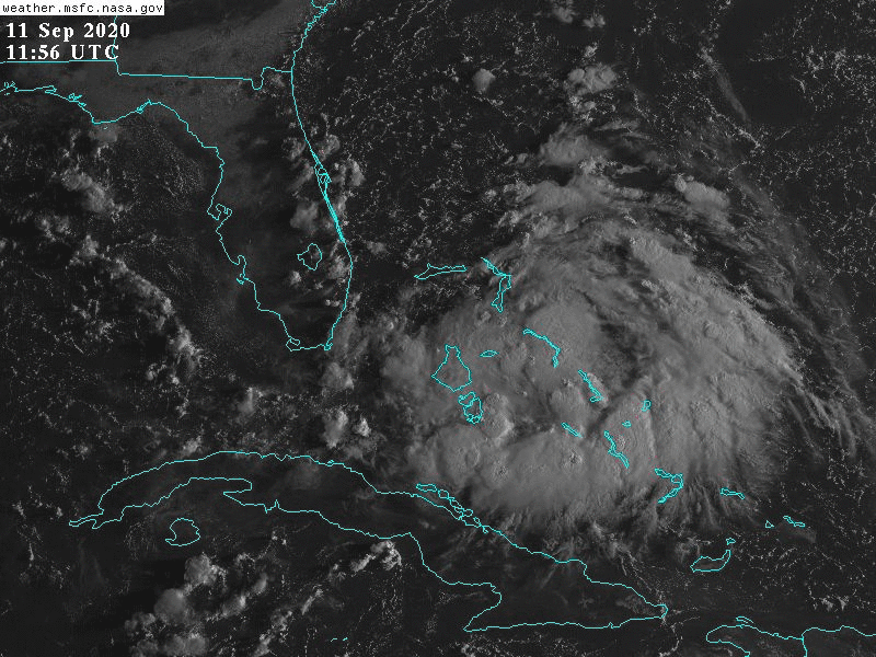
It will drift across the Florida peninsula this weekend, producing widespread heavy rain, then enter the eastern Gulf of Mexico where it is expected to get better organized and strengthen. There's a slight chance that it could develop into a tropical depression near or over south Florida on Saturday. As of now, the guidance has been showing a turn toward the north after Florida, bringing it into the north-central Gulf coast around Monday-Tuesday.
While there is not any indication from the model guidance that it would be more than a tropical storm, conditions in the eastern and central Gulf appear ideal for it to strengthen, so time will be the primary limitation. The map below shows the total rainfall forecast through the coming week.

Much further east, Invest 95L is located near Cabo Verde, and is a broad, elongated, and disorganized system. Although it's disorganized now, there is full model support for this becoming a hurricane further west in the deep tropics. Then, in about 4-5 days, there is a big jump in the track uncertainty.

For a disturbance that has not yet even a tropical cyclone, we expect the models to have challenges with the forecast. The two sets of ensemble forecasts shown below are from the European model (left) and the American model (right). In general, the majority of solutions favor a turn to the northwest before reaching the Lesser Antilles. But of the ones that reach the Antilles, it reaches the islands on Wednesday-Thursday, and it could be a strong hurricane.

As of today, the ACE (Accumulated Cyclone Energy) is at about 101% of average for this date, using the past 50 years as the baseline. Twelve years have had more than twice this value by now, and a couple infamous years in the past have had three times this value by now: 1933 and 1995.

- Visit the Tropical Atlantic Headquarters.
- Subscribe to get these updates emailed to you.
- Follow me on Twitter
No comments:
Post a Comment