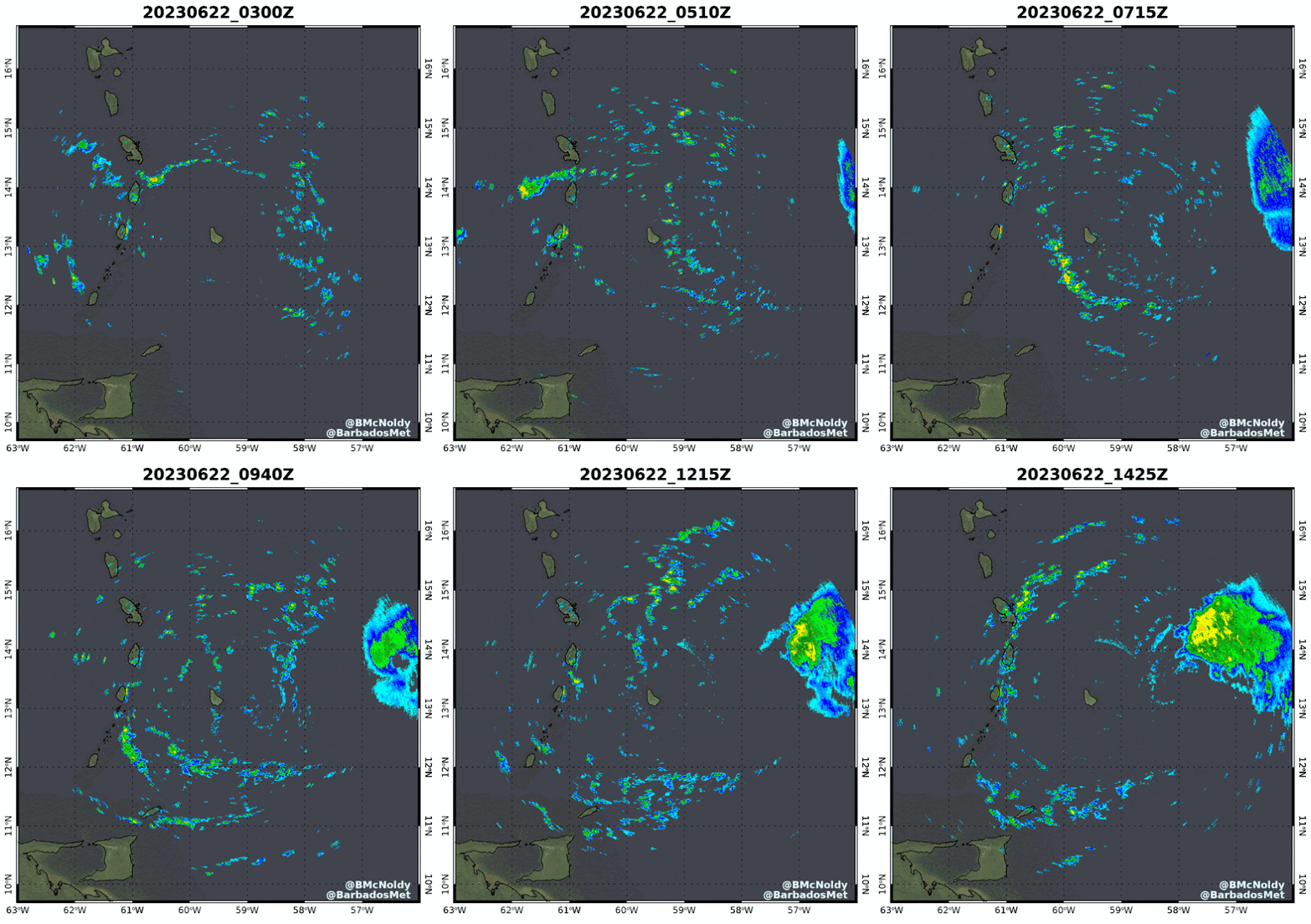
Tropical Storm Bret, which formed on the 19th from an easterly wave that left the African coast on the 15th is now about to cross the Lesser Antilles and enter the Caribbean Sea. Then, newly-upgraded Tropical Depression Four is trailing just 1000 miles east of Bret. The location of this activity is something we don't typically see "turn on" for another couple of months.
Bret is very close to hurricane intensity as it nears the Lesser Antilles... the center should pass over Martinique or St. Lucia on Thursday night, though squally weather will of course extend further away than that (primarily to the north of center). A tropical storm warning is in effect for Dominica, Martinique, and St. Lucia, and a hurricane watch is in effect for St. Lucia. You'll find the most current information at https://www.nhc.noaa.gov/graphics_at3.shtml?start#contents
The storm is already experiencing moderate vertical wind shear, so the low-level circulation is displaced to the west of the mid-level center and the bulk of the thunderstorm activity. The wind shear is expected to increase as Bret enters the Caribbean, so it has likely peaked in intensity and will gradually get ripped apart this weekend.
 |
| Radar loop from Barbados, available at https://bmcnoldy.earth.miami.edu/tropics/radar/ |
Then, the wave behind it which left the African coast on the 18th was upgraded to Tropical Depression Four on Thursday morning. Although it's following closely in Bret's footsteps, the steering pattern has evolved and this storm will most likely turn to the north before reaching the Lesser Antilles and eventually weaken in the face of strong wind shear early next week somewhere south of Bermuda. It is forecast to strengthen to a tropical storm later today, and the next name is Cindy.
This map below shows track forecasts from three global model ensembles, ending Tuesday morning. The black line is the mean of all three ensembles. The intensity guidance generally keeps this below hurricane intensity.
Elsewhere, the basin is quiet for now, but this is certainly a bizarre couple of storms to be writing about so early in the season.


No comments:
Post a Comment