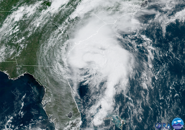
As of Monday morning, Isaías has not regained hurricane intensity, but is really close. The very warm Gulf Stream water is giving it lots of fuel, but strong wind shear is constantly trying to tear it apart -- a battle of conflicting environmental influences. Hurricane warnings are in effect for northern South Carolina and southern North Carolina... tropical storm warnings extend up into Massachusetts, and storm surge watches/warnings span the coastlines of SC and NC. As I mentioned in Saturday's post, this storm will be impactful along the entire US east coast.
Even if Isaias does briefly strengthen to a hurricane again before landfall, the greatest hazard by far will be rain, followed by storm surge, followed by wind. The following map shows the flash flood risk associated with Isaias' trek along the coast over the next couple of days.
And the map of peak storm surge values again confirms how widespread the effects of Isaias will be.
Landfall is forecast to be near Myrtle Beach SC on Monday evening, and Isaias could be a minimal hurricane by then. There are long radar loops available at http://bmcnoldy.rsmas.miami.edu/tropics/radar/
Elsewhere, there is still that tropical wave north of the Lesser Antilles (Invest 94L) with a decent chance of development according to NHC. The support for its development is dwindling in the models though. Should it form and get named, the next name is Josephine. It will remain out over the open ocean, perhaps bring some weather to Bermuda, but even that is a pretty low chance.


No comments:
Post a Comment