
Peak observations from the [un]lucky buoy include a 976mb pressure, 40-foot significant wave height, 68kt sustained winds, and 93kt wind gusts. The SST dropped from its pre-storm value of 28.4C to a low of 25.1C!
http://www.ndbc.noaa.gov/station_page.php?station=41048

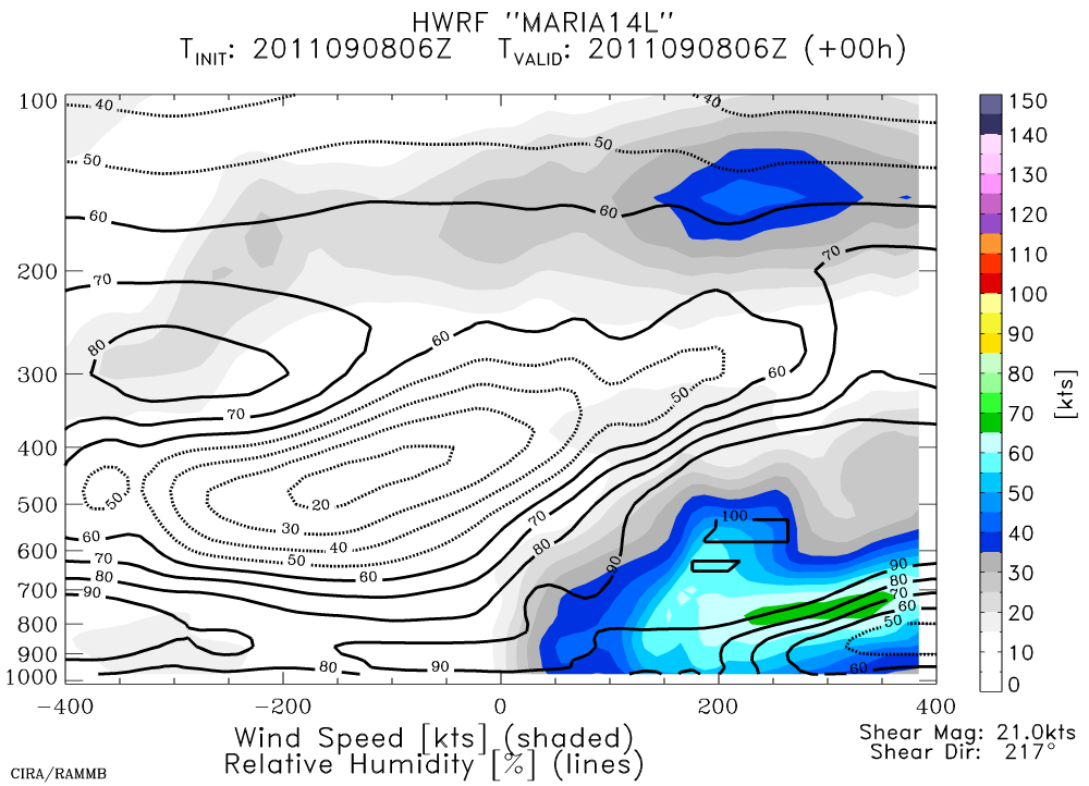
Maria is still a 40kt tropical storm, but looks quite anemic this morning... a sign that shear and dry air are nudging their way into the vortex.

The plot below is the initial condition from HWRF's 06Z run... it's an along-shear cross-section of wind speed and relative humidity. You can clearly see the asymmetry in the wind field (shaded), as well as the low RH values (contours) being forced into the system by the strong shear. The official forecast brings Maria over the central Bahamas in 5 days as a strong tropical storm. Given this track, the southeast and east coast of the US should be very alert... this is nearly a copy of Irene's track.
Tropical Storm Nate is at 45kts, and still virtually stationary. It's forecast to slowly intensify to a hurricane on Saturday as it begins to crawl to the northwest toward the US/Mexico border next week. You can view full-resolution visible images of Nate at http://rammb.cira.colostate.edu/ramsdis/online/loop_640.asp?product=tropical_ge_1km_center_relative_vis_floater

Please visit my tropical Atlantic headquarters.
No comments:
Post a Comment