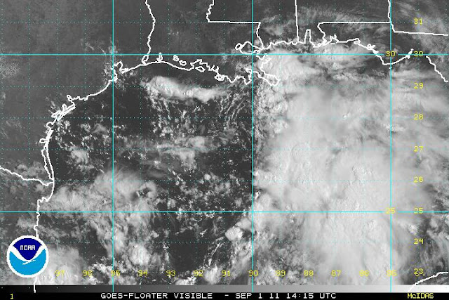
Welcome to September, by far the busiest month of the Atlantic hurricane season!
As of this morning, Katia was upgraded to a hurricane (second of the season) with 65kt
sustained winds and a 987mb central pressure.
It's located about 850
miles east of the Lesser Antilles and heading W at 16kts. This westward
motion was not anticipated... models have been in excellent agreement
that the WNW or even NW track would persist. This could suggest that
the more southern models among the guidance package could be on the
right track. The models also collectively suggest a
continued gradual intensification (shear is an inhibiting factor, but not strong enough to be too detrimental).
The disturbance that was near the northern Yucatan peninsula yesterday is now well into the Gulf (AL93). It has persistent deep convection, but is in about 20kts of vertical shear. This is forecast to let up over the next couple of days, perhaps allowing this to organize. The next name on the list is Lee.
The current NW heading should also come to a halt as it encounters a
region with little or no steering flow, leaving it to drift very slowly
just off the northern Gulf coast... possibly bringing a major flooding
threat with it. The graphic below from NOAA/HPC shows the forecast 5-day rainfall totals. Yes, that's an 18.9" bullseye over southern LA. Whether this storm becomes a TS or hurricane seems like a minor point compared to the flooding potential.
There is also a small and highly-sheared circulation north of Bermuda that bears watching (AL94).
Please visit my tropical Atlantic headquarters.


No comments:
Post a Comment