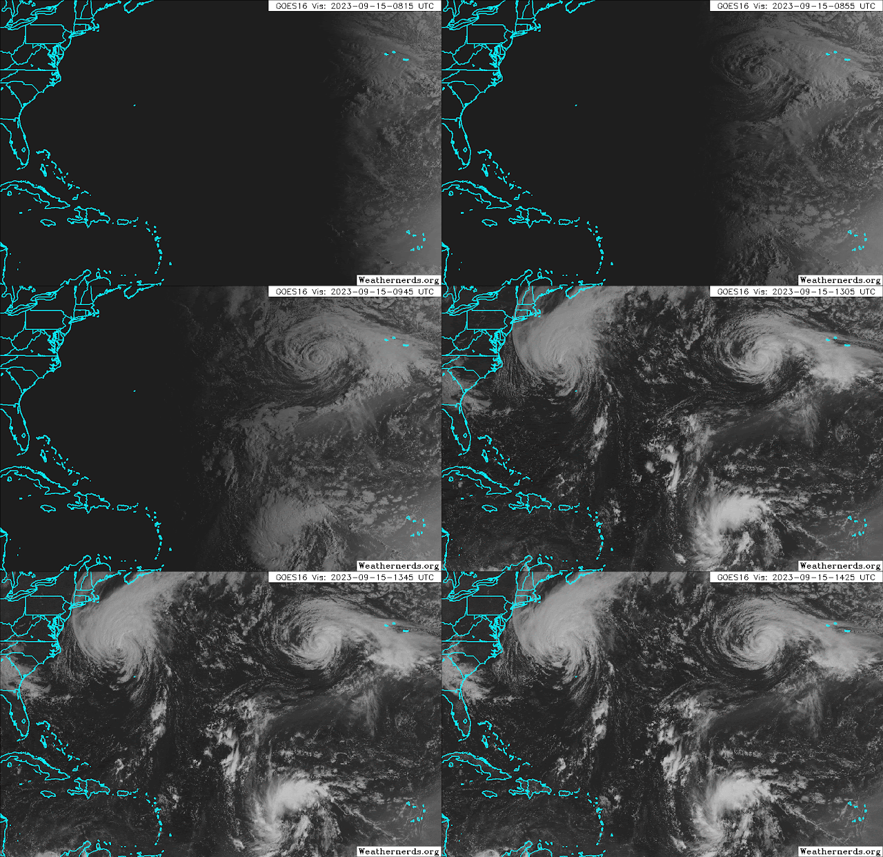
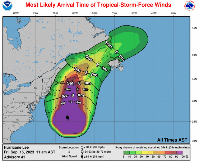
Lee is now a Category 1 hurricane and a very large one at that. Tropical storm winds extend as far as 320 miles from the center, and hurricane winds extend as far as 105 miles from the center. A storm surge of 1-3 feet is possible along much of the New England coast.
It is forecast to make landfall in western Nova Scotia midday Saturday though strong winds will arrive before that... it could be an upper-end tropical storm or Category 1 hurricane, and possibly no longer technically be classified as a tropical cyclone, but that does not change the expected impacts. This process is called "extratropical transition", and it involves changes in the dynamic and thermodynamic structure and properties of the cyclone. Extratropical cyclones can also be very intense and impactful (remember Sandy 2012?).
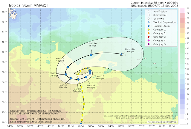
Margot could be around for a while longer, generally maintaining tropical storm intensity. It found itself in an area of weak steering flow and is just circling around west of the Azores. Even if it eventually reaches the Azores sometime in the middle of next week, it should not be too much of a concern.
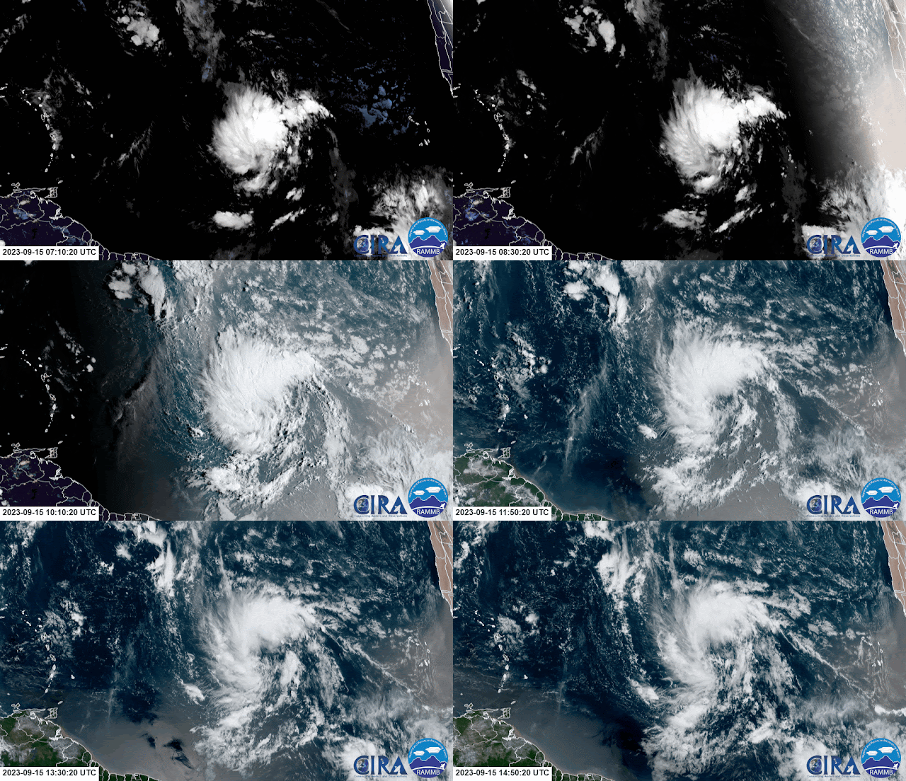
Elsewhere, the Invest 97L and 98L merger happened and has been carried as just 97L... at 11am Eastern on Friday it was upgraded to Tropical Depression 15 and it's quite close to reaching tropical storm status. The next name is Nigel which is a new name on the list, replacing Nate from the 2017 season.
TD15 is located about 1200 miles east of the Lesser Antilles in the deep tropical Atlantic. There is strong agreement among the models that TD15/Nigel will continue tracking to the northwest for the next five days or so, then turn north by the time it reaches about 60°W. The models also agree on it becoming a strong storm -- very likely a hurricane by Monday.
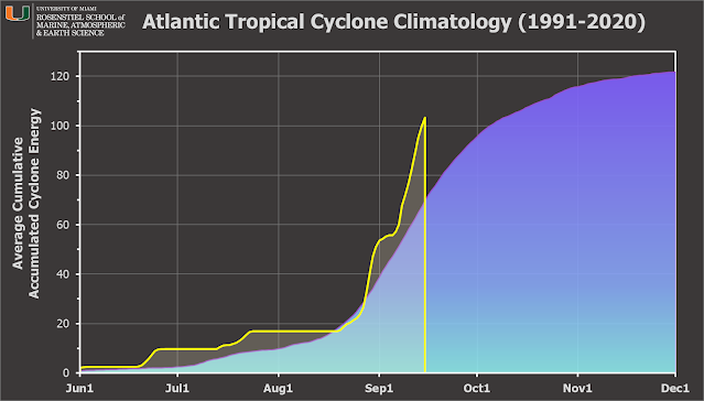
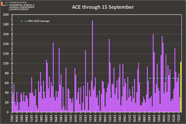
The Accumulated Cyclone Energy (ACE) is at about 148% of average for the date and is the highest value for the date since 2017, then 2008 before that. In other words, pretty exceptional.
 Since my

No comments:
Post a Comment