
Tropical Storm Karl is centered about 900 miles east of the Leeward Islands and moving toward the west at 15 mph. Environmental conditions are expected to gradually become more favorable for some strengthening this week, and the National Hurricane Center forecasts it to reach hurricane intensity in about three days. As of Monday morning however, it is still embedded in dry air and strong wind shear.
Models are in excellent agreement on the storm passing well north of the Leeward Islands, then recurving by about 65°-70°W (the NHC forecast track follows the model consensus). The primary concern then becomes Bermuda... Karl could reach Bermuda as a hurricane by Saturday. The last hurricanes to pass over or close to Bermuda were Joaquin in October 2015 and then Fay and Gonzalo in October 2014 -- only 6 days apart from each other.

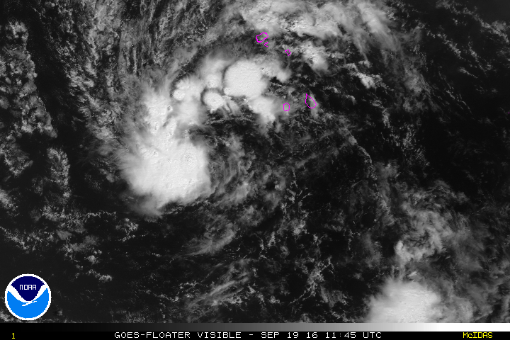
Invest 96L is very close to becoming Tropical Depression 13 or even Tropical Storm Lisa... probably later today. Other recent years that had the 12th named storm form so early in the season are 2012, 2011, 2005, and 1995; all very active years (climatologically, there are only 7 by this date).
In the medium-long range, it does not appear that this system will be a threat... most models do not develop it much after this week, and they indicate that it will turn northward into the central Atlantic.
- Visit the Tropical Atlantic Headquarters.
- Subscribe to get these updates emailed to you.
- Follow me on Twitter
No comments:
Post a Comment