24 November 2015

Hurricane Joaquin tops the list as 2015 Atlantic season comes to a close

To those who have been subscribed and reading my posts since the humble beginnings in 1996 (yes, this was the 20th year!), I want to thank you for your continued support and interest.  And to the many more recent readers, thanks for joining!

I have sent out approximately 1000 tropical updates over those years.  Those updates have spanned 285 tropical storms, 126 hurricanes, 66 major hurricanes, and 36 retired storm names.  WHEW... my fingers are tired just thinking about that!

My summary of the 2015 hurricane season is now available on the Washington Post's Capital Weather Gang blog, and again, thanks for reading and sharing!

Hurricane Joaquin tops the list as 2015 Atlantic season comes to a close


10 November 2015

Kate strengthens as it turns to the northeast

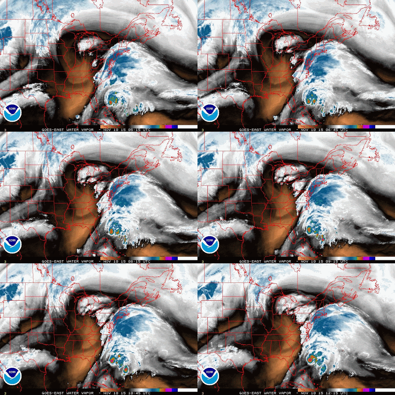
Tropical Storm Kate is now racing toward the northeast, away from the Bahamas, at nearly 20mph.  Peak winds are up to 60mph, and it is forecast to intensify more in the next 24-36 hours before it transitions to an extratropical cyclone.


It is being forced out to sea by a deep trough, which shows up nicely on water vapor images:


If Kate does reach hurricane intensity, it would join the ranks of only 39 other known hurricanes to form during November since 1851.  Typically by now, the Cape Verde season has long-since shut down (the easterly waves moving off of Africa), and the Gulf of Mexico is commonly influenced by cold fronts.  But the western Caribbean is a hot zone for formation, as well as along and on the ends of fronts.  In this map I show the tracks of the 39 November hurricanes as well as their formation point, which is marked with a white dot.  I added a cyan dot where Kate formed for reference.


Elsewhere, the basin is quiet, and the end of the official hurricane season is just under three weeks away.