 |
| Water vapor image showing upper-level features in the atmosphere. The mid-level circulation of ex-Dorian is marked by the red X. (NOAA) |

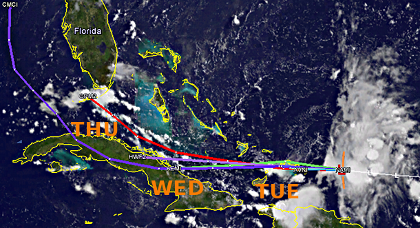
Given the poor organization and the bearish environmental outlook, most models are having a hard time even tracking this feature for very long. So at least for the next few days, the only noticeable effect this will have is to bring enhanced chances of gusty winds and heavy rain to the Dominican Republic, Haiti, Bahamas, and Cuba... and eventually southern Florida by Wednesday evening into Thursday.
- Visit the Tropical Atlantic Headquarters.
- Subscribe to get these updates emailed to you.
- Follow me on Twitter
No comments:
Post a Comment