At about 12Z today (8am EDT), Irene made landfall near Cape Lookout, NC as a Cat 1 hurricane. The radar image from the approximate time of landfall is shown here.
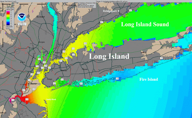
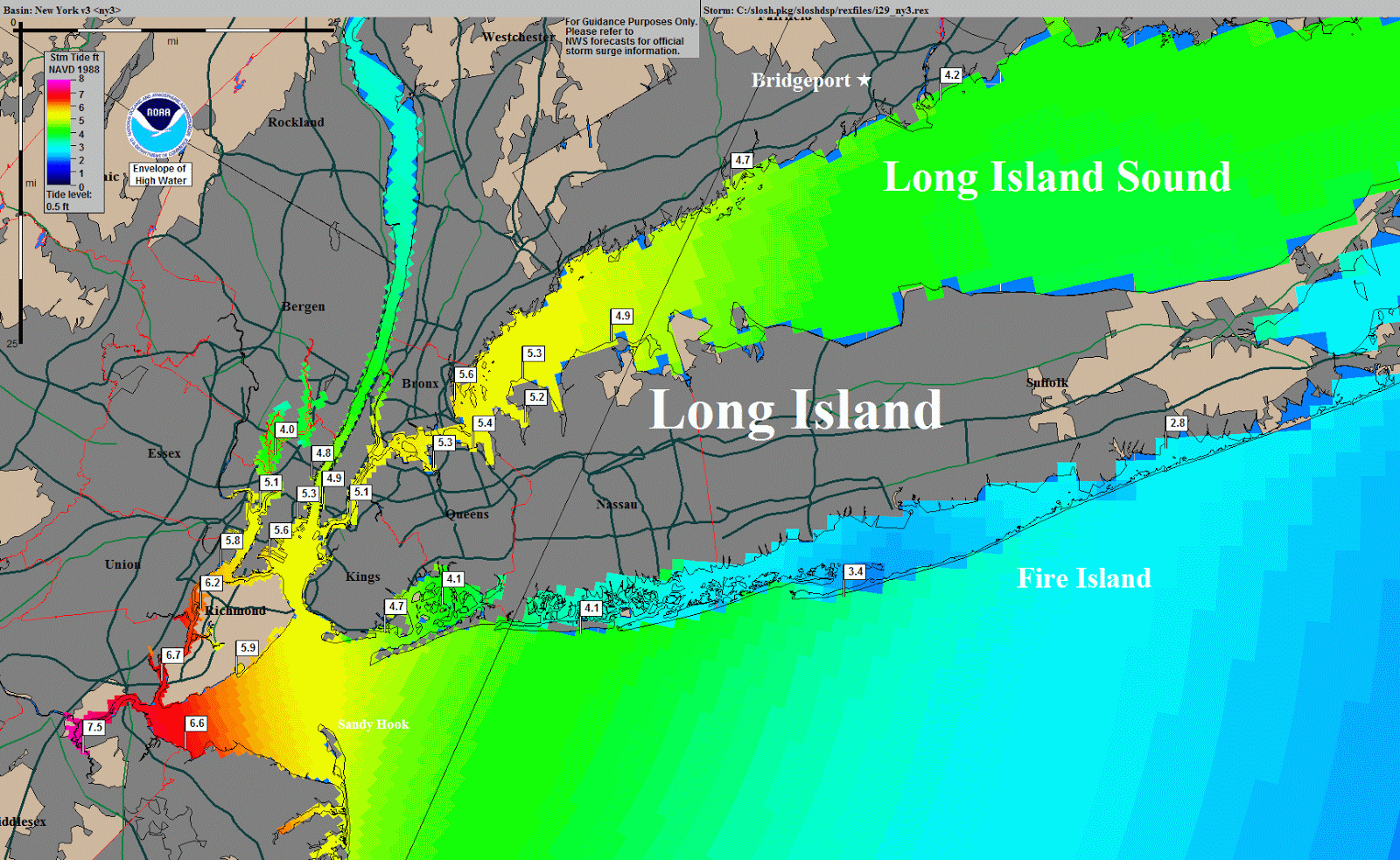
The northeast is still in the crosshairs, and although Irene is weakening, that will only minimally affect the storm surge and not affect the rainfall... the category rating is only for wind, not water (though a stronger storm will generally generate a larger storm surge). The Chesapeake Bay, Delaware Bay, Long Island Sound, and all inlets, bays, and sounds along the northeast coast should still be ready for some major flooding. The latest storm surge model output for the northeast metro areas is shown below:

And, in addition to this, the entire northeast can expect huge amounts of rain in the next 36 hours. The graphic shown here is the forecast accumulated rainfall over the next 3 days (in inches). This will be a very historic storm, even if it's only a tropical storm by the time it reaches New York! As of this update, the rain is already beginning to fall as far north as CT and RI, including VA, PA, DE, MD, NY, NJ. As the storm progresses, you will be able to find current and additional long radar loops at
http://einstein.atmos.colostate.edu/~mcnoldy/tropics/atlantic/
Please visit my tropical Atlantic headquarters.


very amazing post, I like It, Thank you for presenting a wide variety of information that is very interesting to see in this artikle, good job adnd succes For you
ReplyDeleteIngin Liburan Ke karimun jawa dengan aman dan nyaman di karimunjawa ? Ingin Paket Wisata Karimunjawa dan gak murahan? Hubungi Kami "Raja Karimunjawa" biro lokal asli Karimunjawa . Untuk Book Paket Karimunjawa dan Tour Karimunjawa , silahkan hubungi kami karena kami biro karimunjawa dan trevel karimunjawa terpercaya. Paket wisata karimunjawa Murah tapi mewah, murah tapi gak murahan. Kepuasan Wisata Karimunjawa anda di pulau Karimunjawa adalah kebahagia'an dan tujuan kami. Terimakasih telah mempercayakan paket karimunjawa bersama kami Agen Wisata Karimunjawa.