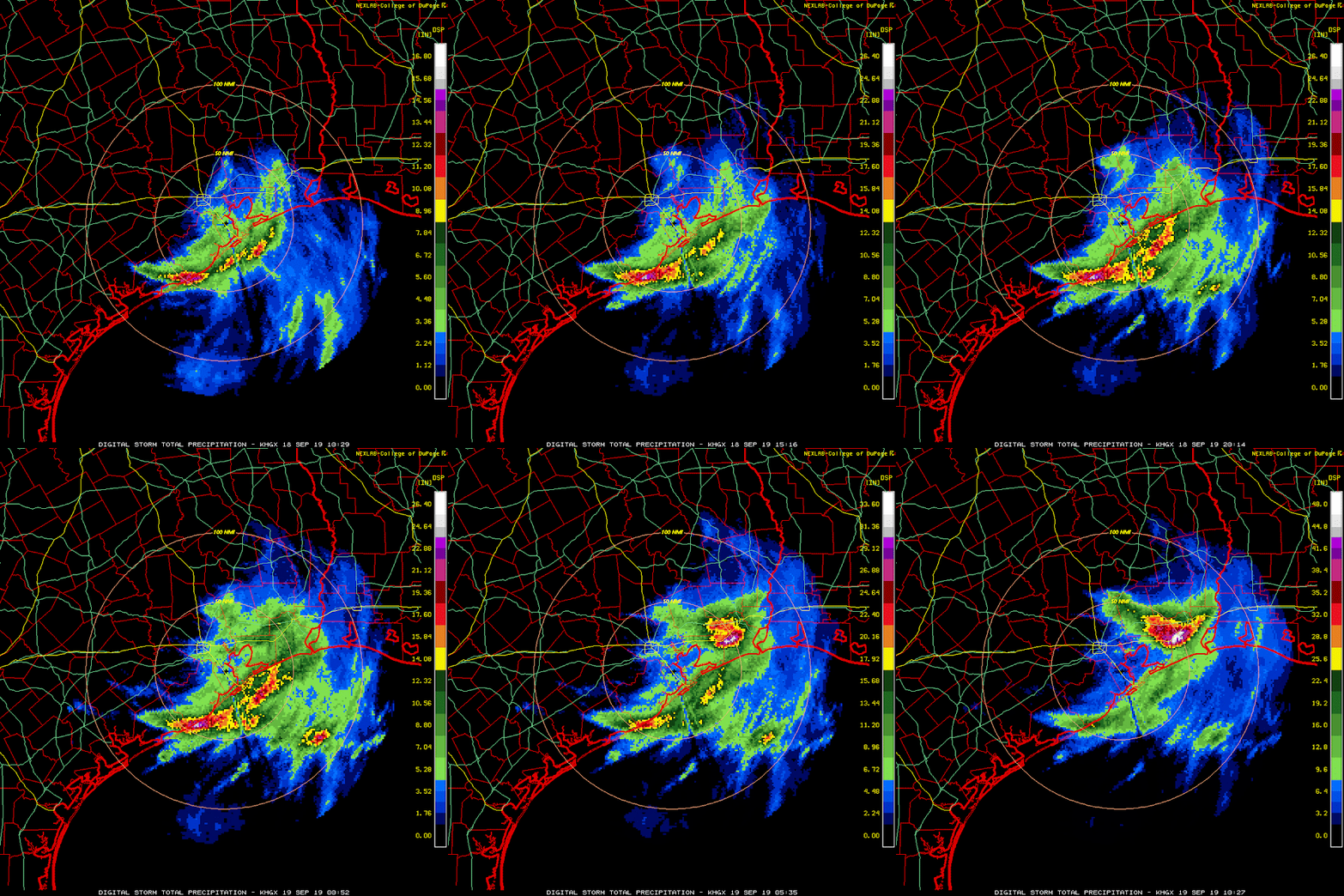
Tropical Depression Imelda is still sitting over southeast Texas, and dumping FEET of rain in the same places that Harvey flooded in 2017.
 |
| Enhanced water vapor satellite image showing a large shield of cold cloud tops sitting over southeast Texas... very dry air is just to the west. (NASA) |
This once again serves as a reminder that it does not take a strong hurricane to cause tremendous destruction and impacts. We saw this with Allison (2001), Harvey (2017), and Florence (2018) to name a few. Water is by far the #1 killer when it comes to hurricanes and tropical storms. Tropical cyclones and their remnants are still very wet, and when they become stationary, they're unbelievably wet. The hurricane rating scale (Saffir-Simpson Scale) is ONLY based on the storm's peak sustained wind speed... it says nothing about size of the wind field, rainfall, storm surge, or tornadoes. There's more to the story than the category!
Moving on to the newly-upgraded Jerry... it is now the season's 4th hurricane and is still headed toward the northern Leeward Islands. Jerry should pass north of the Leewards on Friday, but could bring tropical storm force winds beginning Friday morning. As of 11am EDT on Thursday, it has peak sustained winds of 75 mph and it's moving toward the west-northwest at 16 mph.
Model guidance is in quite good agreement on it recurving to the north prior to reaching the Bahamas later this weekend, but it is not a closed case. The skillful European model ensemble still has 10-15% of its members indicating that Jerry could remain to the south and track along/near the Greater Antilles. Assuming the most likely scenario, the only encounter with land it will have beyond the Leeward Islands is possibly Bermuda early next week -- about six days after Humberto's visit.
Of the three areas of possible formation shown on the map at the top of the post, the only one strongly supported by models is the easternmost. A potent tropical wave inland over Africa is expected to come off the continent on Saturday and quickly get its act together. The next name on the list is Karen.
- Visit the Tropical Atlantic Headquarters.
- Subscribe to get these updates emailed to you.
- Follow me on Twitter


No comments:
Post a Comment